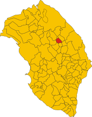
Sternatia (Sternatia)
.svg)
- Italian comune
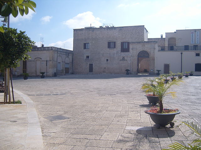
 Hiking in Sternatia
Sternatia, located in the Salento region of Italy, is a charming town that makes for an excellent base for hiking enthusiasts looking to explore the diverse landscapes and natural beauty of the area. While Sternatia itself may not be known specifically for its hiking trails, the surrounding region offers a variety of options.
Here are some key points for hiking in and around Sternatia:
Local Trails
- Countryside Paths: The area around Sternatia features gently rolling hills, olive groves, vineyards, and rural paths. You can enjoy leisurely hikes through the countryside, exploring the local flora and fauna.
- Historical Walks: Combining hiking with cultural experiences, there are routes that take you through historical sites, old churches, and traditional farms, giving you a chance to learn about the local heritage.
Nearby Natural Parks
- Nature Reserves: Plan a hike to visit nearby natural reserves like the Cesine Nature Reserve or the Otranto-Santa Maria di Leuca Natural Park, where you'll find marked trails, diverse wildlife, and beautiful coastal views.
Coastal Hiking
- Adriatic Coast: A short drive will take you to the Adriatic Sea, where coastal hiking trails offer breathtaking views of cliffs, rocky beaches, and crystal-clear waters. The coastal path from Otranto to Santa Maria di Leuca is particularly scenic and can be explored in sections.
Tips for Hiking in Sternatia
- Best Time to Go: Spring (April to June) and fall (September to October) offer the best hiking weather—mild temperatures and fewer crowds.
- Gear Up: Wear comfortable hiking shoes, sun protection, and carry plenty of water, especially for longer treks.
- Local Guidance: Consider connecting with local hiking clubs or guides who may offer organized hikes or further insights into the region's hidden gems.
Conclusion
Hiking around Sternatia can be a delightful experience, especially if you enjoy combining nature with cultural exploration. Be sure to respect the local environment and leave no trace while enjoying the beautiful landscapes of Salento!
- Country:

- Postal Code: 73010
- Local Dialing Code: 0836
- Licence Plate Code: LE
- Coordinates: 40° 13' 0" N, 18° 14' 0" E


- GPS tracks (wikiloc): [Link]
- AboveSeaLevel: 73 м m
- Area: 16.76 sq km
- Population: 2261
- Web site: http://www.comune.sternatia.le.it/
- Wikipedia en: wiki(en)
- Wikipedia: wiki(it)
- Wikidata storage: Wikidata: Q52201
- Wikipedia Commons Category: [Link]
- Freebase ID: [/m/03wkjj]
- GeoNames ID: Alt: [6537599]
- VIAF ID: Alt: [153804694]
- OSM relation ID: [40361]
- ISTAT ID: 075080
- Italian cadastre code: I950
Shares border with regions:

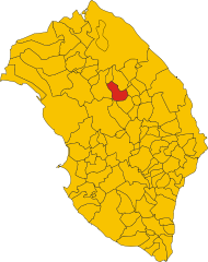
Caprarica di Lecce
- Italian comune
Hiking in Caprarica di Lecce
Caprarica di Lecce is a charming town located in the Salento region of Puglia, Italy. While it may not be as well-known for hiking as some other areas, it can serve as a great starting point for exploring the surrounding countryside and coastal areas. Here’s some information and tips for hiking in and around Caprarica di Lecce:...
- Country:
- Postal Code: 73010
- Local Dialing Code: 0832
- Licence Plate Code: LE
- Coordinates: 40° 16' 0" N, 18° 15' 0" E
- GPS tracks (wikiloc): [Link]
- AboveSeaLevel: 60 м m
- Area: 10.71 sq km
- Population: 2411
- Web site: [Link]

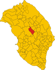
Martignano
- Italian comune
Hiking in Martignano
Martignano, located in the Italian region of Lazio, is known for its beautiful landscapes and natural parks, making it an excellent destination for hiking enthusiasts. The area is characterized by rolling hills, lush forests, and the stunning views of Lake Martignano, a volcanic lake surrounded by greenery....
- Country:
- Postal Code: 73020
- Local Dialing Code: 0832
- Licence Plate Code: LE
- Coordinates: 40° 14' 18" N, 18° 15' 22" E
- GPS tracks (wikiloc): [Link]
- AboveSeaLevel: 99 м m
- Area: 6.49 sq km
- Population: 1665
- Web site: [Link]
San Donato di Lecce
- Italian comune
Hiking in San Donato di Lecce
San Donato di Lecce, located in the Apulia region of Italy, is a charming town that offers a great opportunity for hiking enthusiasts to explore the beautiful countryside and historical sites of the area. Here are some key points to consider if you're planning a hiking trip in and around San Donato di Lecce:...
- Country:
- Postal Code: 73010
- Local Dialing Code: 0832
- Licence Plate Code: LE
- Coordinates: 40° 16' 0" N, 18° 11' 0" E
- GPS tracks (wikiloc): [Link]
- AboveSeaLevel: 70 м m
- Area: 21.58 sq km
- Population: 5656
- Web site: [Link]

Soleto
- Italian comune
Hiking in Soleto
Soleto is a charming town located in the Apulia region of southern Italy, known for its rich history, beautiful architecture, and surrounding natural landscape. Hiking in and around Soleto can offer a blend of cultural experiences and scenic beauty....
- Country:
- Postal Code: 73010
- Local Dialing Code: 0836
- Licence Plate Code: LE
- Coordinates: 40° 11' 16" N, 18° 12' 26" E
- GPS tracks (wikiloc): [Link]
- AboveSeaLevel: 91 м m
- Area: 30.46 sq km
- Population: 5422
- Web site: [Link]
Zollino
- Italian comune
Hiking in Zollino
Zollino, a charming town located in the Apulia region of southern Italy, offers a unique experience for hikers looking to explore natural landscapes and cultural heritage. Here are some key points about hiking in and around Zollino:...
- Country:
- Postal Code: 73010
- Local Dialing Code: 0836
- Licence Plate Code: LE
- Coordinates: 40° 12' 0" N, 18° 15' 0" E
- GPS tracks (wikiloc): [Link]
- AboveSeaLevel: 90 м m
- Area: 9.95 sq km
- Population: 1961
- Web site: [Link]