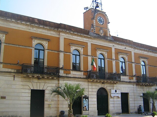
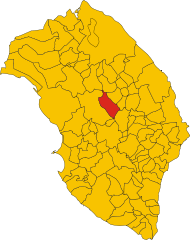
Zollino (Zollino)
.svg)
- Italian comune
 Hiking in Zollino
Zollino, a charming town located in the Apulia region of southern Italy, offers a unique experience for hikers looking to explore natural landscapes and cultural heritage. Here are some key points about hiking in and around Zollino:
Natural Landscapes
-
Countryside Trails: The area around Zollino features beautiful rolling hills, olive groves, and vineyards. Hiking trails often meander through these landscapes, allowing hikers to appreciate the natural beauty and tranquility of the Apulian countryside.
-
Close Proximity to Natural Parks: Zollino is not far from various natural parks, such as the Parco Naturale Regionale Bosco di Gallipoli and the Parco Naturale Regionale Costa Otranto, which offer more challenging routes and stunning coastal views.
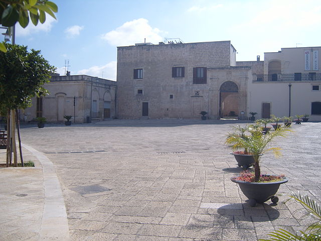
Cultural Hikes
-
Historic Town Center: You can enjoy a leisurely walk through the historic center of Zollino, with its well-preserved architecture and local monuments. Visiting churches and old buildings can provide a rich cultural experience while hiking through the town.
-
Nearby Villages and Towns: Consider hiking from Zollino to nearby towns such as Collepasso or Galatina, where you can discover local traditions, cuisine, and crafts.
Routes and Recommendations
- Trail Guidelines: Look for marked trails and local maps. The trails can vary in difficulty, so it's important to choose routes that match your fitness level.
- Guided Tours: For a deeper understanding of the area’s ecology and history, consider joining a guided tour.
- Optimal Seasons: Spring and fall are ideal for hiking in Zollino, as the temperatures are moderate and the landscape is more vibrant.
Preparation Tips
- Footwear: Wear sturdy hiking boots for comfort and support, especially if you plan on trekking through uneven terrain.
- Hydration: Always carry enough water, especially during the warmer months.
- Respect Nature: Follow the Leave No Trace principles to preserve the beauty of the trails for future hikers.
Whether you're a seasoned hiker or a beginner, Zollino provides an excellent backdrop for enjoying the great outdoors while immersing yourself in local culture. Happy hiking!
- Country:

- Postal Code: 73010
- Local Dialing Code: 0836
- Licence Plate Code: LE
- Coordinates: 40° 12' 0" N, 18° 15' 0" E


- GPS tracks (wikiloc): [Link]
- AboveSeaLevel: 90 м m
- Area: 9.95 sq km
- Population: 1961
- Web site: http://www.comune.zollino.le.it/
- Wikipedia en: wiki(en)
- Wikipedia: wiki(it)
- Wikidata storage: Wikidata: Q52221
- Wikipedia Commons Category: [Link]
- Freebase ID: [/m/03wkfk]
- GeoNames ID: Alt: [6538991]
- OSM relation ID: [40337]
- WOEID: [726431]
- UN/LOCODE: [ITLLZ]
- ISTAT ID: 075094
- Italian cadastre code: M187
Shares border with regions:

Calimera
- Italian comune
Hiking in Calimera
Calimera, located in the Salento region of Italy, is known for its beautiful landscapes, rich history, and vibrant local culture. While it may not be as famous as some larger hiking destinations, it offers several opportunities for outdoor enthusiasts. Here are a few highlights for hiking in and around Calimera:...
- Country:
- Postal Code: 73021
- Local Dialing Code: 0832
- Licence Plate Code: LE
- Coordinates: 40° 14' 58" N, 18° 16' 47" E
- GPS tracks (wikiloc): [Link]
- AboveSeaLevel: 56 м m
- Area: 11.18 sq km
- Population: 7009
- Web site: [Link]


Corigliano d'Otranto
- Italian comune
Hiking in Corigliano d'Otranto
Corigliano d'Otranto, located in the province of Lecce in the Apulia region of Italy, offers a charming landscape that is perfect for hiking enthusiasts. While it may not be the first location that comes to mind for hiking, it does have unique features that attract nature lovers and adventurers alike....
- Country:
- Postal Code: 73022
- Local Dialing Code: 0836
- Licence Plate Code: LE
- Coordinates: 40° 10' 0" N, 18° 15' 0" E
- GPS tracks (wikiloc): [Link]
- AboveSeaLevel: 76 м m
- Area: 28.41 sq km
- Population: 5768
- Web site: [Link]

Martano
- Italian comune
Hiking in Martano
Martano is a small town located in the Apulia region of Italy, known for its rich history, agriculture, and proximity to natural landscapes. While Martano itself is not primarily famous for hiking trails, there are several opportunities for outdoor enthusiasts in the surrounding areas....
- Country:
- Postal Code: 73025
- Local Dialing Code: 0836
- Licence Plate Code: LE
- Coordinates: 40° 12' 0" N, 18° 18' 0" E
- GPS tracks (wikiloc): [Link]
- AboveSeaLevel: 92 м m
- Area: 22.25 sq km
- Population: 9087
- Web site: [Link]

Martignano
- Italian comune
Hiking in Martignano
Martignano, located in the Italian region of Lazio, is known for its beautiful landscapes and natural parks, making it an excellent destination for hiking enthusiasts. The area is characterized by rolling hills, lush forests, and the stunning views of Lake Martignano, a volcanic lake surrounded by greenery....
- Country:
- Postal Code: 73020
- Local Dialing Code: 0832
- Licence Plate Code: LE
- Coordinates: 40° 14' 18" N, 18° 15' 22" E
- GPS tracks (wikiloc): [Link]
- AboveSeaLevel: 99 м m
- Area: 6.49 sq km
- Population: 1665
- Web site: [Link]

Soleto
- Italian comune
Hiking in Soleto
Soleto is a charming town located in the Apulia region of southern Italy, known for its rich history, beautiful architecture, and surrounding natural landscape. Hiking in and around Soleto can offer a blend of cultural experiences and scenic beauty....
- Country:
- Postal Code: 73010
- Local Dialing Code: 0836
- Licence Plate Code: LE
- Coordinates: 40° 11' 16" N, 18° 12' 26" E
- GPS tracks (wikiloc): [Link]
- AboveSeaLevel: 91 м m
- Area: 30.46 sq km
- Population: 5422
- Web site: [Link]


Sternatia
- Italian comune
Hiking in Sternatia
Sternatia, located in the Salento region of Italy, is a charming town that makes for an excellent base for hiking enthusiasts looking to explore the diverse landscapes and natural beauty of the area. While Sternatia itself may not be known specifically for its hiking trails, the surrounding region offers a variety of options....
- Country:
- Postal Code: 73010
- Local Dialing Code: 0836
- Licence Plate Code: LE
- Coordinates: 40° 13' 0" N, 18° 14' 0" E
- GPS tracks (wikiloc): [Link]
- AboveSeaLevel: 73 м m
- Area: 16.76 sq km
- Population: 2261
- Web site: [Link]