Stettfurt (Stettfurt)

- municipality in Switzerland
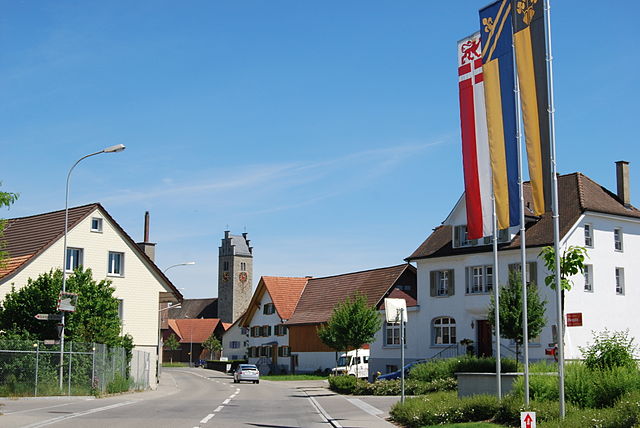
 Hiking in Stettfurt
Stettfurt, located in the picturesque region of Thurgau in Switzerland, offers a wonderful setting for hiking enthusiasts. The area features a variety of trails that cater to different skill levels, from easy walks suitable for families to more challenging routes for experienced hikers.
Key Highlights of Hiking in Stettfurt:
-
Scenic Trails: The region is characterized by rolling hills, lush forests, and beautiful fields. Trails often provide stunning views of the Swiss countryside, making them ideal for photography and nature appreciation.
-
Well-Marked Paths: The hiking routes in Stettfurt are typically well-marked and maintained, making it easier for hikers to navigate. Look for the yellow signposts that indicate trail names and destinations.
-
Lakes and Rivers: Nearby bodies of water, such as Lake Constance, can be accessed through various trails. These areas often feature flat paths perfect for leisurely walks with the possibility of cooling off during warmer months.
-
Cultural Exploration: As you hike, you may encounter charming villages, historical sites, and local farms. This adds a cultural dimension to your hiking experience, allowing you to learn about the region’s heritage.
-
Wildlife Watching: The varied habitats around Stettfurt provide opportunities to spot local wildlife. Keep an eye out for birds, deer, and other animals that thrive in this serene environment.
Recommended Hikes:
-
Stettfurt Circular Route: A popular option that takes you through the countryside, offering a mix of forest paths and open fields.
-
Lake Constance Path: A longer hike that can lead you towards the shores of Lake Constance, providing beautiful lake views.
Tips for Hiking in Stettfurt:
-
Check the Weather: Swiss weather can change quickly, so it’s best to be prepared with appropriate clothing and gear.
-
Stay Hydrated and Snack Ready: Carry enough water and some snacks, as amenities may be sparse on certain trails.
-
Local Maps and Apps: Utilize local hiking maps or apps which can provide detailed trail information and highlight points of interest.
-
Respect Nature: Follow the Leave No Trace principles to help preserve the beauty of the landscape for future hikers.
Stettfurt and the surrounding Thurgau region are perfect for those looking to enjoy a peaceful day in nature, whether you’re a novice hiker or an experienced trekker. Enjoy your hiking adventures!
- Country:

- Postal Code: 9507
- Local Dialing Code: 052
- Licence Plate Code: TG
- Coordinates: 47° 31' 34" N, 8° 57' 20" E


- GPS tracks (wikiloc): [Link]
- AboveSeaLevel: 488 м m
- Area: 6.4 sq km
- Population: 1210
- Web site: http://www.stettfurt.ch
- Wikipedia en: wiki(en)
- Wikipedia: wiki(de)
- Wikidata storage: Wikidata: Q65828
- Wikipedia Commons Category: [Link]
- Freebase ID: [/m/0g3sx_]
- GeoNames ID: Alt: [7287238]
- VIAF ID: Alt: [244307139]
- OSM relation ID: [1684560]
- Library of Congress authority ID: Alt: [n2008005075]
- HDS ID: [1912]
- Swiss municipality code: [4606]
Shares border with regions:


Thundorf
- municipality in Switzerland
Hiking in Thundorf
Thundorf is a charming village located in the Thurgau region of Switzerland, surrounded by beautiful landscapes that are perfect for hiking enthusiasts. While it might not be as well-known as some other Swiss hiking destinations, it offers a variety of trails that take you through serene nature, vineyards, and picturesque countryside....
- Country:
- Postal Code: 8512
- Local Dialing Code: 052
- Licence Plate Code: TG
- Coordinates: 47° 32' 50" N, 8° 57' 52" E
- GPS tracks (wikiloc): [Link]
- AboveSeaLevel: 546 м m
- Area: 15.6 sq km
- Population: 1452
- Web site: [Link]


Matzingen
- municipality in Switzerland
Hiking in Matzingen
Matzingen, located in the canton of Thurgau in Switzerland, offers some lovely hiking opportunities, often accompanied by beautiful landscapes, rolling hills, and picturesque countryside. Here’s an overview to help you with your hiking plans:...
- Country:
- Postal Code: 9548
- Local Dialing Code: 052
- Licence Plate Code: TG
- Coordinates: 47° 31' 36" N, 8° 55' 46" E
- GPS tracks (wikiloc): [Link]
- AboveSeaLevel: 480 м m
- Area: 7.7 sq km
- Population: 2857
- Web site: [Link]

Lommis
- municipality in Switzerland
Hiking in Lommis
Lommis, located in the Thurgau region of Switzerland, offers various hiking opportunities characterized by scenic landscapes, rolling hills, and picturesque vineyards. The region is known for its mild climate, making it an excellent destination for year-round hiking. Here are some insights into hiking in Lommis:...
- Country:
- Postal Code: 9506
- Local Dialing Code: 052
- Licence Plate Code: TG
- Coordinates: 47° 30' 59" N, 8° 58' 59" E
- GPS tracks (wikiloc): [Link]
- AboveSeaLevel: 475 м m
- Area: 8.6 sq km
- Population: 1224
- Web site: [Link]


Wängi
- municipality in Switzerland
Hiking in Wängi
Wängi, located in the canton of Thurgau in Switzerland, is a lovely area for hiking enthusiasts. The region is characterized by its picturesque landscapes, including rolling hills, forests, and agricultural fields, making it a peaceful retreat for outdoor activities....
- Country:
- Postal Code: 9545
- Local Dialing Code: 052
- Licence Plate Code: TG
- Coordinates: 47° 29' 36" N, 8° 57' 27" E
- GPS tracks (wikiloc): [Link]
- AboveSeaLevel: 500 м m
- Area: 16.4 sq km
- Population: 4662
- Web site: [Link]