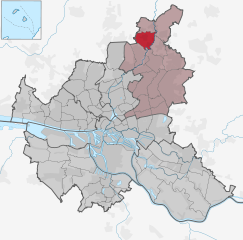
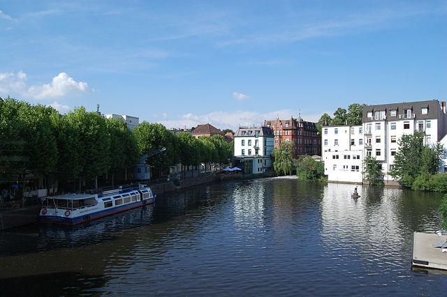
Stormarn (Kreis Stormarn)

- German district
 Hiking in Stormarn
Stormarn is a district in the federal state of Schleswig-Holstein, Germany, known for its beautiful landscapes, lush forests, and charming villages. Hiking in this area offers a variety of trails suitable for all levels of experience, catering to both casual walkers and avid trekkers. Here are some highlights and tips for hiking in Stormarn:
Natural Beauty
- Forests and Nature Reserves: The district is home to several nature reserves and wooded areas, including parts of the Lauenburg Lakes Nature Park. The dense forests are ideal for hiking, with trails lined by beech and oak trees.
- Scenic Landscapes: You can enjoy panoramic views and serene lakes, especially around the areas of the Stormarn lakes like the Kummerfelder Moor and the countryside near the towns of Bad Oldesloe and Trittau.
Hiking Trails
- Well-Marked Routes: Many trails in Stormarn are well-maintained and marked with signs. Popular trails tackle varying terrains, from flat paths ideal for family hikes to more challenging routes.
- Local Hikes: Routes like the "Stormarn Circular" provide opportunities to explore the district's quaint villages and historical sites. You can expect a mix of nature and culture during these hikes.
Cultural Aspects
- Historic Sites: Your hikes can lead you through picturesque villages and towns. Look for historical landmarks, such as old churches and traditional half-timbered houses that add cultural value to your outdoor experience.
- Gastronomy: Many local farms and restaurants welcome hikers, offering traditional Schleswig-Holstein cuisine. Don’t hesitate to take a break and enjoy regional specialties.
Tips for Hiking in Stormarn
- Gear Up: Wear appropriate hiking shoes and clothing, as the terrain can vary. A good backpack with water, snacks, and navigation tools is essential.
- Check the Weather: The weather can change quickly, so it’s a good idea to check forecasts and prepare for conditions like rain or cooler temperatures.
- Stay on Trails: To protect the local flora and fauna, stick to marked paths.
- Trail Maps: Consider obtaining a map or using navigation apps to stay on track, as some routes might not be prominently marked.
Accessibility
Stormarn has good connections to larger cities like Hamburg, making it easily accessible for day hikes. Local public transport or car rentals can help you reach various trailheads.
Overall, hiking in Stormarn is a wonderful way to experience the natural beauty and cultural richness of this charming region while enjoying outdoor activities.
- Country:

- Licence Plate Code: OD
- Coordinates: 53° 45' 0" N, 10° 19' 48" E


- GPS tracks (wikiloc): [Link]
- AboveSeaLevel: 34 м m
- Area: 766.33 sq km
- Population: 236705
- Web site: http://www.kreis-stormarn.de/
- Wikipedia en: wiki(en)
- Wikipedia: wiki(de)
- Wikidata storage: Wikidata: Q3003
- Wikipedia Commons Gallery: [Link]
- Wikipedia Commons Category: [Link]
- Wikipedia Commons Maps Category: [Link]
- Freebase ID: [/m/0py84]
- GeoNames ID: Alt: [3249078]
- VIAF ID: Alt: [150115654]
- OSM relation ID: [62546]
- GND ID: Alt: [4057744-2]
- archINFORM location ID: [2623]
- Library of Congress authority ID: Alt: [n82037879]
- TGN ID: [7076946]
- NUTS code: [DEF0F]
- German district key: 01062
Includes regions:


Billstedt
- quarter in Hamburg-Mitte, Hamburg, Germany
Hiking in Billstedt
Billstedt is a district in Hamburg, Germany, known primarily for its residential areas and urban environment rather than traditional hiking trails. However, if you are looking to enjoy nature and walking in and around Billstedt, there are several nearby options that you can explore:...
- Country:
- Coordinates: 53° 32' 26" N, 10° 6' 0" E
- GPS tracks (wikiloc): [Link]
- AboveSeaLevel: 14 м m
- Area: 17 sq km
- Population: 68936
- Web site: [Link]


Bergstedt
- quarter of Hamburg, Germany
Hiking in Bergstedt
Bergstedt is a charming area located in the northeastern part of Hamburg, Germany. While it may not be as widely known for hiking as some other regions, it offers several opportunities to enjoy nature, particularly for those looking for a more urban or suburban hiking experience....
- Country:
- Postal Code: 22395; 22359
- Local Dialing Code: 040
- Coordinates: 53° 40' 16" N, 10° 7' 37" E
- GPS tracks (wikiloc): [Link]
- AboveSeaLevel: 73 м m
- Area: 7.1 sq km
- Population: 10836
- Web site: [Link]
Bramfeld
- quarter in Hamburg, Germany
Hiking in Bramfeld
Bramfeld is a district in Hamburg, Germany, known more for its urban setting rather than extensive hiking trails, but you can still find some green spaces and parks for walking and enjoying nature. Here are a few tips and suggestions on hiking or walking activities around Bramfeld:...
- Country:
- Coordinates: 53° 36' 31" N, 10° 4' 21" E
- GPS tracks (wikiloc): [Link]
- AboveSeaLevel: 23 м m
- Area: 10.1 sq km


Duvenstedt
- quarter in Hamburg, Germany
Hiking in Duvenstedt
Duvenstedt is a charming district located in the northeastern part of Hamburg, Germany. Known for its natural beauty and scenic landscapes, it's a great spot for hiking enthusiasts. Here are some highlights for hiking in the area:...
- Country:
- Coordinates: 53° 42' 29" N, 10° 6' 16" E
- GPS tracks (wikiloc): [Link]
- AboveSeaLevel: 25 м m
- Area: 6.8 sq km
Hummelsbüttel
- quarter in Hamburg, Germany
Hiking in Hummelsbüttel
Hummelsbüttel is a beautiful residential area located in Hamburg, Germany, known for its parks and nature. While it may not be a traditional hiking destination, there are certainly opportunities for lovely walks and outdoor activities in and around the area....
- Country:
- Coordinates: 53° 38' 52" N, 10° 2' 29" E
- GPS tracks (wikiloc): [Link]
- Area: 9.2 sq km

Lemsahl-Mellingstedt
- quarter in Hamburg, Germany
Hiking in Lemsahl-Mellingstedt
Lemsahl-Mellingstedt is a beautiful district located in the northeastern part of Hamburg, Germany. It is characterized by its mix of natural landscapes, charming residential areas, and proximity to larger urban settings. While it is not a hiking hotspot in the traditional sense, there are some lovely trails and areas where hiking enthusiasts can enjoy the outdoors....
- Country:
- Coordinates: 53° 41' 24" N, 10° 5' 47" E
- GPS tracks (wikiloc): [Link]
- AboveSeaLevel: 34 м m
- Area: 7.9 sq km


Poppenbüttel
- quarter in the borough Wandsbek of Hamburg, Germany
Hiking in Poppenbüttel
Poppenbüttel is a district located in Hamburg, Germany, known for its natural beauty, parks, and proximity to the Alster River. While it may not be a traditional hiking destination, there are plenty of opportunities for walking, biking, and enjoying leisurely hikes in and around the area. Here are some aspects to consider when exploring hiking options in Poppenbüttel:...
- Country:
- Coordinates: 53° 39' 33" N, 10° 5' 5" E
- GPS tracks (wikiloc): [Link]
- AboveSeaLevel: 24 м m
- Area: 8.1 sq km


Rahlstedt
- quarter in Rahlstedt, Germany
Hiking in Rahlstedt
Rahlstedt, a district in the northeast of Hamburg, Germany, offers several opportunities for outdoor activities, including hiking. While it may not be a mountainous hiking destination, there are still lovely trails and parks that can provide a pleasant hiking experience....
- Country:
- Postal Code: 22149; 22147; 22145; 22143
- Local Dialing Code: 040
- Coordinates: 53° 36' 0" N, 10° 9' 0" E
- GPS tracks (wikiloc): [Link]
- AboveSeaLevel: 25 м m
- Area: 26.6 sq km
- Population: 90631


Sasel
- quarter in Hamburg, Germany
Hiking in Sasel
Sasel, a district in Hamburg, Germany, is more oriented towards urban and suburban landscapes rather than traditional hiking terrains. However, there are options for those who want to enjoy walking and light hiking in the area and nearby....
- Country:
- Postal Code: 22393
- Local Dialing Code: 040
- Coordinates: 53° 39' 14" N, 10° 6' 43" E
- GPS tracks (wikiloc): [Link]
- Area: 8.4 sq km
- Population: 23647
Steilshoop
- quarter in Hamburg, Germany
Hiking in Steilshoop
Steilshoop is a district in Hamburg, Germany, primarily known as a residential area. While it's not typically recognized as a prime hiking destination, there are ways to engage in outdoor activities in the vicinity that may appeal to hikers and nature enthusiasts....
- Country:
- Coordinates: 53° 36' 37" N, 10° 3' 33" E
- GPS tracks (wikiloc): [Link]
- AboveSeaLevel: 30 м m
- Area: 2.5 sq km
- Population: 19662


Wellingsbüttel
- quarter in Hamburg, Germany
Hiking in Wellingsbüttel
Wellingsbüttel is a charming district located in the Hamburg area of Germany, known primarily for its residential neighborhoods and green spaces. While it may not be renowned as a traditional hiking destination, there are several trails and areas nearby that offer pleasant walking and hiking opportunities....
- Country:
- Coordinates: 53° 38' 28" N, 10° 4' 47" E
- GPS tracks (wikiloc): [Link]
- AboveSeaLevel: 27 м m
- Area: 4.1 sq km


Lohbrügge
- quarter in the Bergedorf borough of the Free and Hanseatic city of Hamburg, Germany
Hiking in Lohbrügge
Lohbrügge is a district in Hamburg, Germany, known for its charming blend of urban living and natural beauty. While it's not a hiking destination like national parks or major wilderness areas, there are still opportunities for pleasant walks and hikes in and around Lohbrügge....
- Country:
- Local Dialing Code: 040
- Licence Plate Code: HH
- Coordinates: 53° 30' 34" N, 10° 10' 56" E
- GPS tracks (wikiloc): [Link]
- AboveSeaLevel: 4 м m
- Area: 13 sq km
- Population: 39074
Shares border with regions:

Hamburg-Mitte
- district of Hamburg, Germany
Hiking in Hamburg-Mitte
Hiking in Hamburg-Mitte offers a unique blend of urban exploration, historical sites, and beautiful green spaces. While the area is predominantly urban, there are several parks and nature areas where you can enjoy some fresh air and scenic views. Here are a few highlights and suggestions for hiking and outdoor activities in Hamburg-Mitte:...
- Country:
- Coordinates: 53° 33' 1" N, 9° 59' 39" E
- GPS tracks (wikiloc): [Link]
- AboveSeaLevel: 11 м m
- Area: 142.2 sq km
- Population: 301550
Wandsbek
- borough of Hamburg, Germany
Hiking in Wandsbek
Wandsbek is a district in Hamburg, Germany, known more for its urban landscape than traditional hiking trails. However, there are several parks, nature reserves, and green spaces where you can enjoy walking and light hiking activities. Here are some highlights for hiking and outdoor exploration in the Wandsbek area:...
- Country:
- Local Dialing Code: 040
- Coordinates: 53° 35' 0" N, 10° 5' 0" E
- GPS tracks (wikiloc): [Link]
- Area: 147.5 sq km
- Population: 435235
- Web site: [Link]

Bergedorf
- borough of the city of Hamburg, Germany
Hiking in Bergedorf
Bergedorf, a district in Hamburg, Germany, is known for its picturesque landscapes and outdoor opportunities. While it may not be a traditional hiking destination, there are several routes and natural parks in and around the area that provide great walking and hiking experiences. Here are some highlights:...
- Country:
- Coordinates: 53° 29' 14" N, 10° 12' 37" E
- GPS tracks (wikiloc): [Link]
- AboveSeaLevel: 17 м m
- Area: 154.8 sq km
- Population: 129111
- Web site: [Link]
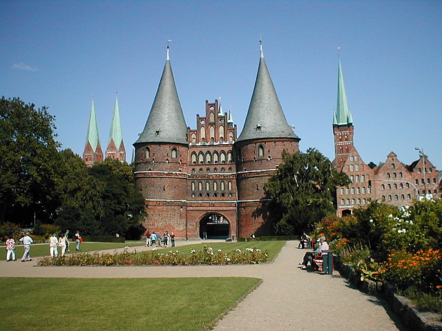

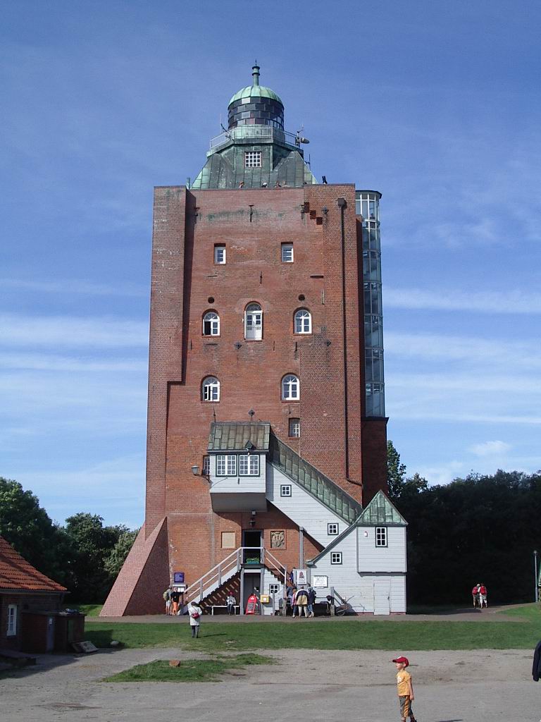
Lübeck
- city in Schleswig-Holstein, Germany
Hiking in Lübeck
Lübeck, located in northern Germany, is known for its rich medieval history, beautiful architecture, and proximity to the scenic Baltic Sea. While it may not be primarily recognized as a hiking destination, there are still several opportunities for outdoor enthusiasts to enjoy nature and explore the region through hiking....
- Country:
- Postal Code: 23552–23570
- Local Dialing Code: 451; 4508; 4502
- Licence Plate Code: HL
- Coordinates: 53° 52' 11" N, 10° 41' 11" E
- GPS tracks (wikiloc): [Link]
- AboveSeaLevel: 13 м m
- Area: 214.21 sq km
- Population: 216709
- Web site: [Link]

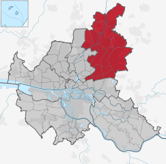
Ostholstein
- German district
Hiking in Ostholstein
Ostholstein, located in the northern part of Germany in Schleswig-Holstein, is a beautiful area known for its diverse landscapes, coastal scenery, and rich cultural history. Here are some highlights and tips for hiking in Ostholstein:...
- Country:
- Licence Plate Code: OH
- Coordinates: 54° 10' 12" N, 10° 49' 48" E
- GPS tracks (wikiloc): [Link]
- AboveSeaLevel: 46 м m
- Web site: [Link]
Segeberg
- district in Germany
Hiking in Segeberg
Segeberg, located in Schleswig-Holstein, Germany, offers a variety of hiking opportunities amidst its beautiful natural landscapes. The area is renowned for its rolling hills, dense forests, and picturesque lakes, making it a great destination for outdoor enthusiasts....
- Country:
- Licence Plate Code: SE
- Coordinates: 53° 55' 12" N, 10° 10' 12" E
- GPS tracks (wikiloc): [Link]
- AboveSeaLevel: 37 м m
- Area: 1344.39 sq km
- Population: 272235
- Web site: [Link]
Herzogtum Lauenburg
- district of Germany
Hiking in Herzogtum Lauenburg
Herzogtum Lauenburg is a picturesque region in northern Germany, known for its scenic landscapes, rich history, and charming towns. If you're considering hiking in this area, you'll find a variety of trails and natural attractions that cater to different skill levels. Here are some highlights and tips for hiking in Herzogtum Lauenburg:...
- Country:
- Licence Plate Code: RZ
- Coordinates: 53° 35' 0" N, 10° 40' 0" E
- GPS tracks (wikiloc): [Link]
- AboveSeaLevel: 35 м m
- Area: 1262.97 sq km
- Population: 192999
- Web site: [Link]