
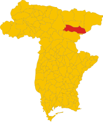
Tarvisio (Tarvisio)
.svg)
- town in Italy
 Hiking in Tarvisio
Tarvisio, located in the northeastern part of Italy near the borders with Austria and Slovenia, is a beautiful destination for hiking enthusiasts. It is situated in the Julian Alps and offers a wide range of trails that cater to various skill levels, from easy strolls to challenging treks. Here are some highlights of hiking in Tarvisio:
Scenic Beauty
- Natural Landscapes: The area is known for its stunning natural beauty, including lush forests, crystal-clear lakes, and panoramic mountain views.
- Wildlife: Hikers may encounter diverse wildlife, including deer, various bird species, and small mammals, making the experience even more rewarding.
Popular Trails
-
Monte Lussari:
- This hike takes you to the summit of Monte Lussari, offering breathtaking views of the surrounding mountains and valleys. It can be accessed by a cable car for those who prefer a less strenuous ascent.
-
Valli del Natisone:
- This area features a variety of trails, including easier routes suitable for families. Hikers can enjoy lush meadows and beautiful riverside paths.
-
Lago del Predil:
- A scenic loop around Lake Predil, where you can enjoy crystal-clear water and the surrounding mountainous landscape. This area provides opportunities for leisurely walks and picnics.
-
Path of the Dolomites:
- A more challenging trek that combines stunning views with historical significance as it follows the paths of WWI soldiers. The trail includes various memorials and offers an insight into the region’s history.
Difficulty Levels
- Beginner: Many trails around lakes and lower elevations are perfect for beginners or families.
- Intermediate & Advanced: There are numerous trails with varying difficulty levels, including steep ascents and technical terrain for experienced hikers.
Tips for Hiking in Tarvisio
- Best Time to Visit: The ideal times for hiking are late spring, summer, and early fall when the weather is milder and the trails are generally accessible.
- Local Guides: Consider hiring a local guide who can provide insights on the best trails and ensure safety, especially if you plan to hike in less-trafficked areas.
- Gear and Preparation: Wear appropriate hiking footwear, dress in layers, and carry enough water, snacks, and a map or GPS device. It’s also wise to check the weather conditions before heading out.
Additional Activities
- In addition to hiking, Tarvisio offers skiing in winter, mountain biking, and exploration of the local culture and cuisine. The area is rich in history and has charming towns worth visiting.
Tarvisio is a fantastic destination for anyone looking to immerse themselves in nature and enjoy the mountainous terrain while hiking in Italy. Whether you're a seasoned hiker or a beginner, you will find trails tailored to your experience level.
- Country:

- Postal Code: 33018
- Local Dialing Code: 0428
- Licence Plate Code: UD
- Coordinates: 46° 30' 0" N, 13° 34' 0" E


- GPS tracks (wikiloc): [Link]
- AboveSeaLevel: 754 м m
- Area: 208.36 sq km
- Population: 4224
- Web site: http://www.comuneditarvisio.com
- Wikipedia en: wiki(en)
- Wikipedia: wiki(it)
- Wikidata storage: Wikidata: Q18801
- Wikipedia Commons Gallery: [Link]
- Wikipedia Commons Category: [Link]
- Freebase ID: [/m/05hsrz]
- GeoNames ID: Alt: [6539937]
- OSM relation ID: [79140]
- UN/LOCODE: [ITTVS]
- Digital Atlas of the Roman Empire ID: [12936]
- ISTAT ID: 030117
- Italian cadastre code: L057
Shares border with regions:

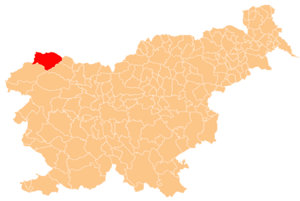
Kranjska Gora Municipality
- municipality of Slovenia
Hiking in Kranjska Gora Municipality
Kranjska Gora, located in Slovenia, is a beautiful area renowned for its stunning alpine scenery and excellent hiking opportunities. Nestled at the foot of the Julian Alps, it offers a variety of trails suitable for hikers of all skill levels, from gentle walks to more challenging ascents....
- Country:

- Postal Code: 4280
- Licence Plate Code: KR
- Coordinates: 46° 27' 37" N, 13° 50' 19" E
- GPS tracks (wikiloc): [Link]
- AboveSeaLevel: 1283 м m
- Area: 256.3 sq km
- Web site: [Link]

Chiusaforte
- Italian comune
Hiking in Chiusaforte
Chiusaforte, located in the Friuli Venezia Giulia region of Italy, is a great destination for hiking enthusiasts. Nestled in the Julian Alps, this area offers a stunning landscape characterized by towering mountains, lush valleys, and clear rivers....
- Country:
- Postal Code: 33010
- Local Dialing Code: 0433
- Licence Plate Code: UD
- Coordinates: 46° 24' 0" N, 13° 19' 0" E
- GPS tracks (wikiloc): [Link]
- AboveSeaLevel: 391 м m
- Area: 100.2 sq km
- Population: 628
- Web site: [Link]


Malborghetto Valbruna
- Italian comune
Hiking in Malborghetto Valbruna
Malborghetto Valbruna is a picturesque village located in the Valcanale region of northeastern Italy, close to the Austrian border. It is surrounded by stunning Alpine scenery and offers a variety of hiking opportunities for all skill levels. Here are some highlights and tips for hiking in this area:...
- Country:
- Postal Code: 33010
- Local Dialing Code: 0428
- Licence Plate Code: UD
- Coordinates: 46° 30' 24" N, 13° 26' 22" E
- GPS tracks (wikiloc): [Link]
- AboveSeaLevel: 721 м m
- Area: 124.21 sq km
- Population: 919
- Web site: [Link]

Hohenthurn
- municipality in Austria
Hiking in Hohenthurn
Hohenthurn, a small village in Austria located near the border with Slovenia, is surrounded by beautiful natural landscapes that offer various hiking opportunities. The area is characterized by scenic views, lush forests, and the picturesque backdrop of the Julian Alps....
- Country:

- Postal Code: 9613
- Local Dialing Code: 0 42 56
- Licence Plate Code: VL
- Coordinates: 46° 33' 24" N, 13° 39' 33" E
- GPS tracks (wikiloc): [Link]
- AboveSeaLevel: 620 м m
- Area: 27.16 sq km
- Population: 851
- Web site: [Link]

Arnoldstein
- municipality in Austria
Hiking in Arnoldstein
Arnoldstein is a charming town located in southern Austria, nestled in the scenic landscapes of Carinthia near the borders of Italy and Slovenia. The region is known for its beautiful hiking trails, offering a mix of stunning views, diverse terrain, and cultural experiences....
- Country:
- Postal Code: 9601
- Local Dialing Code: 04255
- Licence Plate Code: VL
- Coordinates: 46° 33' 2" N, 13° 42' 14" E
- GPS tracks (wikiloc): [Link]
- AboveSeaLevel: 578 м m
- Area: 67.4 sq km
- Population: 7096
- Web site: [Link]