Tracy-sur-Loire (Tracy-sur-Loire)

- commune in Nièvre, France
- Country:

- Postal Code: 58150
- Coordinates: 47° 19' 10" N, 2° 54' 38" E


- GPS tracks (wikiloc): [Link]
- Area: 23.07 sq km
- Population: 950
- Wikipedia en: wiki(en)
- Wikipedia: wiki(fr)
- Wikidata storage: Wikidata: Q27647
- Wikipedia Commons Category: [Link]
- Freebase ID: [/m/02vmqmh]
- GeoNames ID: Alt: [6438112]
- SIREN number: [215802950]
- BnF ID: [152665604]
- PACTOLS thesaurus ID: [pcrtnRAZ4lYRxz]
- INSEE municipality code: 58295
Shares border with regions:


Saint-Martin-sur-Nohain
- commune in Nièvre, France
- Country:
- Postal Code: 58150
- Coordinates: 47° 21' 45" N, 2° 59' 3" E
- GPS tracks (wikiloc): [Link]
- Area: 24.03 sq km
- Population: 376


Saint-Andelain
- commune in Nièvre, France
- Country:
- Postal Code: 58150
- Coordinates: 47° 18' 31" N, 2° 57' 38" E
- GPS tracks (wikiloc): [Link]
- Area: 20.31 sq km
- Population: 489

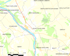
Pouilly-sur-Loire
- commune in Nièvre, France
- Country:
- Postal Code: 58150
- Coordinates: 47° 16' 58" N, 2° 57' 28" E
- GPS tracks (wikiloc): [Link]
- Area: 20.28 sq km
- Population: 1679

Cosne-Cours-sur-Loire
- commune in Nièvre, France
- Country:
- Postal Code: 58200
- Coordinates: 47° 24' 37" N, 2° 55' 30" E
- GPS tracks (wikiloc): [Link]
- AboveSeaLevel: 148 м m
- Area: 53.3 sq km
- Population: 10388
- Web site: [Link]


Ménétréol-sous-Sancerre
- commune in Cher, France
- Country:
- Postal Code: 18300
- Coordinates: 47° 19' 4" N, 2° 51' 22" E
- GPS tracks (wikiloc): [Link]
- Area: 5.67 sq km
- Population: 317

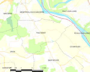
Thauvenay
- commune in Cher, France
- Country:
- Postal Code: 18300
- Coordinates: 47° 18' 18" N, 2° 52' 5" E
- GPS tracks (wikiloc): [Link]
- Area: 9.86 sq km
- Population: 338
- Web site: [Link]

Couargues
- commune in Cher, France
- Country:
- Postal Code: 18300
- Coordinates: 47° 16' 38" N, 2° 55' 44" E
- GPS tracks (wikiloc): [Link]
- Area: 11.62 sq km
- Population: 202


Saint-Satur
- commune in Cher, France
- Country:
- Postal Code: 18300
- Coordinates: 47° 20' 28" N, 2° 51' 12" E
- GPS tracks (wikiloc): [Link]
- Area: 7.86 sq km
- Population: 1460

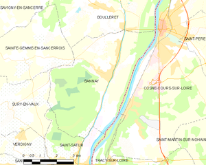
Bannay
- commune in Cher, France
- Country:
- Postal Code: 18300
- Coordinates: 47° 23' 9" N, 2° 52' 49" E
- GPS tracks (wikiloc): [Link]
- Area: 25.03 sq km
- Population: 910
- Web site: [Link]