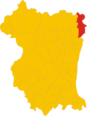
Trasaghis (Trasaghis)
.svg)
- Italian comune
 Hiking in Trasaghis
Trasaghis, located in the Friuli Venezia Giulia region of northeastern Italy, is an excellent destination for hiking enthusiasts. The area is known for its stunning natural landscapes, characterized by lush forests, picturesque valleys, and serene lakes. Here are some key points to consider when hiking in Trasaghis:
Scenic Trails
-
Laghi di Cavazzo: These beautiful lakes offer a range of trails with varying levels of difficulty. The paths around the lakes are perfect for leisurely hikes with opportunities for swimming and picnicking.
-
Monte D’Osservatorio: For those looking for a more challenging hike, trails leading to Monte D’Osservatorio provide stunning views of the surrounding area. The routes may involve some elevation gain, rewarding hikers with breathtaking panoramas.
-
The Val d'Arzino: This valley is known for its gentle slopes and beautiful landscapes, making it ideal for both easy walks and more strenuous hikes.
Flora and Fauna
The region is rich in biodiversity. Hikers may encounter diverse plant species and wildlife, including birds and small mammals. Be mindful of the local ecosystem and follow Leave No Trace principles to preserve the natural beauty.
Preparation and Safety
- Maps and Guides: Obtain local maps and guides before heading out. Trails are generally marked, but it's always wise to be prepared.
- Weather: Check the weather conditions before your hike, as they can change rapidly in the mountains. Dress in layers and be prepared for various conditions.
- Hydration and Snacks: Always bring enough water and snacks, especially on longer hikes. Many trails don’t have easy access to water sources.
Local Amenities
Trasaghis has a quaint charm, with local villages offering accommodations, restaurants, and shops. Consider trying local cuisine, which often includes hearty dishes perfect for re-energizing after a day of hiking.
Accessibility
While some trails are accessible to families and beginners, others can be quite rugged, so always choose a trail that matches your fitness level and experience.
Overall, hiking in Trasaghis offers a wonderful opportunity to explore the beauty of Italy's natural landscapes while enjoying outdoor activities. Whether you’re a seasoned hiker or a beginner, the area provides a variety of options that cater to all levels of experience.
- Country:

- Postal Code: 33010
- Local Dialing Code: 0432
- Licence Plate Code: UD
- Coordinates: 46° 17' 0" N, 13° 5' 0" E


- GPS tracks (wikiloc): [Link]
- AboveSeaLevel: 217 м m
- Area: 77.85 sq km
- Population: 2222
- Web site: http://www.comune.trasaghis.ud.it/
- Wikipedia en: wiki(en)
- Wikipedia: wiki(it)
- Wikidata storage: Wikidata: Q53384
- Wikipedia Commons Category: [Link]
- Freebase ID: [/m/0gkbnk]
- GeoNames ID: Alt: [6538398]
- VIAF ID: Alt: [237037068]
- OSM relation ID: [79106]
- WOEID: [725203]
- UN/LOCODE: [ITTFV]
- ISTAT ID: 030124
- Italian cadastre code: L335
Shares border with regions:

Vito d'Asio
- Italian comune
Hiking in Vito d'Asio
Vito d'Asio is a picturesque village located in the Friuli Venezia Giulia region of northern Italy. Surrounded by the beautiful landscapes of the eastern Alps, this area offers various hiking opportunities for both beginners and experienced hikers. Here are some highlights and tips for hiking in Vito d'Asio:...
- Country:
- Postal Code: 33090
- Local Dialing Code: 0427
- Licence Plate Code: PN
- Coordinates: 46° 14' 0" N, 12° 56' 0" E
- GPS tracks (wikiloc): [Link]
- AboveSeaLevel: 381 м m
- Area: 53.72 sq km
- Population: 734
- Web site: [Link]


Bordano
- Italian comune
Hiking in Bordano
Bordano, located in the Friuli Venezia Giulia region of northeastern Italy, is known for its stunning natural landscapes and rich cultural heritage, making it a wonderful destination for hiking enthusiasts. Here are some key points to consider for hiking in Bordano:...
- Country:
- Postal Code: 33010
- Local Dialing Code: 0432
- Licence Plate Code: UD
- Coordinates: 46° 19' 0" N, 13° 6' 0" E
- GPS tracks (wikiloc): [Link]
- AboveSeaLevel: 224 м m
- Area: 14.9 sq km
- Population: 736
- Web site: [Link]


Cavazzo Carnico
- Italian comune
Hiking in Cavazzo Carnico
Cavazzo Carnico, located in the Friuli Venezia Giulia region of northeastern Italy, is a fantastic destination for hiking enthusiasts. Nestled between the beautiful Julian Alps and the Carnic Alps, the area is known for its stunning landscapes, diverse flora and fauna, and rich cultural heritage....
- Country:
- Postal Code: 33020
- Local Dialing Code: 0433
- Licence Plate Code: UD
- Coordinates: 46° 22' 0" N, 13° 2' 0" E
- GPS tracks (wikiloc): [Link]
- AboveSeaLevel: 290 м m
- Area: 39.44 sq km
- Population: 1024
- Web site: [Link]


Forgaria nel Friuli
- Italian comune
Hiking in Forgaria nel Friuli
Forgaria nel Friuli is a picturesque town located in the Friuli-Venezia Giulia region of Italy. Nestled near the eastern foothills of the Carnic Alps, it offers a range of hiking opportunities suitable for various skill levels. Here are some highlights of hiking in this area:...
- Country:
- Postal Code: 33030
- Local Dialing Code: 0427
- Licence Plate Code: UD
- Coordinates: 46° 13' 0" N, 12° 58' 0" E
- GPS tracks (wikiloc): [Link]
- AboveSeaLevel: 270 м m
- Area: 28.94 sq km
- Population: 1773
- Web site: [Link]


Gemona del Friuli
- Italian comune
Hiking in Gemona del Friuli
Gemona del Friuli, located in the Friuli Venezia Giulia region of northeastern Italy, is a beautiful destination for hiking enthusiasts. This area is characterized by stunning mountainous landscapes, rich history, and vibrant local culture. Here are some key points about hiking in and around Gemona del Friuli:...
- Country:
- Postal Code: 33013
- Local Dialing Code: 0432
- Licence Plate Code: UD
- Coordinates: 46° 16' 27" N, 13° 7' 21" E
- GPS tracks (wikiloc): [Link]
- AboveSeaLevel: 272 м m
- Area: 56.06 sq km
- Population: 10869
- Web site: [Link]


Osoppo
- Italian comune
Hiking in Osoppo
Osoppo is a small town located in the Friuli Venezia Giulia region of northern Italy, surrounded by beautiful landscapes and a rich mix of natural and historical features. It offers various hiking opportunities that cater to different experience levels. Here are some key points about hiking in and around Osoppo:...
- Country:
- Postal Code: 33010
- Local Dialing Code: 0432
- Licence Plate Code: UD
- Coordinates: 46° 15' 0" N, 13° 5' 0" E
- GPS tracks (wikiloc): [Link]
- AboveSeaLevel: 185 м m
- Area: 22.4 sq km
- Population: 2865
- Web site: [Link]