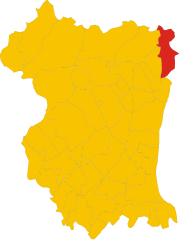
Forgaria nel Friuli (Forgaria nel Friuli)
.svg)
- Italian comune
 Hiking in Forgaria nel Friuli
Forgaria nel Friuli is a picturesque town located in the Friuli-Venezia Giulia region of Italy. Nestled near the eastern foothills of the Carnic Alps, it offers a range of hiking opportunities suitable for various skill levels. Here are some highlights of hiking in this area:
Scenic Trails
-
Monte Sernio: A popular hiking destination, this mountain offers trails that vary in difficulty and provide stunning views of the surrounding valleys and peaks.
-
Val d’Arzino: This area features beautiful forested trails alongside the Arzino River, making it perfect for those who enjoy nature, peace, and a moderate hike.
-
Ciclovia Alpe Adria: For those interested in longer treks or cycling, this route connects the Alps with the Adriatic Sea and passes through some beautiful landscapes.
Flora and Fauna
The region is rich in biodiversity, with various flora and fauna. Hikers can encounter unique plant species and possibly spot wildlife, including deer and various bird species.
Cultural Experience
Hiking in the Forgaria nel Friuli area also provides opportunities to experience local culture. You'll find traditional Friulian architecture, charming villages, and local cuisine in nearby towns.
Seasonal Considerations
- Spring and Summer: These seasons offer the best weather for hiking, with wildflowers in bloom and lush greenery.
- Autumn: Fall is particularly lovely, with beautiful foliage color changes.
- Winter: Hiking in winter should be undertaken with caution; snow and ice can make trails challenging, but the scenery can be breathtaking if dressed appropriately.
Preparation Tips
- Proper Footwear: Ensure you wear suitable hiking boots with good grip for varying terrain.
- Weather Checks: Always check the weather forecast before heading out to prepare accordingly.
- Hydration and Snacks: Carry enough water and energy snacks for your hike.
- Maps and Navigation: Familiarize yourself with trail maps, and consider using GPS or hiking apps for safety.
Local Resources
Visitors can find local hiking guides or join organized hiking tours for a more structured experience. The local tourist office can provide maps, guides, and recommendations tailored to your skill level.
Overall, hiking in Forgaria nel Friuli offers a combination of natural beauty, diverse trails, and cultural experiences, making it a wonderful destination for outdoor enthusiasts.
- Country:

- Postal Code: 33030
- Local Dialing Code: 0427
- Licence Plate Code: UD
- Coordinates: 46° 13' 0" N, 12° 58' 0" E


- GPS tracks (wikiloc): [Link]
- AboveSeaLevel: 270 м m
- Area: 28.94 sq km
- Population: 1773
- Web site: http://www.comune.forgarianelfriuli.ud.it
- Wikipedia en: wiki(en)
- Wikipedia: wiki(it)
- Wikidata storage: Wikidata: Q53261
- Wikipedia Commons Category: [Link]
- Freebase ID: [/m/0gkbyl]
- GeoNames ID: Alt: [6542250]
- BnF ID: [14435822r]
- VIAF ID: Alt: [155033352]
- OSM relation ID: [79214]
- Digital Atlas of the Roman Empire ID: [17992]
- ISTAT ID: 030137
- Italian cadastre code: D700
Shares border with regions:


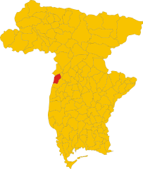
Pinzano al Tagliamento
- Italian comune
Hiking in Pinzano al Tagliamento
Pinzano al Tagliamento, located in the Friuli Venezia Giulia region of northeastern Italy, is an excellent destination for hiking enthusiasts. The area is characterized by its stunning natural landscapes, including rolling hills, the Tagliamento River, and lush forests....
- Country:
- Postal Code: 33094
- Local Dialing Code: 0432
- Licence Plate Code: PN
- Coordinates: 46° 10' 59" N, 12° 56' 43" E
- GPS tracks (wikiloc): [Link]
- AboveSeaLevel: 201 м m
- Area: 21.95 sq km
- Population: 1514
- Web site: [Link]

Vito d'Asio
- Italian comune
Hiking in Vito d'Asio
Vito d'Asio is a picturesque village located in the Friuli Venezia Giulia region of northern Italy. Surrounded by the beautiful landscapes of the eastern Alps, this area offers various hiking opportunities for both beginners and experienced hikers. Here are some highlights and tips for hiking in Vito d'Asio:...
- Country:
- Postal Code: 33090
- Local Dialing Code: 0427
- Licence Plate Code: PN
- Coordinates: 46° 14' 0" N, 12° 56' 0" E
- GPS tracks (wikiloc): [Link]
- AboveSeaLevel: 381 м m
- Area: 53.72 sq km
- Population: 734
- Web site: [Link]
Majano
- Italian comune
Hiking in Majano
Majano, a charming town in the Friuli Venezia Giulia region of northeastern Italy, offers a variety of hiking opportunities that showcase its beautiful landscapes, historic sites, and rich cultural heritage. Here are some key points to consider when planning a hiking trip in Majano and its surroundings:...
- Country:
- Postal Code: 33030
- Local Dialing Code: 0432
- Licence Plate Code: UD
- Coordinates: 46° 11' 0" N, 13° 4' 0" E
- GPS tracks (wikiloc): [Link]
- AboveSeaLevel: 170 м m
- Area: 28.28 sq km
- Population: 5932
- Web site: [Link]


Osoppo
- Italian comune
Hiking in Osoppo
Osoppo is a small town located in the Friuli Venezia Giulia region of northern Italy, surrounded by beautiful landscapes and a rich mix of natural and historical features. It offers various hiking opportunities that cater to different experience levels. Here are some key points about hiking in and around Osoppo:...
- Country:
- Postal Code: 33010
- Local Dialing Code: 0432
- Licence Plate Code: UD
- Coordinates: 46° 15' 0" N, 13° 5' 0" E
- GPS tracks (wikiloc): [Link]
- AboveSeaLevel: 185 м m
- Area: 22.4 sq km
- Population: 2865
- Web site: [Link]

Ragogna
- Italian comune
Hiking in Ragogna
Ragogna is a lovely location situated in the Friuli Venezia Giulia region of northeastern Italy. Nestled in the foothills of the Alps, it offers stunning landscapes and a variety of hiking opportunities. Here are some key points to consider when planning a hike in Ragogna:...
- Country:
- Postal Code: 33030
- Local Dialing Code: 0432
- Licence Plate Code: UD
- Coordinates: 46° 11' 18" N, 12° 59' 42" E
- GPS tracks (wikiloc): [Link]
- AboveSeaLevel: 235 м m
- Area: 22.03 sq km
- Population: 2858
- Web site: [Link]


San Daniele del Friuli
- Italian comune
Hiking in San Daniele del Friuli
San Daniele del Friuli, located in the Friuli Venezia Giulia region of northeastern Italy, is known not only for its famous prosciutto but also for its picturesque landscapes and hiking opportunities. The area is characterized by rolling hills, vineyards, and lush countryside, making it an appealing destination for hiking enthusiasts....
- Country:
- Postal Code: 33038
- Local Dialing Code: 0432
- Licence Plate Code: UD
- Coordinates: 46° 9' 0" N, 13° 1' 0" E
- GPS tracks (wikiloc): [Link]
- AboveSeaLevel: 252 м m
- Area: 34.78 sq km
- Population: 7987
- Web site: [Link]


Trasaghis
- Italian comune
Hiking in Trasaghis
Trasaghis, located in the Friuli Venezia Giulia region of northeastern Italy, is an excellent destination for hiking enthusiasts. The area is known for its stunning natural landscapes, characterized by lush forests, picturesque valleys, and serene lakes. Here are some key points to consider when hiking in Trasaghis:...
- Country:
- Postal Code: 33010
- Local Dialing Code: 0432
- Licence Plate Code: UD
- Coordinates: 46° 17' 0" N, 13° 5' 0" E
- GPS tracks (wikiloc): [Link]
- AboveSeaLevel: 217 м m
- Area: 77.85 sq km
- Population: 2222
- Web site: [Link]