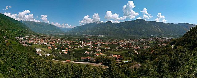
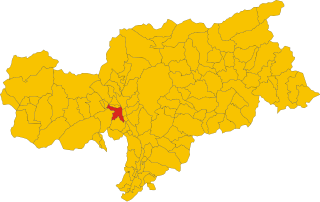
Tscherms (Cermes)
.svg)
- Italian comune
 Hiking in Tscherms
Tscherms, a picturesque village in South Tyrol, Italy, offers a variety of hiking experiences for outdoor enthusiasts. Nestled near the charming town of Merano, it provides access to beautiful trails set against the stunning backdrop of the South Tyrolean Alps.
Popular Hiking Trails in Tscherms:
-
Tscherms - Marlengo - Merano:
- Distance: Approximately 10 km round-trip
- Elevation Gain: Moderate
- This trail takes you from Tscherms to the nearby village of Marlengo and then into Merano. It offers scenic views of the valley and the surrounding mountains, passing through vineyards and apple orchards.
-
Hiking to the Hofer Almhütte:
- Distance: About 7 km one way
- Elevation Gain: Moderate to strenuous
- A lovely route that leads to the Hofer Almhütte, a mountain hut. It's a great spot to rest and enjoy traditional Tyrolean cuisine while taking in panoramic views from the terrace.
-
Merano High Route (Meraner Höhenweg):
- Distance: Varies, but a section runs near Tscherms
- Elevation Gain: Varies
- This classic trek around Merano offers breathtaking views and is suitable for experienced hikers. While parts of this trail can be challenging, the scenery makes it worth the effort.
Tips for Hiking in Tscherms:
-
Best Season: Spring to early autumn is the best time for hiking, as trails are usually well-marked and accessible. Summer can be warm, while early autumn offers beautiful fall colors.
-
Gear: Make sure to wear sturdy hiking boots and bring plenty of water and snacks. A map or GPS device can also be helpful for navigating the trails.
-
Local Regulations: Always follow local guidelines and check the weather before heading out. Some trails may be closed during certain seasons or require permits.
-
Respect Nature: Carry out what you bring in, stay on marked paths, and respect wildlife and plants.
Whether you're seeking a leisurely stroll through the orchards or a challenging hike with spectacular vistas, Tscherms has something for everyone. Enjoy your adventure!
- Country:

- Postal Code: 39010
- Local Dialing Code: 0473
- Licence Plate Code: BZ
- Coordinates: 46° 37' 58" N, 11° 8' 49" E


- GPS tracks (wikiloc): [Link]
- AboveSeaLevel: 292 м m
- Area: 6.62 sq km
- Population: 1546
- Web site: http://www.comune.cermes.bz.it
- Wikipedia en: wiki(en)
- Wikipedia: wiki(it)
- Wikidata storage: Wikidata: Q377608
- Wikipedia Commons Gallery: [Link]
- Wikipedia Commons Category: [Link]
- Freebase ID: [/m/0g9g3b]
- GeoNames ID: Alt: [6535891]
- VIAF ID: Alt: [236804644]
- OSM relation ID: [47288]
- GND ID: Alt: [4061099-8]
- MusicBrainz area ID: [d0e5df71-a1ef-4542-9cce-e455fdf5d139]
- UN/LOCODE: [ITEMS]
- ISTAT ID: 021020
- Italian cadastre code: A022
Shares border with regions:


Merano
- Italian comune
Hiking in Merano
Merano, located in South Tyrol, Italy, is a stunning destination for hiking enthusiasts. Nestled in the mountains, it offers a beautiful combination of alpine scenery, Mediterranean climate, and rich cultural heritage. Here are some highlights about hiking in and around Merano:...
- Country:
- Postal Code: 39012
- Local Dialing Code: 0473
- Licence Plate Code: BZ
- Coordinates: 46° 40' 8" N, 11° 9' 50" E
- GPS tracks (wikiloc): [Link]
- AboveSeaLevel: 325 м m
- Area: 26.34 sq km
- Population: 40047
- Web site: [Link]
Lana
- Italian comune in South Tyrol
Hiking in Lana
Lana, located in South Tyrol, Italy, is a fantastic destination for hiking enthusiasts, offering a diverse range of trails set against stunning alpine scenery. Nestled near the larger town of Merano, Lana provides access to beautiful landscapes, charming villages, and cultural sites....
- Country:
- Postal Code: 39011
- Local Dialing Code: 0473
- Licence Plate Code: BZ
- Coordinates: 46° 37' 0" N, 11° 10' 0" E
- GPS tracks (wikiloc): [Link]
- AboveSeaLevel: 310 м m
- Area: 36.12 sq km
- Population: 12286
- Web site: [Link]
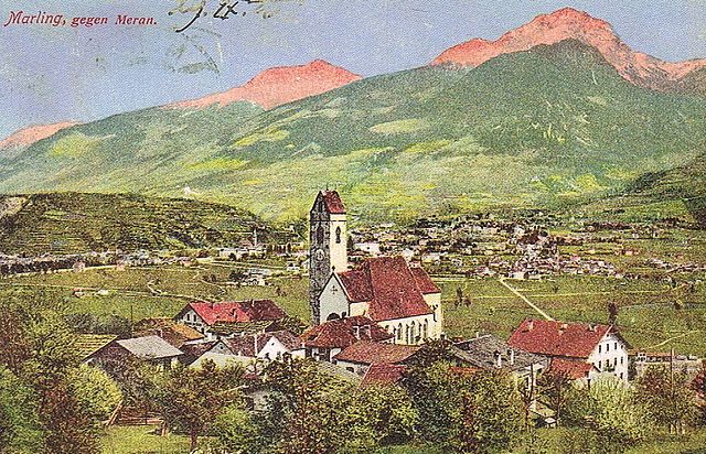

Marling, South Tyrol
- Italian comune
Hiking in Marling, South Tyrol
Marling, located in South Tyrol, Italy, is a charming village that offers a plethora of hiking opportunities amidst stunning Alpine scenery. The region is characterized by its mild climate, diverse landscapes, and beautiful panoramic views, making it an ideal destination for both casual walkers and seasoned hikers....
- Country:
- Postal Code: 39020
- Local Dialing Code: 0473
- Licence Plate Code: BZ
- Coordinates: 46° 39' 9" N, 11° 8' 44" E
- GPS tracks (wikiloc): [Link]
- AboveSeaLevel: 363 м m
- Area: 12.86 sq km
- Population: 2710
- Web site: [Link]