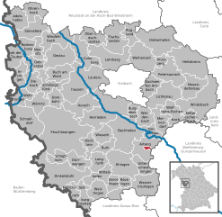
Unterer Wald (Unterer Wald)
- unincorporated in Germany
Unterer Wald is a beautiful area known for its scenic landscapes and hiking opportunities. Here are some details that may enhance your hiking experience:
Overview
- Location: Unterer Wald is situated in the region known for its rich natural beauty, often characterized by dense forests, rolling hills, and diverse flora and fauna.
- Terrain: The terrain can vary, featuring gentle hills, shaded forest paths, and occasionally more challenging trails that may lead to vantage points offering panoramic views.
Hiking Trails
- Difficulty Levels: There are trails suitable for all skill levels, from easy walks for families to more challenging routes for experienced hikers. Make sure to choose a trail that matches your fitness level.
- Wayfinding: Trails are typically marked with signs and trail markers, but it's always advisable to have a map or GPS device, especially on less-traveled paths.
Points of Interest
- Natural Features: Look out for local wildlife, unique plant species, and perhaps rivers or lakes that might offer a spot to rest.
- Cultural Sites: Depending on the area, there may be historical landmarks or viewpoints worth visiting.
Preparation
- Gear: Wear sturdy hiking boots and appropriate clothing for the weather. A daypack with water, snacks, first aid kit, and perhaps a camera to capture the scenery can enhance your trip.
- Weather: Check the local weather forecast before heading out and be prepared for sudden changes in conditions, especially if hiking in higher elevations.
Safety Tips
- Stay on Marked Trails: For safety and to help preserve the environment, stick to established trails.
- Group Hiking: If possible, hike with a buddy or group for added safety.
- Wildlife Awareness: Be mindful of local wildlife. Know how to behave in bear or snake country if applicable.
Local Regulations
- Permits: Some areas may require permits or have specific regulations, especially in protected natural spaces, so it’s a good idea to check beforehand.
Conclusion
Whether you’re looking for a leisurely walk through nature or an invigorating hike, Unterer Wald offers a variety of options that can cater to different preferences. Always plan ahead, stay safe, and enjoy the stunning scenery!
- Country:

- Coordinates: 49° 8' 21" N, 10° 38' 31" E


- GPS tracks (wikiloc): [Link]
- Wikidata storage: Wikidata: Q2497472
- Wikipedia Commons Category: [Link]
- OSM relation ID: [534393]
Shares border with regions:


Gunzenhausen
- town in Bavaria, Germany
Gunzenhausen is a charming town located in Bavaria, Germany, and serves as a gateway to some beautiful hiking opportunities, particularly around the Franconian Lake District (Fränkisches Seenland). Here’s what you can expect when hiking in and around Gunzenhausen:...
- Country:

- Postal Code: 91710
- Local Dialing Code: 09836; 09831
- Coordinates: 49° 6' 53" N, 10° 45' 15" E


- GPS tracks (wikiloc): [Link]
- AboveSeaLevel: 416 м m
- Area: 82.72 sq km
- Population: 16562
- Web site: [Link]

