Vandœuvre-lès-Nancy (Vandœuvre-lès-Nancy)

- commune in Meurthe-et-Moselle, France
- Country:

- Postal Code: 54500
- Coordinates: 48° 39' 22" N, 6° 10' 3" E


- GPS tracks (wikiloc): [Link]
- AboveSeaLevel: 300 м m
- Area: 9.46 sq km
- Population: 29923
- Web site: http://www.vandoeuvre.fr
- Wikipedia en: wiki(en)
- Wikipedia: wiki(fr)
- Wikidata storage: Wikidata: Q320308
- Wikipedia Commons Category: [Link]
- Freebase ID: [/m/06s8v3]
- Freebase ID: [/m/06s8v3]
- Freebase ID: [/m/06s8v3]
- Freebase ID: [/m/06s8v3]
- GeoNames ID: Alt: [2970797]
- GeoNames ID: Alt: [2970797]
- GeoNames ID: Alt: [2970797]
- GeoNames ID: Alt: [2970797]
- SIREN number: [215405473]
- SIREN number: [215405473]
- SIREN number: [215405473]
- SIREN number: [215405473]
- BnF ID: [15264614r]
- BnF ID: [15264614r]
- BnF ID: [15264614r]
- BnF ID: [15264614r]
- VIAF ID: Alt: [126209197]
- VIAF ID: Alt: [126209197]
- VIAF ID: Alt: [126209197]
- VIAF ID: Alt: [126209197]
- OSM relation ID: [52395]
- OSM relation ID: [52395]
- OSM relation ID: [52395]
- OSM relation ID: [52395]
- archINFORM location ID: [8958]
- archINFORM location ID: [8958]
- archINFORM location ID: [8958]
- archINFORM location ID: [8958]
- Library of Congress authority ID: Alt: [n85066205]
- Library of Congress authority ID: Alt: [n85066205]
- Library of Congress authority ID: Alt: [n85066205]
- Library of Congress authority ID: Alt: [n85066205]
- PACTOLS thesaurus ID: [pcrtxL1WmFxyJR]
- PACTOLS thesaurus ID: [pcrtxL1WmFxyJR]
- PACTOLS thesaurus ID: [pcrtxL1WmFxyJR]
- PACTOLS thesaurus ID: [pcrtxL1WmFxyJR]
- MusicBrainz area ID: [9c0440a3-9420-4285-af59-67819f5b64bc]
- MusicBrainz area ID: [9c0440a3-9420-4285-af59-67819f5b64bc]
- MusicBrainz area ID: [9c0440a3-9420-4285-af59-67819f5b64bc]
- MusicBrainz area ID: [9c0440a3-9420-4285-af59-67819f5b64bc]
- Gran Enciclopèdia Catalana ID: [0069529]
- Gran Enciclopèdia Catalana ID: [0069529]
- Gran Enciclopèdia Catalana ID: [0069529]
- Gran Enciclopèdia Catalana ID: [0069529]
- Twitter username: Alt: [Vandoeuvre]
- Twitter username: Alt: [Vandoeuvre]
- Twitter username: Alt: [Vandoeuvre]
- Twitter username: Alt: [Vandoeuvre]
- INSEE municipality code: 54547
- INSEE municipality code: 54547
- INSEE municipality code: 54547
- INSEE municipality code: 54547
Shares border with regions:

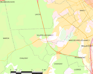
Villers-lès-Nancy
- commune in Meurthe-et-Moselle, France
- Country:
- Postal Code: 54600
- Coordinates: 48° 40' 23" N, 6° 9' 17" E
- GPS tracks (wikiloc): [Link]
- Area: 9.95 sq km
- Population: 14503
- Web site: [Link]


Heillecourt
- commune in Meurthe-et-Moselle, France
- Country:
- Postal Code: 54180
- Coordinates: 48° 39' 9" N, 6° 11' 39" E
- GPS tracks (wikiloc): [Link]
- Area: 3.65 sq km
- Population: 5610


Chavigny
- commune in Meurthe-et-Moselle, France
- Country:
- Postal Code: 54230
- Coordinates: 48° 37' 45" N, 6° 7' 27" E
- GPS tracks (wikiloc): [Link]
- Area: 6.69 sq km
- Population: 1875


Houdemont
- commune in Meurthe-et-Moselle, France
- Country:
- Postal Code: 54180
- Coordinates: 48° 38' 46" N, 6° 10' 29" E
- GPS tracks (wikiloc): [Link]
- Area: 3.62 sq km
- Population: 2183
- Web site: [Link]

Nancy
- city in Meurthe-et-Moselle, France
- Country:
- Postal Code: 54000
- Coordinates: 48° 41' 34" N, 6° 11' 1" E
- GPS tracks (wikiloc): [Link]
- AboveSeaLevel: 212 м m
- Area: 15.01 sq km
- Population: 105162
- Web site: [Link]


Jarville-la-Malgrange
- commune in Meurthe-et-Moselle, France
- Country:
- Postal Code: 54140
- Coordinates: 48° 40' 10" N, 6° 12' 22" E
- GPS tracks (wikiloc): [Link]
- Area: 2.43 sq km
- Population: 9273
- Web site: [Link]