Vannes-sur-Cosson (Vannes-sur-Cosson)

- commune in Loiret, France
- Country:

- Postal Code: 45510
- Coordinates: 47° 42' 47" N, 2° 12' 43" E


- GPS tracks (wikiloc): [Link]
- Area: 35.65 sq km
- Population: 587
- Web site: http://www.vannes-sur-cosson.fr
- Wikipedia en: wiki(en)
- Wikipedia: wiki(fr)
- Wikidata storage: Wikidata: Q919895
- Wikipedia Commons Category: [Link]
- Freebase ID: [/m/03nwh4r]
- Freebase ID: [/m/03nwh4r]
- GeoNames ID: Alt: [2970773]
- GeoNames ID: Alt: [2970773]
- SIREN number: [214503310]
- SIREN number: [214503310]
- BnF ID: [152607231]
- BnF ID: [152607231]
- VIAF ID: Alt: [149039714]
- VIAF ID: Alt: [149039714]
- Library of Congress authority ID: Alt: [n88610760]
- Library of Congress authority ID: Alt: [n88610760]
- INSEE municipality code: 45331
- INSEE municipality code: 45331
Shares border with regions:

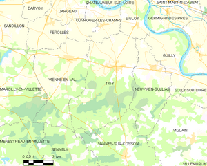
Tigy
- commune in Loiret, France
- Country:
- Postal Code: 45510
- Coordinates: 47° 47' 42" N, 2° 11' 54" E
- GPS tracks (wikiloc): [Link]
- Area: 47.29 sq km
- Population: 2310
- Web site: [Link]

Sennely
- commune in Loiret, France
- Country:
- Postal Code: 45240
- Coordinates: 47° 40' 42" N, 2° 8' 57" E
- GPS tracks (wikiloc): [Link]
- Area: 49.32 sq km
- Population: 703
- Web site: [Link]

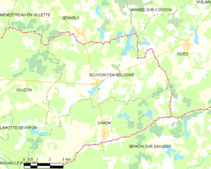
Souvigny-en-Sologne
- commune in Loir-et-Cher, France
- Country:
- Postal Code: 41600
- Coordinates: 47° 38' 41" N, 2° 9' 51" E
- GPS tracks (wikiloc): [Link]
- Area: 41.55 sq km
- Population: 515
- Web site: [Link]


Isdes
- commune in Loiret, France
- Country:
- Postal Code: 45620
- Coordinates: 47° 40' 19" N, 2° 15' 20" E
- GPS tracks (wikiloc): [Link]
- Area: 43.89 sq km
- Population: 549
- Web site: [Link]


Neuvy-en-Sullias
- commune in Loiret, France
- Country:
- Postal Code: 45510
- Coordinates: 47° 47' 40" N, 2° 14' 43" E
- GPS tracks (wikiloc): [Link]
- Area: 25.28 sq km
- Population: 1341
- Web site: [Link]

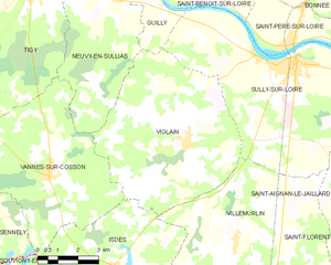
Viglain
- commune in Loiret, France
- Country:
- Postal Code: 45600
- Coordinates: 47° 43' 42" N, 2° 18' 9" E
- GPS tracks (wikiloc): [Link]
- Area: 39.99 sq km
- Population: 880