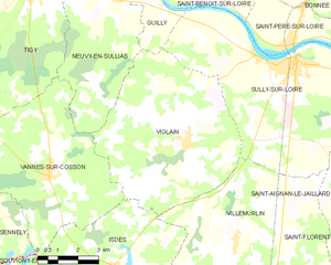
Isdes (Isdes)

- commune in Loiret, France
- Country:

- Postal Code: 45620
- Coordinates: 47° 40' 19" N, 2° 15' 20" E


- GPS tracks (wikiloc): [Link]
- Area: 43.89 sq km
- Population: 549
- Web site: http://www.isdes.fr
- Wikipedia en: wiki(en)
- Wikipedia: wiki(fr)
- Wikidata storage: Wikidata: Q1391532
- Wikipedia Commons Category: [Link]
- Freebase ID: [/m/06jth9]
- GeoNames ID: Alt: [6434621]
- SIREN number: [214501710]
- BnF ID: [15260563q]
- INSEE municipality code: 45171
Shares border with regions:


Brinon-sur-Sauldre
- commune in Cher, France
- Country:
- Postal Code: 18410
- Coordinates: 47° 33' 53" N, 2° 15' 18" E
- GPS tracks (wikiloc): [Link]
- Area: 116.3 sq km
- Population: 1004

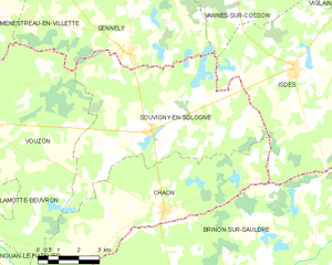
Souvigny-en-Sologne
- commune in Loir-et-Cher, France
- Country:
- Postal Code: 41600
- Coordinates: 47° 38' 41" N, 2° 9' 51" E
- GPS tracks (wikiloc): [Link]
- Area: 41.55 sq km
- Population: 515
- Web site: [Link]


Cerdon
- commune in Loiret, France
- Country:
- Postal Code: 45620
- Coordinates: 47° 38' 9" N, 2° 21' 40" E
- GPS tracks (wikiloc): [Link]
- Area: 67.07 sq km
- Population: 967
- Web site: [Link]


Chaon
- commune in Loir-et-Cher, France
- Country:
- Postal Code: 41600
- Coordinates: 47° 36' 31" N, 2° 10' 21" E
- GPS tracks (wikiloc): [Link]
- Area: 31.85 sq km
- Population: 467


Villemurlin
- commune in Loiret, France
- Country:
- Postal Code: 45600
- Coordinates: 47° 41' 6" N, 2° 20' 8" E
- GPS tracks (wikiloc): [Link]
- Area: 48.95 sq km
- Population: 600
- Web site: [Link]


Vannes-sur-Cosson
- commune in Loiret, France
- Country:
- Postal Code: 45510
- Coordinates: 47° 42' 47" N, 2° 12' 43" E
- GPS tracks (wikiloc): [Link]
- Area: 35.65 sq km
- Population: 587
- Web site: [Link]

Viglain
- commune in Loiret, France
- Country:
- Postal Code: 45600
- Coordinates: 47° 43' 42" N, 2° 18' 9" E
- GPS tracks (wikiloc): [Link]
- Area: 39.99 sq km
- Population: 880