Vasselay (Vasselay)

- commune in Cher, France
- Country:

- Postal Code: 18110
- Coordinates: 47° 9' 28" N, 2° 23' 18" E


- GPS tracks (wikiloc): [Link]
- Area: 20.21 sq km
- Population: 1410
- Web site: http://info.vasselay.free.fr
- Wikipedia en: wiki(en)
- Wikipedia: wiki(fr)
- Wikidata storage: Wikidata: Q1429340
- Wikipedia Commons Category: [Link]
- Freebase ID: [/m/03mffgw]
- GeoNames ID: Alt: [6428323]
- SIREN number: [211802715]
- BnF ID: [15249617k]
- INSEE municipality code: 18271
Shares border with regions:
Saint-Martin-d'Auxigny
- commune in Cher, France
- Country:
- Postal Code: 18110
- Coordinates: 47° 12' 14" N, 2° 25' 0" E
- GPS tracks (wikiloc): [Link]
- Area: 24.08 sq km
- Population: 2340

Saint-Doulchard
- commune in Cher, France
- Country:
- Postal Code: 18230
- Coordinates: 47° 5' 59" N, 2° 22' 22" E
- GPS tracks (wikiloc): [Link]
- Area: 24.01 sq km
- Population: 9431
- Web site: [Link]
Saint-Éloy-de-Gy
- commune in Cher, France
- Country:
- Postal Code: 18110
- Coordinates: 47° 9' 22" N, 2° 20' 33" E
- GPS tracks (wikiloc): [Link]
- Area: 31.2 sq km
- Population: 1547
Saint-Georges-sur-Moulon
- commune in Cher, France
- Country:
- Postal Code: 18110
- Coordinates: 47° 11' 25" N, 2° 25' 21" E
- GPS tracks (wikiloc): [Link]
- Area: 9.43 sq km
- Population: 716

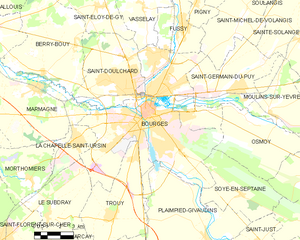
Bourges
- commune in Cher, France
- Country:
- Postal Code: 18000
- Coordinates: 47° 5' 1" N, 2° 23' 44" E
- GPS tracks (wikiloc): [Link]
- AboveSeaLevel: 153 м m
- Area: 68.74 sq km
- Population: 66071
- Web site: [Link]


Fussy
- commune in Cher, France
- Country:
- Postal Code: 18110
- Coordinates: 47° 8' 41" N, 2° 25' 44" E
- GPS tracks (wikiloc): [Link]
- Area: 11.08 sq km
- Population: 1980
- Web site: [Link]