Vaumeilh (Vaumeilh)
- commune in Alpes-de-Haute-Provence, France
Vaumeilh is a charming village located in the Alpes-de-Haute-Provence region of France, nestled in the foothills of the French Alps. The area is well-known for its picturesque landscapes, and it offers a variety of hiking opportunities suitable for different skill levels, from leisurely walks to more challenging hikes.
Hiking Trails
-
Local Trails: There are several marked trails around Vaumeilh that take you through beautiful natural scenery, including hills, forests, and valleys. The terrain often offers views of the surrounding mountains and the opportunity to explore local flora and fauna.
-
The GR6: This major long-distance hiking trail passes near Vaumeilh. It runs across the French landscape from the Atlantic to the Mediterranean, providing hikers with stunning views and the chance to experience diverse environments.
-
Montagne de la Lure: A bit further out, the Montagne de la Lure has a range of hiking trails that cater to various skill levels, and it provides spectacular panoramic views from the summit.
Hiking Tips
-
Preparation: Always check the weather before heading out and ensure you're adequately prepared with appropriate footwear, clothing, and supplies (water, snacks, map, first-aid kit).
-
Navigation: While many trails are marked, having a detailed map or a GPS device can be very helpful, especially if you're venturing onto less-traveled paths.
-
Respect Nature: Stay on marked trails, follow local guidelines, and take all trash with you to preserve the natural beauty of the area.
Best Time to Hike
-
Spring and Fall: These seasons typically offer the best weather for hiking, with mild temperatures and fewer crowds. The spring brings blooming wildflowers, while fall showcases beautiful foliage.
-
Summer: While summer hikes can be enjoyable, be prepared for warmer temperatures and ensure you have plenty of water.
Local Amenities
Vaumeilh has a few local amenities such as small shops and cafes where you can rest and refresh before or after your hike. Make sure to try some local cuisine if you get the chance!
Overall, hiking in Vaumeilh is a rewarding experience, offering both natural beauty and a chance to explore the unique culture of the Alpes-de-Haute-Provence region.
- Country:

- Postal Code: 04200
- Coordinates: 44° 17' 18" N, 5° 57' 33" E


- GPS tracks (wikiloc): [Link]
- Area: 25.52 sq km
- Population: 259
- Wikipedia en: wiki(en)
- Wikipedia: wiki(fr)
- Wikidata storage: Wikidata: Q1094779
- Wikipedia Commons Category: [Link]
- Freebase ID: [/m/03d9b8c]
- Freebase ID: [/m/03d9b8c]
- GeoNames ID: Alt: [2970450]
- GeoNames ID: Alt: [2970450]
- SIREN number: [210402335]
- SIREN number: [210402335]
- INSEE municipality code: 04233
- INSEE municipality code: 04233
Shares border with regions:

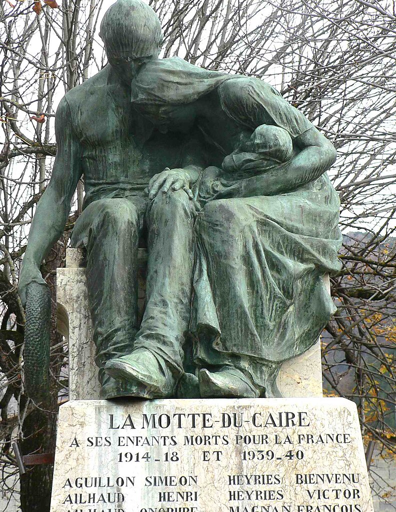
La Motte-du-Caire
- commune in Alpes-de-Haute-Provence, France
La Motte-du-Caire is a charming village located in the Alpes-de-Haute-Provence region of southeastern France. It's a great area for hiking, offering beautiful landscapes, diverse flora and fauna, and various trails that cater to different skill levels. Here are some key points to consider if you're planning a hiking trip in La Motte-du-Caire:...
- Country:

- Postal Code: 04250
- Coordinates: 44° 20' 38" N, 6° 1' 42" E


- GPS tracks (wikiloc): [Link]
- Area: 27.27 sq km
- Population: 554

Valernes
- commune in Alpes-de-Haute-Provence, France
Valernes is a lesser-known yet charming destination for hiking enthusiasts, located in the Alpes-de-Haute-Provence region of France. Surrounded by picturesque landscapes, Valernes offers a variety of trails suitable for different skill levels, allowing hikers to immerse themselves in the stunning natural beauty of the area....
- Country:

- Postal Code: 04200
- Coordinates: 44° 15' 44" N, 5° 57' 29" E


- GPS tracks (wikiloc): [Link]
- Area: 28.49 sq km
- Population: 253

Nibles
- commune in Alpes-de-Haute-Provence, France
It seems there might be a small misunderstanding—there isn't a widely recognized hiking destination specifically called "Nibles." However, if you're referring to a particular place or a lesser-known trail, please provide more context or correct the name, and I'd be happy to help!...
- Country:

- Postal Code: 04250
- Coordinates: 44° 16' 53" N, 6° 1' 9" E


- GPS tracks (wikiloc): [Link]
- Area: 12.31 sq km
- Population: 43
Le Poët
- commune in Hautes-Alpes, France
Le Poët is a charming commune in the Drôme department of southeastern France, nestled in the foothills of the Vercors Mountains. It offers a variety of hiking opportunities that showcase its beautiful landscapes, historical sites, and the rich natural environment....
- Country:

- Postal Code: 05300
- Coordinates: 44° 17' 35" N, 5° 53' 49" E


- GPS tracks (wikiloc): [Link]
- Area: 15.51 sq km
- Population: 771
- Web site: [Link]

Sigoyer
- commune in Alpes-de-Haute-Provence, France
Sigoyer, located in the Alpes-de-Haute-Provence region of France, is a charming village surrounded by beautiful natural landscapes, making it an excellent destination for hiking enthusiasts. The area offers a variety of hiking trails that cater to different skill levels, providing opportunities for both casual walkers and experienced trekkers....
- Country:

- Postal Code: 04200
- Coordinates: 44° 19' 9" N, 5° 57' 30" E


- GPS tracks (wikiloc): [Link]
- Area: 15.3 sq km
- Population: 104
