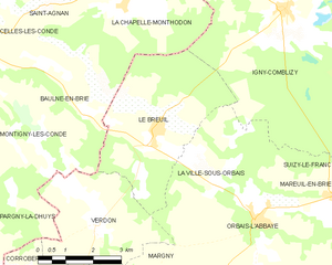
Verdon (Verdon)

- commune in Marne, France
- Country:

- Postal Code: 51210
- Coordinates: 48° 56' 56" N, 3° 37' 17" E


- GPS tracks (wikiloc): [Link]
- Area: 11.39 sq km
- Population: 209
- Wikipedia en: wiki(en)
- Wikipedia: wiki(fr)
- Wikidata storage: Wikidata: Q544929
- Wikipedia Commons Category: [Link]
- Freebase ID: [/m/03qdbq7]
- GeoNames ID: Alt: [2969972]
- SIREN number: [215106188]
- BnF ID: [15263197n]
- INSEE municipality code: 51607
Shares border with regions:


Margny
- commune in Marne, France
- Country:
- Postal Code: 51210
- Coordinates: 48° 55' 50" N, 3° 38' 39" E
- GPS tracks (wikiloc): [Link]
- AboveSeaLevel: 199 м m
- Area: 10.53 sq km
- Population: 114

Le Breuil
- commune in Marne, France
- Country:
- Postal Code: 51210
- Coordinates: 48° 58' 32" N, 3° 38' 48" E
- GPS tracks (wikiloc): [Link]
- AboveSeaLevel: 125 м m
- Area: 16.01 sq km
- Population: 393

Pargny-la-Dhuys
- commune in Aisne, France
- Country:
- Postal Code: 02330
- Coordinates: 48° 57' 12" N, 3° 33' 15" E
- GPS tracks (wikiloc): [Link]
- Area: 12.66 sq km
- Population: 177


Corrobert
- commune in Marne, France
- Country:
- Postal Code: 51210
- Coordinates: 48° 54' 56" N, 3° 36' 17" E
- GPS tracks (wikiloc): [Link]
- Area: 14.26 sq km
- Population: 201


La Ville-sous-Orbais
- commune in Marne, France
- Country:
- Postal Code: 51270
- Coordinates: 48° 57' 41" N, 3° 40' 43" E
- GPS tracks (wikiloc): [Link]
- Area: 11.05 sq km
- Population: 52

Baulne-en-Brie
- former commune in Aisne, France
- Country:
- Postal Code: 02330
- Coordinates: 48° 59' 14" N, 3° 36' 50" E
- GPS tracks (wikiloc): [Link]
- Area: 18.89 sq km
- Population: 260