Verfeuil (Verfeuil)

- commune in Gard, France
- Country:

- Postal Code: 30630
- Coordinates: 44° 10' 9" N, 4° 26' 48" E


- GPS tracks (wikiloc): [Link]
- Area: 25.97 sq km
- Population: 615
- Web site: http://www.verfeuil.fr
- Wikipedia en: wiki(en)
- Wikipedia: wiki(fr)
- Wikidata storage: Wikidata: Q239885
- Wikipedia Commons Category: [Link]
- Freebase ID: [/m/03c7wtn]
- GeoNames ID: Alt: [6431478]
- SIREN number: [213003437]
- BnF ID: [152549836]
- INSEE municipality code: 30343
Shares border with regions:

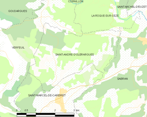
Saint-André-d'Olérargues
- commune in Gard, France
- Country:
- Postal Code: 30330
- Coordinates: 44° 9' 43" N, 4° 29' 8" E
- GPS tracks (wikiloc): [Link]
- Area: 9.75 sq km
- Population: 423
- Web site: [Link]


La Roque-sur-Cèze
- commune in Gard, France
- Country:
- Postal Code: 30200
- Coordinates: 44° 11' 37" N, 4° 31' 10" E
- GPS tracks (wikiloc): [Link]
- Area: 8.37 sq km
- Population: 182
- Web site: [Link]


Fontarèches
- commune in Gard, France
- Country:
- Postal Code: 30580
- Coordinates: 44° 6' 30" N, 4° 26' 17" E
- GPS tracks (wikiloc): [Link]
- Area: 13.42 sq km
- Population: 258


Lussan
- commune in Gard, France
- Country:
- Postal Code: 30580
- Coordinates: 44° 9' 11" N, 4° 21' 59" E
- GPS tracks (wikiloc): [Link]
- Area: 46.92 sq km
- Population: 497
- Web site: [Link]


Goudargues
- commune in Gard, France
- Country:
- Postal Code: 30630
- Coordinates: 44° 12' 56" N, 4° 27' 57" E
- GPS tracks (wikiloc): [Link]
- Area: 30.27 sq km
- Population: 1105


Cornillon
- commune in Gard, France
- Country:
- Postal Code: 30630
- Coordinates: 44° 13' 5" N, 4° 29' 11" E
- GPS tracks (wikiloc): [Link]
- Area: 15.58 sq km
- Population: 925
- Web site: [Link]


Saint-Marcel-de-Careiret
- commune in Gard, France
- Country:
- Postal Code: 30330
- Coordinates: 44° 8' 35" N, 4° 29' 16" E
- GPS tracks (wikiloc): [Link]
- AboveSeaLevel: 212 м m
- Area: 10.17 sq km
- Population: 841
- Web site: [Link]


Saint-Laurent-la-Vernède
- commune in Gard, France
- Country:
- Postal Code: 30330
- Coordinates: 44° 6' 18" N, 4° 27' 29" E
- GPS tracks (wikiloc): [Link]
- Area: 11.8 sq km
- Population: 709
- Web site: [Link]