Saint-Georges-de-Commiers (Saint-Georges-de-Commiers)

- commune in Isère, France
 Hiking in Saint-Georges-de-Commiers
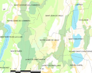
Saint-Georges-de-Commiers is a picturesque commune located in the Isère department of the Auvergne-Rhône-Alpes region in southeastern France. Nestled at the foothills of the Vercors Massif, it offers a variety of hiking opportunities that cater to different experience levels and preferences.
Hiking Trails
-
Vercors Regional Natural Park: This nearby park has numerous trails that showcase stunning mountainous landscapes and diverse flora and fauna. The area is especially known for its limestone cliffs, deep gorges, and expansive meadows.
-
Local Trails: There are several well-marked paths starting directly from Saint-Georges-de-Commiers. These trails can lead you through forests, past rivers, and up to viewpoints that offer breathtaking panoramas over the surrounding valleys and mountains.
-
Circuit des Rivières: This is a great trail for both hiking and enjoying nature. It follows riverbanks, allowing hikers to experience the local ecosystem and possibly spot some wildlife.
-
Mont Aiguille: For more experienced hikers, trails leading to Mont Aiguille offer a challenging adventure. It’s one of the most iconic peaks in the Vercors and is often sought out for its unique shape and the views it offers from the summit.
Best Time to Hike
The best times for hiking in Saint-Georges-de-Commiers are late spring through early autumn (May to October). During this period, the weather is generally mild, and the trails are most accessible. Spring offers vibrant wildflowers, while autumn provides stunning foliage.
Preparation and Tips
-
Equipment: A good pair of hiking boots, a backpack with essential supplies, and appropriate clothing depending on the season are crucial. Don't forget water, snacks, and a map or GPS.
-
Navigating Trails: While many trails are marked, it's always a good idea to have a map or a hiking app on your phone. Some paths can be remote, so being prepared is important.
-
Environmental Responsibility: Follow the Leave No Trace principles. Enjoy the beautiful surroundings while ensuring you leave no impact behind.
Local Attractions
After hiking, you might want to explore the local culture and cuisine. The area around Saint-Georges-de-Commiers has charming villages and local eateries where you can enjoy traditional French food.
Whether you are looking for a gentle stroll or a more demanding trek, Saint-Georges-de-Commiers offers a great starting point for exploring the natural beauty of the French Alps. Happy hiking!
- Country:

- Postal Code: 38450
- Coordinates: 45° 2' 17" N, 5° 42' 13" E


- GPS tracks (wikiloc): [Link]
- Area: 14.62 sq km
- Population: 2134
- Web site: http://st-georges-de-commiers.fr
- Wikipedia en: wiki(en)
- Wikipedia: wiki(fr)
- Wikidata storage: Wikidata: Q686097
- Wikipedia Commons Category: [Link]
- Freebase ID: [/m/03g_120]
- GeoNames ID: Alt: [6433342]
- SIREN number: [213803885]
- BnF ID: [152581980]
- VIAF ID: Alt: [242336571]
- INSEE municipality code: 38388
Shares border with regions:


Saint-Jean-de-Vaulx
- commune in Isère, France
Hiking in Saint-Jean-de-Vaulx
Saint-Jean-de-Vaulx is a charming village located in the Auvergne-Rhône-Alpes region of France, known for its beautiful landscapes and outdoor recreation opportunities, particularly hiking....
- Country:
- Postal Code: 38220
- Coordinates: 45° 0' 46" N, 5° 45' 30" E
- GPS tracks (wikiloc): [Link]
- Area: 10.73 sq km
- Population: 542
- Web site: [Link]


Champ-sur-Drac
- commune in Isère, France
Hiking in Champ-sur-Drac
Champ-sur-Drac is a charming commune located in the Isère department of the Auvergne-Rhône-Alpes region in southeastern France. The area is surrounded by beautiful natural landscapes, making it a great destination for hiking enthusiasts....
- Country:
- Postal Code: 38560
- Coordinates: 45° 4' 58" N, 5° 44' 3" E
- GPS tracks (wikiloc): [Link]
- Area: 8.92 sq km
- Population: 3037
- Web site: [Link]

Notre-Dame-de-Vaulx
- commune in Isère, France
Hiking in Notre-Dame-de-Vaulx
Notre-Dame-de-Vaulx is a picturesque area located in the Auvergne-Rhône-Alpes region of France. While not as widely known as other hiking destinations, it offers several opportunities for outdoor enthusiasts to explore its natural beauty and serene landscapes....
- Country:
- Postal Code: 38144
- Coordinates: 44° 59' 11" N, 5° 44' 56" E
- GPS tracks (wikiloc): [Link]
- Area: 7.88 sq km
- Population: 510
- Web site: [Link]


Notre-Dame-de-Commiers
- commune in Isère, France
Hiking in Notre-Dame-de-Commiers
Notre-Dame-de-Commiers, located in the French Alps near Grenoble, is a beautiful destination for hiking enthusiasts. Nestled at the foot of the Chartreuse Mountains, the area offers a variety of trails that cater to different skill levels and preferences....
- Country:
- Postal Code: 38450
- Coordinates: 45° 0' 36" N, 5° 42' 0" E
- GPS tracks (wikiloc): [Link]
- Area: 4.79 sq km
- Population: 479
- Web site: [Link]


Vif
- commune in Isère, France
Hiking in Vif
Vif is a charming commune located in the Isère department in the Auvergne-Rhône-Alpes region of southeastern France. Nestled at the foot of the Chartreuse Mountains and near the Écrins National Park, Vif offers a variety of hiking opportunities that cater to different skill levels. Here are some highlights of hiking in and around Vif:...
- Country:
- Postal Code: 38450
- Coordinates: 45° 3' 19" N, 5° 40' 12" E
- GPS tracks (wikiloc): [Link]
- Area: 28.3 sq km
- Population: 8212
- Web site: [Link]