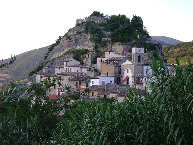
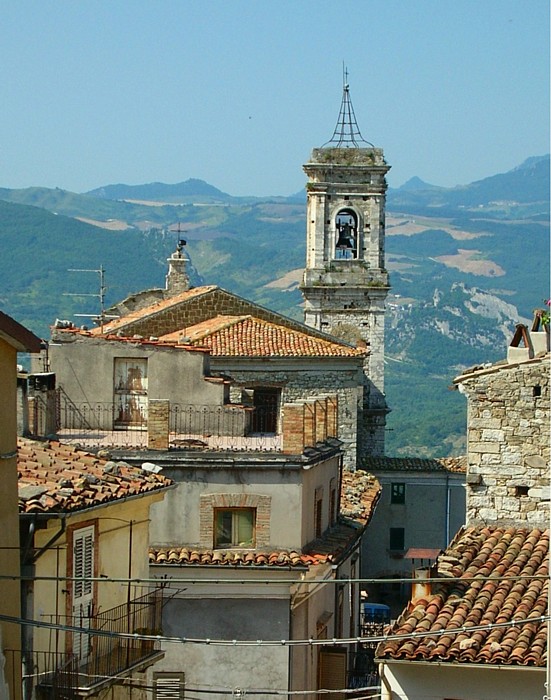
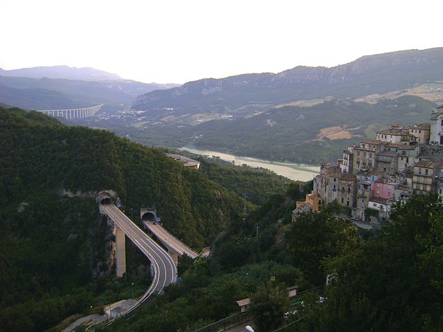
Villa Santa Maria (Villa Santa Maria)
.svg)
- Italian comune
 Hiking in Villa Santa Maria
Villa Santa Maria is a beautiful destination located in the heart of Italy, surrounded by stunning landscapes that make it an excellent spot for hiking and outdoor activities. The area is characterized by rolling hills, lush forests, and breathtaking views of the surrounding mountains.
Hiking Trails:
-
Local Trails: There are numerous local trails that cater to various skill levels, from easy walks suitable for families to more challenging hikes for experienced hikers. Trail markers are generally well-maintained, but it's always a good idea to have a map or a GPS device.
-
Monte di Villa Santa Maria: This area features trails that lead to the peaks of nearby mountains, offering panoramic views of the region. The hike to the summit can be a rewarding experience, especially during sunrise or sunset.
-
Nature Reserves: The nearby nature reserves provide a fantastic opportunity to explore diverse flora and fauna. Keep an eye out for local wildlife, including various bird species.
Tips for Hiking in Villa Santa Maria:
-
Best Time to Hike: Spring and early fall are ideal for hiking due to mild temperatures and blooming landscapes. Summers can be hot, so opt for early morning hikes.
-
Preparation: Ensure you're properly equipped with comfortable hiking shoes, enough water, snacks, and appropriate clothing for changing weather conditions.
-
Respect Nature: Follow "Leave No Trace" principles to protect the natural environment. Stay on marked trails and avoid disturbing wildlife.
-
Local Guides: Consider hiring a local guide, especially if you're unfamiliar with the area. They can provide insights into the local culture, wildlife, and hidden gems.
-
Safety: Always let someone know your hiking plans, especially if you're heading out alone, and check weather conditions before setting off.
Whether you’re looking for a leisurely hike through the countryside or a more challenging trek up a mountain, Villa Santa Maria offers a splendid experience for outdoor enthusiasts. Enjoy the adventure!
- Country:

- Postal Code: 66047
- Local Dialing Code: 0872
- Licence Plate Code: CH
- Coordinates: 41° 57' 5" N, 14° 21' 5" E


- GPS tracks (wikiloc): [Link]
- AboveSeaLevel: 390 м m
- Area: 16.23 sq km
- Population: 1338
- Web site: http://www.villasantamaria.eu/
- Wikipedia en: wiki(en)
- Wikipedia: wiki(it)
- Wikidata storage: Wikidata: Q51317
- Wikipedia Commons Category: [Link]
- Freebase ID: [/m/08lnnf]
- GeoNames ID: Alt: [6539831]
- VIAF ID: Alt: [245858282]
- OSM relation ID: [41656]
- MusicBrainz area ID: [f2e9f658-9d31-47f6-b15f-b5099c8493c1]
- DMOZ ID: Alt: [Regional/Europe/Italy/Abruzzo/Localities/Villa_Santa_Maria/]
- ISTAT ID: 069102
- Italian cadastre code: M022
Shares border with regions:

Pietraferrazzana
- Italian comune
Hiking in Pietraferrazzana
Pietraferrazzana is a charming village in the province of Chieti, situated in the Abruzzo region of Italy. It's nestled within the scenic landscapes of the Apennines, making it a wonderful destination for hikers and nature lovers. Here are some highlights and tips for hiking in the area:...
- Country:
- Postal Code: 66040
- Local Dialing Code: 0872
- Licence Plate Code: CH
- Coordinates: 41° 58' 0" N, 14° 22' 0" E
- GPS tracks (wikiloc): [Link]
- AboveSeaLevel: 357 м m
- Area: 4.37 sq km
- Population: 133
- Web site: [Link]


Fallo
- Italian comune
Hiking in Fallo
It seems there may be a misunderstanding or a typographical error with "Fallo," as it does not refer to a well-known hiking location or area. However, if you're referring to a specific place, it could be helpful to clarify which region or country you mean....
- Country:
- Postal Code: 66040
- Local Dialing Code: 0872
- Licence Plate Code: CH
- Coordinates: 41° 56' 0" N, 14° 19' 0" E
- GPS tracks (wikiloc): [Link]
- AboveSeaLevel: 575 м m
- Area: 6.1 sq km
- Population: 138
- Web site: [Link]


Roio del Sangro
- Italian comune
Hiking in Roio del Sangro
Roio del Sangro is a charming town located in the Abruzzo region of Italy, surrounded by beautiful natural landscapes, making it a great destination for hiking enthusiasts. The area is characterized by its varied terrain, including mountains, forests, and rivers, offering a wide range of hiking trails suitable for different skill levels....
- Country:
- Postal Code: 66040
- Local Dialing Code: 0872
- Licence Plate Code: CH
- Coordinates: 41° 55' 0" N, 14° 22' 0" E
- GPS tracks (wikiloc): [Link]
- AboveSeaLevel: 840 м m
- Area: 11.81 sq km
- Population: 101
- Web site: [Link]


Montelapiano
- Italian comune
Hiking in Montelapiano
Montelapiano is a charming village located in the Apennine Mountains of Italy, particularly known for its beautiful landscapes, tranquility, and opportunities for outdoor activities. Hiking in this area can be a rewarding experience for nature enthusiasts and those looking to explore the natural beauty of the region....
- Country:
- Postal Code: 66040
- Local Dialing Code: 0872
- Licence Plate Code: CH
- Coordinates: 41° 58' 0" N, 14° 21' 0" E
- GPS tracks (wikiloc): [Link]
- AboveSeaLevel: 740 м m
- Area: 8.27 sq km
- Population: 79
- Web site: [Link]
Montebello sul Sangro
- Italian comune
Hiking in Montebello sul Sangro
Montebello sul Sangro is a charming municipality located in the Abruzzo region of Italy, surrounded by stunning natural landscapes that are perfect for hiking enthusiasts. Here’s what you can expect when hiking in and around Montebello sul Sangro:...
- Country:
- Postal Code: 66040
- Local Dialing Code: 0872
- Licence Plate Code: CH
- Coordinates: 41° 59' 0" N, 14° 20' 0" E
- GPS tracks (wikiloc): [Link]
- AboveSeaLevel: 810 м m
- Area: 5.38 sq km
- Population: 88
- Web site: [Link]

Monteferrante
- Italian comune
Hiking in Monteferrante
Monteferrante, located in the Abruzzo region of Italy, offers beautiful hiking opportunities surrounded by stunning scenery and rich natural biodiversity. Here are some highlights to consider for your hiking trip in Monteferrante:...
- Country:
- Postal Code: 66040
- Local Dialing Code: 0872
- Licence Plate Code: CH
- Coordinates: 41° 57' 0" N, 14° 23' 0" E
- GPS tracks (wikiloc): [Link]
- AboveSeaLevel: 850 м m
- Area: 15.29 sq km
- Population: 123
- Web site: [Link]


Atessa
- Italian comune
Hiking in Atessa
Atessa, located in the Abruzzo region of Italy, offers a range of hiking opportunities that showcase the area's beautiful landscapes, rich history, and cultural heritage. Here are some key points about hiking in Atessa:...
- Country:
- Postal Code: 66041
- Local Dialing Code: 0872
- Licence Plate Code: CH
- Coordinates: 42° 4' 0" N, 14° 27' 0" E
- GPS tracks (wikiloc): [Link]
- AboveSeaLevel: 435 м m
- Area: 110.98 sq km
- Population: 10580
- Web site: [Link]

Bomba
- Italian comune
Hiking in Bomba
Bomba is a charming small town located in the province of Chieti in the Abruzzo region of Italy. Nestled within the foothills of the Appennine mountains and surrounded by stunning natural landscapes, it offers a variety of hiking opportunities for both beginners and experienced hikers....
- Country:
- Postal Code: 66042
- Local Dialing Code: 0872
- Licence Plate Code: CH
- Coordinates: 42° 2' 0" N, 14° 22' 0" E
- GPS tracks (wikiloc): [Link]
- AboveSeaLevel: 424 м m
- Area: 17.26 sq km
- Population: 785
- Web site: [Link]


Borrello
- Italian comune
Hiking in Borrello
Borrello is a small village located in the Abruzzo region of Italy, characterized by its beautiful landscapes, charming hillsides, and proximity to both the mountains and the Adriatic Sea. Hiking in this region can offer stunning views and a chance to explore the natural beauty of Italy....
- Country:
- Postal Code: 66040
- Local Dialing Code: 0872
- Licence Plate Code: CH
- Coordinates: 41° 55' 0" N, 14° 18' 0" E
- GPS tracks (wikiloc): [Link]
- AboveSeaLevel: 804 м m
- Area: 14.51 sq km
- Population: 335
- Web site: [Link]

Colledimezzo
- Italian comune
Hiking in Colledimezzo
Colledimezzo is a picturesque village in the Abruzzo region of Italy, situated in the province of Chieti. This area is characterized by its stunning landscapes, rolling hills, and a mix of natural beauty and rich cultural heritage, making it an ideal destination for hiking enthusiasts....
- Country:
- Postal Code: 66040
- Local Dialing Code: 0872
- Licence Plate Code: CH
- Coordinates: 41° 59' 0" N, 14° 23' 0" E
- GPS tracks (wikiloc): [Link]
- AboveSeaLevel: 425 м m
- Area: 11.05 sq km
- Population: 482
- Web site: [Link]
Pennadomo
- Italian comune
Hiking in Pennadomo
Pennadomo, located in the Province of L'Aquila in the Abruzzo region of Italy, is a wonderful spot for hiking enthusiasts. The area is known for its stunning natural landscapes, including lush forests, rolling hills, and breathtaking views of the surrounding Apennine mountains....
- Country:
- Postal Code: 66040
- Local Dialing Code: 0872
- Licence Plate Code: CH
- Coordinates: 42° 0' 0" N, 14° 19' 0" E
- GPS tracks (wikiloc): [Link]
- AboveSeaLevel: 460 м m
- Area: 11.02 sq km
- Population: 251
- Web site: [Link]


Rosello
- Italian comune
Hiking in Rosello
Hiking in Rosello, a location known for its natural beauty and scenic trails, offers a variety of experiences for outdoor enthusiasts. While specific details about the area can vary, here are some general highlights and tips for hiking in Rosello:...
- Country:
- Postal Code: 66040
- Local Dialing Code: 0872
- Licence Plate Code: CH
- Coordinates: 41° 54' 4" N, 14° 20' 57" E
- GPS tracks (wikiloc): [Link]
- AboveSeaLevel: 927 м m
- Area: 19.23 sq km
- Population: 226
- Web site: [Link]