Villargent (Villargent)

- commune in Haute-Saône, France
- Country:

- Postal Code: 70110
- Coordinates: 47° 32' 30" N, 6° 29' 9" E


- GPS tracks (wikiloc): [Link]
- Area: 2.86 sq km
- Population: 125
- Wikipedia en: wiki(en)
- Wikipedia: wiki(fr)
- Wikidata storage: Wikidata: Q918851
- Wikipedia Commons Category: [Link]
- Freebase ID: [/m/03nw0w5]
- GeoNames ID: Alt: [6442160]
- SIREN number: [217005537]
- BnF ID: [15272945k]
- INSEE municipality code: 70553
Shares border with regions:


Georfans
- commune in Haute-Saône, France
 Hiking in Georfans
It seems like you might be referring to the "Georgian" region or perhaps a specific hiking area, but "Georfans" does not appear to be a recognized hiking location. Could you clarify if you meant “Georgia” (the country) or a specific national park or region?...
- Country:
- Postal Code: 70110
- Coordinates: 47° 32' 11" N, 6° 30' 45" E
- GPS tracks (wikiloc): [Link]
- Area: 2.99 sq km
- Population: 60

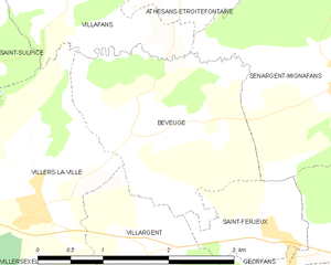
Beveuge
- commune in Haute-Saône, France
- Country:
- Postal Code: 70110
- Coordinates: 47° 33' 30" N, 6° 28' 58" E
- GPS tracks (wikiloc): [Link]
- Area: 5.18 sq km
- Population: 82

Mélecey
- commune in Haute-Saône, France
Hiking in Mélecey
Melécey is a charming commune located in the Côte-d'Or department in the Bourgogne-Franche-Comté region of east-central France. While it may not be as widely known as some larger hiking hotspots, it offers beautiful landscapes and a tranquil environment for hikers looking to explore nature away from the crowded trails....
- Country:
- Postal Code: 70110
- Coordinates: 47° 31' 10" N, 6° 29' 25" E
- GPS tracks (wikiloc): [Link]
- Area: 3.35 sq km
- Population: 154


Villers-la-Ville
- commune in Haute-Saône, France
- Country:
- Postal Code: 70110
- Coordinates: 47° 32' 55" N, 6° 27' 43" E
- GPS tracks (wikiloc): [Link]
- Area: 5.87 sq km
- Population: 143


Saint-Ferjeux
- commune in Haute-Saône, France
- Country:
- Postal Code: 70110
- Coordinates: 47° 32' 37" N, 6° 30' 36" E
- GPS tracks (wikiloc): [Link]
- Area: 1.77 sq km
- Population: 78