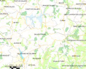
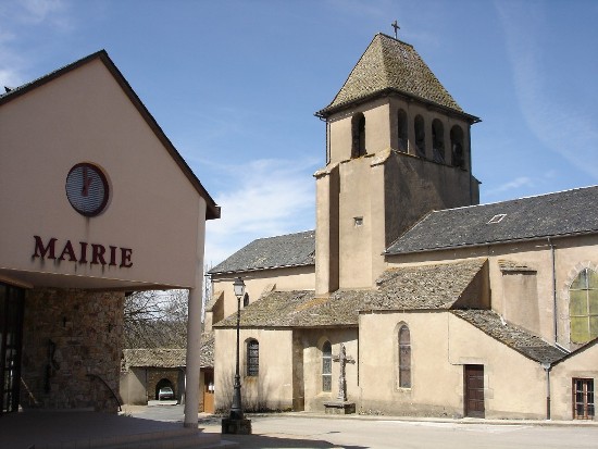
Villefranche-de-Panat (Villefranche-de-Panat)
- commune in Aveyron, France
- Country:

- Postal Code: 12430
- Coordinates: 44° 5' 18" N, 2° 42' 17" E


- GPS tracks (wikiloc): [Link]
- Area: 29.13 sq km
- Population: 730
- Web site: http://www.villefranche-de-panat.fr
- Wikipedia en: wiki(en)
- Wikipedia: wiki(fr)
- Wikidata storage: Wikidata: Q973642
- Wikipedia Commons Category: [Link]
- Freebase ID: [/m/03m9698]
- GeoNames ID: Alt: [6427080]
- SIREN number: [211202999]
- BnF ID: [152472755]
- VIAF ID: Alt: [131463297]
- Library of Congress authority ID: Alt: [n88603326]
- PACTOLS thesaurus ID: [pcrt4SYAwHo3AG]
- INSEE municipality code: 12299
Shares border with regions:


Broquiès
- commune in Aveyron, France
- Country:

- Postal Code: 12480
- Coordinates: 44° 0' 18" N, 2° 41' 45" E


- GPS tracks (wikiloc): [Link]
- Area: 37.99 sq km
- Population: 606
- Web site: [Link]


Ayssènes
- commune in Aveyron, France
- Country:

- Postal Code: 12430
- Coordinates: 44° 4' 10" N, 2° 46' 46" E


- GPS tracks (wikiloc): [Link]
- AboveSeaLevel: 356 м m
- Area: 23.14 sq km
- Population: 215


Salles-Curan
- commune in Aveyron, France
- Country:

- Postal Code: 12410
- Coordinates: 44° 10' 57" N, 2° 47' 14" E


- GPS tracks (wikiloc): [Link]
- Area: 93.9 sq km
- Population: 1057
Lestrade-et-Thouels
- commune in Aveyron, France
- Country:

- Postal Code: 12430
- Coordinates: 44° 3' 33" N, 2° 39' 34" E


- GPS tracks (wikiloc): [Link]
- Area: 42.27 sq km
- Population: 479


Le Truel
- commune in Aveyron, France
- Country:

- Postal Code: 12430
- Coordinates: 44° 2' 58" N, 2° 45' 18" E


- GPS tracks (wikiloc): [Link]
- Area: 26.48 sq km
- Population: 344


Durenque
- commune in Aveyron, France
- Country:

- Postal Code: 12170
- Coordinates: 44° 6' 35" N, 2° 37' 6" E


- GPS tracks (wikiloc): [Link]
- Area: 33.15 sq km
- Population: 529


Alrance
- commune in Aveyron, France
- Country:

- Postal Code: 12430
- Coordinates: 44° 7' 53" N, 2° 41' 0" E


- GPS tracks (wikiloc): [Link]
- Area: 35.43 sq km
- Population: 362
- Web site: [Link]
