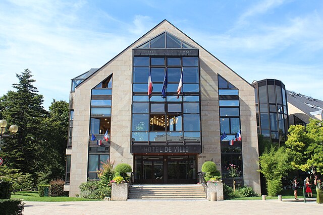
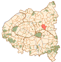
Villemomble (Villemomble)


- commune in Seine-Saint-Denis, France
- Country:

- Postal Code: 93250
- Coordinates: 48° 53' 25" N, 2° 30' 40" E


- GPS tracks (wikiloc): [Link]
- AboveSeaLevel: 58 м m
- Area: 4.04 sq km
- Population: 29847
- Web site: http://www.villemomble.fr
- Wikipedia en: wiki(en)
- Wikipedia: wiki(fr)
- Wikidata storage: Wikidata: Q244716
- Wikipedia Commons Category: [Link]
- Wikipedia Commons Maps Category: [Link]
- Freebase ID: [/m/097_08]
- Freebase ID: [/m/097_08]
- GeoNames ID: Alt: [2968653]
- GeoNames ID: Alt: [2968653]
- SIREN number: [219300779]
- SIREN number: [219300779]
- BnF ID: [15280318r]
- BnF ID: [15280318r]
- VIAF ID: Alt: [161053890]
- VIAF ID: Alt: [161053890]
- MusicBrainz area ID: [cce9113c-1a91-4564-9096-9819e96eb7d7]
- MusicBrainz area ID: [cce9113c-1a91-4564-9096-9819e96eb7d7]
- data.gouv.fr org ID: [villemomble]
- data.gouv.fr org ID: [villemomble]
- INSEE municipality code: 93077
- INSEE municipality code: 93077
Shares border with regions:


Gagny
- commune in Seine-Saint-Denis, France
- Country:
- Postal Code: 93220
- Coordinates: 48° 52' 54" N, 2° 32' 20" E
- GPS tracks (wikiloc): [Link]
- AboveSeaLevel: 80 м m
- Area: 6.83 sq km
- Population: 39603
- Web site: [Link]

Neuilly-sur-Marne
- commune in Seine-Saint-Denis, France
- Country:
- Postal Code: 93330
- Coordinates: 48° 51' 28" N, 2° 31' 52" E
- GPS tracks (wikiloc): [Link]
- AboveSeaLevel: 43 м m
- Area: 6.86 sq km
- Population: 34763
- Web site: [Link]


Bondy
- commune in Seine-Saint-Denis, France
- Country:
- Postal Code: 93140
- Licence Plate Code: 93
- Coordinates: 48° 54' 10" N, 2° 29' 1" E
- GPS tracks (wikiloc): [Link]
- AboveSeaLevel: 55 м m
- Area: 5.47 sq km
- Population: 53439
- Web site: [Link]


Le Raincy
- commune in Seine-Saint-Denis, France
- Country:
- Postal Code: 93340
- Coordinates: 48° 53' 57" N, 2° 31' 23" E
- GPS tracks (wikiloc): [Link]
- AboveSeaLevel: 83 м m
- Area: 2.24 sq km
- Population: 14411
- Web site: [Link]

Rosny-sous-Bois
- commune in Seine-Saint-Denis, France
- Country:
- Postal Code: 93110
- Coordinates: 48° 52' 23" N, 2° 29' 7" E
- GPS tracks (wikiloc): [Link]
- AboveSeaLevel: 69 м m
- Area: 5.91 sq km
- Population: 44728
- Web site: [Link]


Les Pavillons-sous-Bois
- commune in Seine-Saint-Denis, France
- Country:
- Postal Code: 93320
- Coordinates: 48° 54' 21" N, 2° 30' 38" E
- GPS tracks (wikiloc): [Link]
- AboveSeaLevel: 55 м m
- Area: 2.92 sq km
- Population: 23356
- Web site: [Link]


Neuilly-Plaisance
- commune in Seine-Saint-Denis, France
- Country:
- Postal Code: 93360
- Coordinates: 48° 51' 39" N, 2° 30' 35" E
- GPS tracks (wikiloc): [Link]
- AboveSeaLevel: 48 м m
- Area: 3.42 sq km
- Population: 21165
- Web site: [Link]