Villiers-au-Bouin (Villiers-au-Bouin)

- commune in Indre-et-Loire, France
- Country:

- Postal Code: 37330
- Coordinates: 47° 34' 29" N, 0° 18' 46" E


- GPS tracks (wikiloc): [Link]
- Area: 29.83 sq km
- Population: 763
- Wikipedia en: wiki(en)
- Wikipedia: wiki(fr)
- Wikidata storage: Wikidata: Q604852
- Wikipedia Commons Category: [Link]
- Freebase ID: [/m/03nvcw_]
- GeoNames ID: Alt: [6433159]
- SIREN number: [213702798]
- BnF ID: [152578275]
- INSEE municipality code: 37279
Shares border with regions:


Braye-sur-Maulne
- commune in Indre-et-Loire, France
- Country:
- Postal Code: 37330
- Coordinates: 47° 33' 20" N, 0° 14' 55" E
- GPS tracks (wikiloc): [Link]
- Area: 11.84 sq km
- Population: 178


Broc
- former commune in Maine-et-Loire, France
- Country:
- Postal Code: 49490
- Coordinates: 47° 34' 46" N, 0° 9' 59" E
- GPS tracks (wikiloc): [Link]
- Area: 21.23 sq km
- Population: 318


Lublé
- commune in Indre-et-Loire, France
- Country:
- Postal Code: 37330
- Coordinates: 47° 30' 53" N, 0° 14' 42" E
- GPS tracks (wikiloc): [Link]
- Area: 12.6 sq km
- Population: 146


Couesmes
- commune in Indre-et-Loire, France
- Country:
- Postal Code: 37330
- Coordinates: 47° 33' 50" N, 0° 20' 30" E
- GPS tracks (wikiloc): [Link]
- Area: 19.12 sq km
- Population: 481
- Web site: [Link]

Marcilly-sur-Maulne
- commune in Indre-et-Loire, France
- Country:
- Postal Code: 37330
- Coordinates: 47° 33' 3" N, 0° 14' 29" E
- GPS tracks (wikiloc): [Link]
- Area: 14.6 sq km
- Population: 235
- Web site: [Link]


La Chapelle-aux-Choux
- commune in Sarthe, France
- Country:
- Postal Code: 72800
- Coordinates: 47° 37' 56" N, 0° 13' 53" E
- GPS tracks (wikiloc): [Link]
- Area: 14.43 sq km
- Population: 269

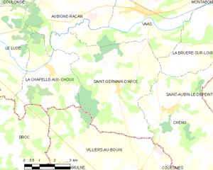
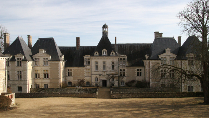
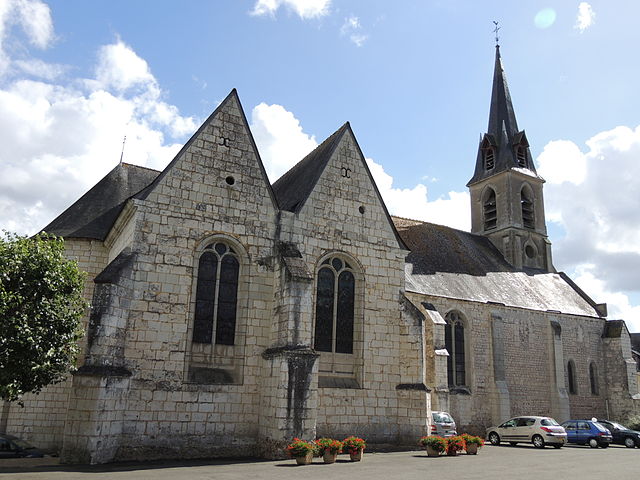
Saint-Germain-d'Arcé
- commune in Sarthe, France
- Country:
- Postal Code: 72800
- Coordinates: 47° 37' 24" N, 0° 17' 28" E
- GPS tracks (wikiloc): [Link]
- Area: 29.19 sq km
- Population: 341

Chenu, Sarthe
- commune in Sarthe, France
- Country:
- Postal Code: 72500
- Coordinates: 47° 36' 47" N, 0° 20' 14" E
- GPS tracks (wikiloc): [Link]
- Area: 30.56 sq km
- Population: 428


Château-la-Vallière
- commune in Indre-et-Loire, France
- Country:
- Postal Code: 37330
- Coordinates: 47° 32' 49" N, 0° 19' 30" E
- GPS tracks (wikiloc): [Link]
- Area: 21.94 sq km
- Population: 1768
- Web site: [Link]