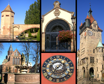
Walbourg (Walbourg)
- commune in Bas-Rhin, France
- Country:

- Postal Code: 67360
- Coordinates: 48° 53' 12" N, 7° 47' 22" E


- GPS tracks (wikiloc): [Link]
- Area: 5.33 sq km
- Population: 881
- Web site: http://www.walbourg-hinterfeld.fr/
- Wikipedia en: wiki(en)
- Wikipedia: wiki(fr)
- Wikidata storage: Wikidata: Q21608
- Wikipedia Commons Category: [Link]
- Freebase ID: [/m/03m9cnl]
- Freebase ID: [/m/03m9cnl]
- Freebase ID: [/m/03m9cnl]
- GeoNames ID: Alt: [2967506]
- GeoNames ID: Alt: [2967506]
- GeoNames ID: Alt: [2967506]
- SIREN number: [216705111]
- SIREN number: [216705111]
- SIREN number: [216705111]
- BnF ID: [152716534]
- BnF ID: [152716534]
- BnF ID: [152716534]
- VIAF ID: Alt: [240131844]
- VIAF ID: Alt: [240131844]
- VIAF ID: Alt: [240131844]
- INSEE municipality code: 67511
- INSEE municipality code: 67511
- INSEE municipality code: 67511
Shares border with regions:


Biblisheim
- commune in Bas-Rhin, France
- Country:

- Postal Code: 67360
- Coordinates: 48° 53' 56" N, 7° 47' 42" E


- GPS tracks (wikiloc): [Link]
- AboveSeaLevel: 155 м m
- Area: 2.24 sq km
- Population: 343
Hegeney
- commune in Bas-Rhin, France
- Country:

- Postal Code: 67360
- Coordinates: 48° 53' 26" N, 7° 44' 28" E


- GPS tracks (wikiloc): [Link]
- Area: 1.76 sq km
- Population: 415
Eschbach
- commune in Bas-Rhin, France
- Country:

- Postal Code: 67360
- Coordinates: 48° 52' 27" N, 7° 44' 11" E


- GPS tracks (wikiloc): [Link]
- Area: 3.97 sq km
- Population: 929


Haguenau
- commune in Bas-Rhin, France
- Country:

- Postal Code: 67500
- Coordinates: 48° 49' 0" N, 7° 47' 16" E


- GPS tracks (wikiloc): [Link]
- AboveSeaLevel: 150 м m
- Area: 182.59 sq km
- Population: 34846
- Web site: [Link]


Durrenbach
- commune in Bas-Rhin, France
- Country:

- Postal Code: 67360
- Coordinates: 48° 53' 47" N, 7° 46' 6" E


- GPS tracks (wikiloc): [Link]
- Area: 5.3 sq km
- Population: 1080
