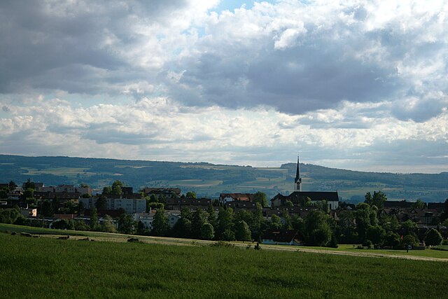
Widen (Widen)
- municipality in Switzerland
Widen, located in the Canton of Aargau in Switzerland, offers beautiful hiking opportunities with its picturesque landscapes and well-marked trails. Here are some details to consider when planning a hike in Widen:
Trail Options
- Local Trails: You may find various local trails that wind through charming villages, lush forests, and rolling hills. Popular routes often connect Widen to nearby towns or natural landmarks.
- Nature Reserves: The area may have nearby nature reserves where you can explore diverse flora and fauna.
- Scenic Views: Hikes in the region often provide panoramic views of the surrounding countryside, making it an excellent spot for photography and nature appreciation.
Trail Difficulty
- Variety of Levels: Trails in the Widen area can cater to a range of skill levels, from easy walks suitable for families to more challenging hikes for experienced trekkers.
Preparation
- Weather Conditions: Always check the weather forecast before you head out. Swiss weather can change rapidly, so being prepared is crucial.
- Footwear: Wear sturdy hiking shoes for comfort and support, especially if you are tackling uneven terrain.
- Supplies: Pack essentials such as water, snacks, a map or GPS device, and a first aid kit.
Local Amenities
- Food and Drink: After your hike, you might find local restaurants or cafés in Widen or nearby villages where you can relax and enjoy Swiss cuisine.
- Transport: Public transport options may be available to help you reach the trailheads, making it convenient for hikers without private vehicles.
Safety Tips
- Hiking Alone: If you're hiking alone, let someone know your plans and expected return time.
- Wildlife Awareness: Be aware of local wildlife and follow guidelines to ensure a safe encounter.
Conclusion
Hiking in Widen is an enjoyable experience that showcases Switzerland's natural beauty. Whether you're a seasoned hiker or just starting, the trails around Widen offer a peaceful retreat into nature. Always plan ahead and prioritize safety to make the most of your adventure!
- Country:

- Postal Code: 8967
- Local Dialing Code: 056
- Licence Plate Code: AG
- Coordinates: 47° 22' 12" N, 8° 21' 29" E


- GPS tracks (wikiloc): [Link]
- AboveSeaLevel: 562 м m
- Area: 2.62 sq km
- Population: 3668
- Web site: http://www.widen.ch
- Wikipedia en: wiki(en)
- Wikipedia: wiki(de)
- Wikidata storage: Wikidata: Q64384
- Wikipedia Commons Category: [Link]
- Freebase ID: [/m/09s0nh]
- GeoNames ID: Alt: [7287566]
- OSM relation ID: [1684459]
- HDS ID: [1680]
- Swiss municipality code: [4081]
Shares border with regions:


Rudolfstetten-Friedlisberg
- municipality in Switzerland
 Hiking in Rudolfstetten-Friedlisberg
Rudolfstetten-Friedlisberg is a picturesque municipality located in the Canton of Aargau in Switzerland. This area offers a variety of hiking opportunities, showcasing beautiful landscapes, lush forests, and stunning views of the surrounding hills and valleys....
- Country:

- Postal Code: 8964
- Local Dialing Code: 056
- Licence Plate Code: AG
- Coordinates: 47° 22' 9" N, 8° 22' 55" E


- GPS tracks (wikiloc): [Link]
- AboveSeaLevel: 479 м m
- Area: 4.90 sq km
- Population: 4466
- Web site: [Link]


Berikon
- municipality in Switzerland
Berikon is a picturesque town located in the canton of Aargau, Switzerland, and it offers a variety of hiking opportunities that appeal to both casual walkers and more experienced hikers. Here are some key points to consider when hiking in and around Berikon:...
- Country:

- Postal Code: 8965
- Local Dialing Code: 056
- Licence Plate Code: AG
- Coordinates: 47° 21' 14" N, 8° 23' 1" E


- GPS tracks (wikiloc): [Link]
- AboveSeaLevel: 583 м m
- Area: 5.38 sq km
- Population: 4715
- Web site: [Link]


Bergdietikon
- municipality in Switzerland
Bergdietikon is a charming municipality located in the canton of Aargau, Switzerland. It's situated in a picturesque region characterized by rolling hills, forests, and beautiful landscapes, making it an excellent destination for hiking enthusiasts of all levels....
- Country:

- Postal Code: 8962
- Local Dialing Code: 044
- Licence Plate Code: AG
- Coordinates: 47° 23' 39" N, 8° 23' 10" E


- GPS tracks (wikiloc): [Link]
- AboveSeaLevel: 508 м m
- Area: 5.94 sq km
- Population: 2827
- Web site: [Link]
