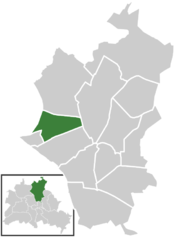
Wilhelmsruh (Wilhelmsruh)

- locality of Berlin
 Hiking in Wilhelmsruh
Wilhelmsruh is a charming area located in Berlin, Germany, known for its natural beauty and peaceful surroundings. Though it may not be as prominent as some of the larger hiking destinations, it offers a unique blend of urban and natural landscapes, making it a fantastic spot for walking and light hiking.
Trail Overview
-
Scenic Routes: The trails around Wilhelmsruh often wind through lush parks, along small streams, and through forests, making it easy to escape the hustle and bustle of the city.
-
Accessibility: Since it is situated in a metropolitan area, the trails are quite accessible, making it a great option for beginners or those looking to enjoy a leisurely walk.
-
Wildlife: Hikers might encounter various local wildlife and enjoy the flora that thrives in the area. It's a good spot for birdwatching and appreciating Berlin's urban greenery.
Recommended Hikes
- Local Parks: Start with the nearby parks like the Schönhauser Allee or Mauerpark, which are great for leisurely walks and enjoying the urban nature.
- Berlin's Green Spaces: Hike towards larger green spaces such as the Grunewald or the nearby Tegeler See for slightly more challenging trails that offer more in terms of distance and natural scenery.
Tips for Hiking in Wilhelmsruh
- Gear Up Properly: Even for easy trails, wear comfortable shoes and dress appropriately for the weather.
- Stay Hydrated: Always carry water, especially if you plan to hike longer distances.
- Be Aware of Urban Elements: As you’re in a metropolitan area, be mindful of road crossings and urban development.
- Check Local Guidelines: Be sure to check any specific local rules about walking, as urban areas might have specific regulations.
Additional Attractions
- Local Cafés: After your hike, consider stopping by local cafés or bakeries to enjoy a coffee or snack.
- Cultural Sites: Explore local historical sites or exhibitions to blend the hike with cultural insights.
Conclusion
Hiking in Wilhelmsruh can be a refreshing way to explore Berlin's outdoor offerings while enjoying the combination of nature and urban life. Whether you're looking for a casual stroll or a longer hike, this area offers a unique setting that appeals to both locals and visitors alike.
- Country:

- Coordinates: 52° 35' 14" N, 13° 22' 5" E


- GPS tracks (wikiloc): [Link]
- AboveSeaLevel: 44 м m
- Area: 1.37 sq km
- Wikipedia en: wiki(en)
- Wikipedia: wiki(de)
- Wikidata storage: Wikidata: Q648000
- Wikipedia Commons Gallery: [Link]
- Wikipedia Commons Category: [Link]
- Freebase ID: [/m/0bwg4k6]
- GeoNames ID: Alt: [2808664]
- VIAF ID: Alt: [236419580]
- OSM relation ID: [407650]
- GND ID: Alt: [4208604-8]
- archINFORM location ID: [43343]
Shares border with regions:


Niederschönhausen
- locality of Berlin
Hiking in Niederschönhausen
Niederschönhausen is a district located in the Pankow borough of Berlin, Germany. While it may not be as widely known for hiking as some of the more rural areas surrounding Berlin, there are still opportunities for walks and nature exploration in and around the area....
- Country:
- Coordinates: 52° 35' 0" N, 13° 24' 0" E
- GPS tracks (wikiloc): [Link]
- AboveSeaLevel: 48 м m
- Area: 6.49 sq km
- Population: 28313

Rosenthal
- locality of Berlin
Hiking in Rosenthal
Rosenthal is a district in the northeastern part of Berlin, known for its natural beauty and green spaces, making it a lovely destination for hiking and outdoor activities. Though it's not a vast or well-known hiking hub compared to some larger parks or forests, it still offers some nice opportunities for nature walks and hikes....
- Country:
- Coordinates: 52° 35' 57" N, 13° 22' 38" E
- GPS tracks (wikiloc): [Link]
- AboveSeaLevel: 47 м m
- Area: 4.9 sq km


Reinickendorf
- locality of the borough Reinickendorf of Berlin
Hiking in Reinickendorf
Reinickendorf is a district located in the northern part of Berlin, Germany. While it's primarily an urban area, it offers several opportunities for hiking and outdoor activities, particularly in its parks and natural reserves....
- Country:
- Postal Code: 13409; 13407; 13403
- Coordinates: 52° 34' 0" N, 13° 20' 0" E
- GPS tracks (wikiloc): [Link]
- AboveSeaLevel: 42 м m
- Area: 10.5 sq km
- Population: 80687