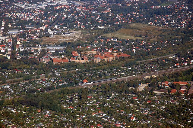
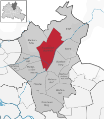
Niederschönhausen (Niederschönhausen)

- locality of Berlin
 Hiking in Niederschönhausen
Niederschönhausen is a district located in the Pankow borough of Berlin, Germany. While it may not be as widely known for hiking as some of the more rural areas surrounding Berlin, there are still opportunities for walks and nature exploration in and around the area.
Hiking Opportunities in Niederschönhausen:
-
Natur-Park Schöneberger Südgelände: Although this park is actually located a bit further away, it's well worth the visit if you're heading out for a day of hiking. It features a mix of industrial heritage and natural landscapes, with trails that weave through unique flora and abandoned train tracks.
-
Parks and Green Spaces: In Niederschönhausen, you will find parks such as the Schönhausen Palace Park. This park offers pleasant walking paths, gardens, and plenty of green space, ideal for a leisurely stroll rather than strenuous hiking. The historic Schönhausen Palace is also a notable landmark.
-
Nearby Forests: Just outside Niederschönhausen, there are forested areas such as the Tegeler Forst and the Grunewald, which feature numerous trails suitable for hiking. These areas offer a more traditional hiking experience, with various paths for different skill levels.
-
Cycling and Walking Paths: The district is interconnected with a network of cycling and walking paths that you can explore. You may find routes that take you along the Panke River or through the surrounding neighborhoods, providing a mix of urban and natural scenery.
Tips for Hiking in the Area:
- Check Local Maps and Guides: Before heading out, consult local maps or apps like Komoot or AllTrails, which offer detailed trail information.
- Shared Paths: Be mindful that some trails may also be used by cyclists or runners, so stay aware and courteous.
- Bring Essentials: Even for short walks, carry water, wear good walking shoes, and dress appropriately for the weather.
- Public Transport: Utilize Berlin’s efficient public transport system to access nearby hiking destinations easily.
While Niederschönhausen may not be a primary hiking destination, it can serve as a starting point to explore the many trails and parks in nearby areas. Enjoy your time outdoors!
- Country:

- Coordinates: 52° 35' 0" N, 13° 24' 0" E


- GPS tracks (wikiloc): [Link]
- AboveSeaLevel: 48 м m
- Area: 6.49 sq km
- Population: 28313
- Wikipedia en: wiki(en)
- Wikipedia: wiki(de)
- Wikidata storage: Wikidata: Q512959
- Wikipedia Commons Gallery: [Link]
- Wikipedia Commons Category: [Link]
- Wikipedia Commons Maps Category: [Link]
- Freebase ID: [/m/0bwmlrm]
- GeoNames ID: Alt: [2862888]
- VIAF ID: Alt: [239011494]
- OSM relation ID: [407652]
- GND ID: Alt: [4087335-3]
- archINFORM location ID: [43206]
- TGN ID: [1005205]
Shares border with regions:


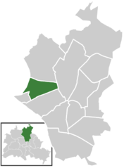
Pankow
- locality of the borough Pankow of Berlin
Hiking in Pankow
Pankow is a district in northeastern Berlin, Germany, known for its charming neighborhoods, parks, and green areas. While it is more urban compared to rural hiking destinations, there are still opportunities for enjoyable walks and hikes within and around the area....
- Country:
- Coordinates: 52° 34' 0" N, 13° 24' 0" E
- GPS tracks (wikiloc): [Link]
- AboveSeaLevel: 47 м m
- Area: 5.66 sq km
- Population: 57113


Wilhelmsruh
- locality of Berlin
Hiking in Wilhelmsruh
Wilhelmsruh is a charming area located in Berlin, Germany, known for its natural beauty and peaceful surroundings. Though it may not be as prominent as some of the larger hiking destinations, it offers a unique blend of urban and natural landscapes, making it a fantastic spot for walking and light hiking....
- Country:
- Coordinates: 52° 35' 14" N, 13° 22' 5" E
- GPS tracks (wikiloc): [Link]
- AboveSeaLevel: 44 м m
- Area: 1.37 sq km
Französisch Buchholz
- locality of Berlin
Hiking in Französisch Buchholz
Französisch Buchholz is a charming district located in the northern part of Berlin, Germany. While it may not be a traditional hiking destination like some of Germany's national parks, there are still several beautiful spots and trails in and around this area that offer pleasant walking and hiking experiences....
- Country:
- Coordinates: 52° 36' 0" N, 13° 26' 0" E
- GPS tracks (wikiloc): [Link]
- AboveSeaLevel: 46 м m
- Area: 12 sq km

Rosenthal
- locality of Berlin
Hiking in Rosenthal
Rosenthal is a district in the northeastern part of Berlin, known for its natural beauty and green spaces, making it a lovely destination for hiking and outdoor activities. Though it's not a vast or well-known hiking hub compared to some larger parks or forests, it still offers some nice opportunities for nature walks and hikes....
- Country:
- Coordinates: 52° 35' 57" N, 13° 22' 38" E
- GPS tracks (wikiloc): [Link]
- AboveSeaLevel: 47 м m
- Area: 4.9 sq km


Reinickendorf
- locality of the borough Reinickendorf of Berlin
Hiking in Reinickendorf
Reinickendorf is a district located in the northern part of Berlin, Germany. While it's primarily an urban area, it offers several opportunities for hiking and outdoor activities, particularly in its parks and natural reserves....
- Country:
- Postal Code: 13409; 13407; 13403
- Coordinates: 52° 34' 0" N, 13° 20' 0" E
- GPS tracks (wikiloc): [Link]
- AboveSeaLevel: 42 м m
- Area: 10.5 sq km
- Population: 80687