
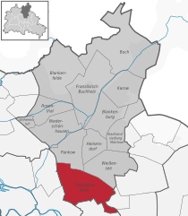
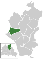
Pankow (Pankow)
- borough of Berlin, Germany
 Hiking in Pankow
Pankow is a borough in Berlin, Germany, and while it's primarily known for its urban environment, there are some options for hiking and enjoying nature in the area or nearby. Here are a few suggestions for hiking and outdoor activities around Pankow:
-
Parks and Green Spaces: Pankow contains several parks where you can enjoy leisurely walks. Notable ones include:
- Schlosspark Schönhausen: A beautiful park surrounding the palace with well-maintained paths perfect for walking.
- Antonplatz: A square with green areas that can serve as a pleasant urban walk.
-
Biosfera Potsdam: Although not in Pankow, this botanical garden is about 30 minutes away and offers a great experience if you're looking for a bit of nature outside the city.
-
Tegel Forest (Tegeler Forst):
- Located a bit northwest of Pankow, Tegel Forest offers various hiking trails and is an excellent place for longer walks in nature. You can explore the diversity of the forest and enjoy the peace of the outdoors.
-
Sophie-Charlotte-Strasse to the Schönhauser Allee:
- Take a hike along this route if you prefer an urban hike exploring the charm of Pankow’s neighborhoods while transitioning into greener areas.
-
Nearby Excursions: If you're willing to venture a bit further, you can also reach:
- Grunewald: A large forest area with many marked trails, lakes, and stunning viewpoints.
- Müggelberge: Located a bit further southeast, it’s a popular hiking area in Berlin with a series of trails.
-
Cycling and Walking Paths: Berlin has an extensive network of cycling and walking paths, linking various parks and natural areas even from Pankow to surrounding districts.
While Pankow may not be a traditional hiking destination, it offers opportunities for walking and enjoying nature in a city setting. For more extended hiking adventures, consider traveling to the outskirts of Berlin where larger parks and forests are located. Always check local maps and guides for specific trails and their conditions. Happy hiking!
- Country:

- Licence Plate Code: B
- Coordinates: 52° 34' 0" N, 13° 24' 0" E


- GPS tracks (wikiloc): [Link]
- Area: 103 sq km
- Web site: http://www.berlin.de/ba-pankow/
- Wikipedia en: wiki(en)
- Wikipedia: wiki(de)
- Wikidata storage: Wikidata: Q163012
- Wikipedia Commons Gallery: [Link]
- Wikipedia Commons Category: [Link]
- Freebase ID: [/m/022n9f]
- GeoNames ID: Alt: [2855597]
- VIAF ID: Alt: [241581214]
- OSM relation ID: [164723]
- GND ID: Alt: [4298423-3]
- archINFORM location ID: [43199]
- TGN ID: [1005309]
- Gran Enciclopèdia Catalana ID: [0048843]
- BabelNet ID: [03112122n]
Includes regions:

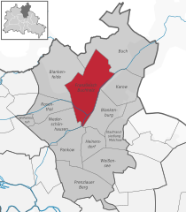
Prenzlauer Berg
- locality of Berlin
Hiking in Prenzlauer Berg
Prenzlauer Berg, a vibrant district in Berlin, is primarily known for its urban environment, charming architecture, and lively atmosphere rather than traditional hiking trails. However, there are plenty of opportunities for enjoyable walks and exploration in this area. Here are some aspects to consider if you're looking to hike or walk in Prenzlauer Berg:...
- Country:
- Coordinates: 52° 32' 3" N, 13° 25' 7" E
- GPS tracks (wikiloc): [Link]
- AboveSeaLevel: 54 м m
- Area: 11 sq km
- Population: 156910


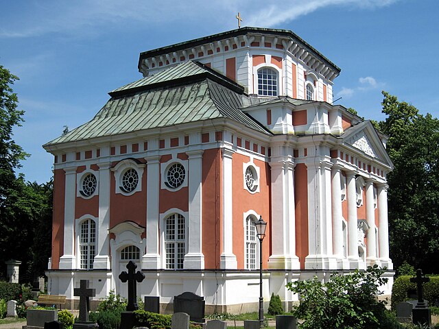
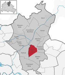
Pankow
- locality of the borough Pankow of Berlin
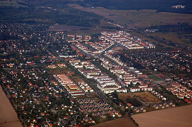
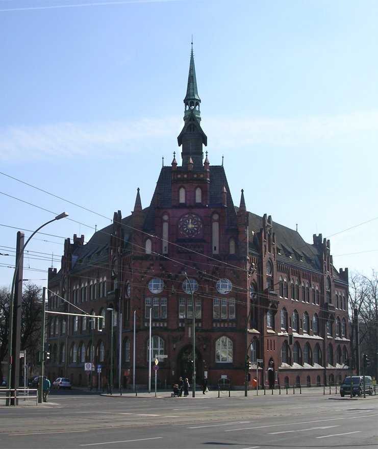
Hiking in Pankow
Pankow is a district in northeastern Berlin, Germany, known for its charming neighborhoods, parks, and green areas. While it is more urban compared to rural hiking destinations, there are still opportunities for enjoyable walks and hikes within and around the area....
- Country:
- Coordinates: 52° 34' 0" N, 13° 24' 0" E
- GPS tracks (wikiloc): [Link]
- AboveSeaLevel: 47 м m
- Area: 5.66 sq km
- Population: 57113


Niederschönhausen
- locality of Berlin
Hiking in Niederschönhausen
Niederschönhausen is a district located in the Pankow borough of Berlin, Germany. While it may not be as widely known for hiking as some of the more rural areas surrounding Berlin, there are still opportunities for walks and nature exploration in and around the area....
- Country:
- Coordinates: 52° 35' 0" N, 13° 24' 0" E
- GPS tracks (wikiloc): [Link]
- AboveSeaLevel: 48 м m
- Area: 6.49 sq km
- Population: 28313


Stadtrandsiedlung Malchow
- locality of Berlin
Hiking in Stadtrandsiedlung Malchow
Stadtrandsiedlung Malchow is a charming area located in the outskirts of Berlin, characterized by its natural beauty and access to various outdoor activities, including hiking. Here’s a breakdown of what you can expect when hiking in this area:...
- Country:
- Coordinates: 52° 34' 20" N, 13° 28' 0" E
- GPS tracks (wikiloc): [Link]
- AboveSeaLevel: 47 м m
- Area: 5.68 sq km


Wilhelmsruh
- locality of Berlin
Hiking in Wilhelmsruh
Wilhelmsruh is a charming area located in Berlin, Germany, known for its natural beauty and peaceful surroundings. Though it may not be as prominent as some of the larger hiking destinations, it offers a unique blend of urban and natural landscapes, making it a fantastic spot for walking and light hiking....
- Country:
- Coordinates: 52° 35' 14" N, 13° 22' 5" E
- GPS tracks (wikiloc): [Link]
- AboveSeaLevel: 44 м m
- Area: 1.37 sq km

Buch
- locality of Berlin
Hiking in Buch
Buch, located in the northeastern part of Berlin, offers various hiking and outdoor opportunities, although it’s not a sprawling wilderness. Instead, it features accessible paths, parks, and green spaces that provide a pleasant environment for hiking and nature walks....
- Country:
- Coordinates: 52° 38' 0" N, 13° 30' 0" E
- GPS tracks (wikiloc): [Link]
- AboveSeaLevel: 57 м m
- Area: 18.2 sq km
- Population: 12674
Französisch Buchholz
- locality of Berlin
Hiking in Französisch Buchholz
Französisch Buchholz is a charming district located in the northern part of Berlin, Germany. While it may not be a traditional hiking destination like some of Germany's national parks, there are still several beautiful spots and trails in and around this area that offer pleasant walking and hiking experiences....
- Country:
- Coordinates: 52° 36' 0" N, 13° 26' 0" E
- GPS tracks (wikiloc): [Link]
- AboveSeaLevel: 46 м m
- Area: 12 sq km


Weissensee
- locality of Berlin
Hiking in Weissensee
Weissensee is a district in the northeastern part of Berlin, known for its large lake, Weissensee, which is a popular destination for both locals and tourists looking to enjoy nature and outdoor activities. While Weissensee is not traditionally associated with extensive hiking trails like some of the larger natural parks or forested areas, it offers some lovely spots for walking and enjoying the outdoors....
- Country:
- Coordinates: 52° 33' 0" N, 13° 28' 0" E
- GPS tracks (wikiloc): [Link]
- AboveSeaLevel: 53 м m
- Area: 7.93 sq km
- Population: 51699
- Web site: [Link]

Rosenthal
- locality of Berlin
Hiking in Rosenthal
Rosenthal is a district in the northeastern part of Berlin, known for its natural beauty and green spaces, making it a lovely destination for hiking and outdoor activities. Though it's not a vast or well-known hiking hub compared to some larger parks or forests, it still offers some nice opportunities for nature walks and hikes....
- Country:
- Coordinates: 52° 35' 57" N, 13° 22' 38" E
- GPS tracks (wikiloc): [Link]
- AboveSeaLevel: 47 м m
- Area: 4.9 sq km

Heinersdorf
- locality of Berlin
Hiking in Heinersdorf
Heinersdorf, a charming district on the outskirts of Berlin, offers a unique opportunity for hiking enthusiasts to explore a blend of natural landscapes and quaint, urban settings. While Heinersdorf itself may not have extensive hiking trails like those found in more rugged areas, it serves as an excellent base for accessing nearby natural areas....
- Country:
- Coordinates: 52° 34' 1" N, 13° 26' 24" E
- GPS tracks (wikiloc): [Link]
- AboveSeaLevel: 50 м m
- Area: 3.95 sq km
Blankenburg
- locality of Berlin
Hiking in Blankenburg
Blankenburg, a district in the northeastern part of Berlin, is not typically known for traditional hiking trails like those found in more mountainous or rural areas. However, it still offers opportunities for outdoor exploration and walking in a more urban and suburban environment. Here are some highlights and suggestions for enjoying the area:...
- Country:
- Coordinates: 52° 35' 35" N, 13° 27' 15" E
- GPS tracks (wikiloc): [Link]
- AboveSeaLevel: 47 м m
- Area: 6.03 sq km
- Population: 6536

Karow
- locality of Berlin
Hiking in Karow
Karow, located in the northeastern part of Berlin, is primarily a residential district, but it offers some opportunities for nature walks and light hiking. While it may not be a primary destination for serious hikers, there are several parks and green spaces nearby that can make for pleasant outdoor activities....
- Country:
- Coordinates: 52° 36' 45" N, 13° 29' 0" E
- GPS tracks (wikiloc): [Link]
- AboveSeaLevel: 55 м m
- Area: 6.65 sq km
Blankenfelde
- locality of Berlin
Hiking in Blankenfelde
Blankenfelde, located in the state of Brandenburg, Germany, offers a variety of hiking opportunities amidst its picturesque landscapes, including forests, fields, and small lakes. Here are some highlights of hiking in the area:...
- Country:
- Coordinates: 52° 37' 7" N, 13° 23' 26" E
- GPS tracks (wikiloc): [Link]
- AboveSeaLevel: 53 м m
- Area: 13.4 sq km
Shares border with regions:


Reinickendorf
- borough of Berlin, Germany
Hiking in Reinickendorf
Reinickendorf is a district located in the northern part of Berlin, Germany. While it is primarily an urban area, there are still opportunities for hiking and enjoying nature. Here are some highlights and tips for hiking in Reinickendorf:...
- Country:
- Coordinates: 52° 34' 0" N, 13° 20' 0" E
- GPS tracks (wikiloc): [Link]
- Area: 89.5 sq km
- Population: 260253
- Web site: [Link]


Friedrichshain-Kreuzberg
- borough of Berlin, Germany
Hiking in Friedrichshain-Kreuzberg
Friedrichshain-Kreuzberg is a vibrant district in Berlin, known for its rich culture, street art, and diverse communities rather than traditional hiking trails. However, it does offer some great opportunities for walking and exploring. Here are some options for those looking to enjoy urban hiking in this area:...
- Country:
- Coordinates: 52° 30' 0" N, 13° 27' 0" E
- GPS tracks (wikiloc): [Link]
- Area: 20.2 sq km
- Population: 281076
- Web site: [Link]


Mitte
- borough of Berlin, Germany
Hiking in Mitte
Mitte is a central borough of Berlin, Germany, and while it's better known for its urban environment, historical landmarks, and museums, there are some nearby outdoor opportunities for hiking and nature exploration. Here are a few options for enjoying a hike around Mitte and the surrounding areas:...
- Country:
- Coordinates: 52° 31' 0" N, 13° 22' 0" E
- GPS tracks (wikiloc): [Link]
- Area: 39.5 sq km
- Population: 333905
- Web site: [Link]

Lichtenberg
- borough of Berlin, Germany
Hiking in Lichtenberg
Lichtenberg is a beautiful region that offers various hiking opportunities, especially notable in both natural beauty and cultural significance. While there are different locations and contexts for Lichtenberg (such as a district in Berlin or other areas named Lichtenberg), I'll focus on general hiking aspects that you might find in such areas....
- Country:
- Coordinates: 52° 32' 0" N, 13° 30' 0" E
- GPS tracks (wikiloc): [Link]
- Area: 52.11 sq km
- Population: 275142
- Web site: [Link]