Wilwisheim (Wilwisheim)

- commune in Bas-Rhin, France
- Country:

- Postal Code: 67270
- Coordinates: 48° 44' 54" N, 7° 30' 27" E


- GPS tracks (wikiloc): [Link]
- Area: 5.3 sq km
- Population: 726
- Wikipedia en: wiki(en)
- Wikipedia: wiki(fr)
- Wikidata storage: Wikidata: Q21296
- Wikipedia Commons Category: [Link]
- Freebase ID: [/m/03m9cx4]
- Freebase ID: [/m/03m9cx4]
- GeoNames ID: Alt: [6441413]
- GeoNames ID: Alt: [6441413]
- SIREN number: [216705343]
- SIREN number: [216705343]
- BnF ID: [15271676s]
- BnF ID: [15271676s]
- VIAF ID: Alt: [236963915]
- VIAF ID: Alt: [236963915]
- INSEE municipality code: 67534
- INSEE municipality code: 67534
Shares border with regions:


Gottesheim
- commune in Bas-Rhin, France
- Country:
- Postal Code: 67490
- Coordinates: 48° 46' 29" N, 7° 28' 48" E
- GPS tracks (wikiloc): [Link]
- Area: 5.11 sq km
- Population: 335


Ingenheim
- commune in Bas-Rhin, France
- Country:
- Postal Code: 67270
- Coordinates: 48° 44' 5" N, 7° 31' 14" E
- GPS tracks (wikiloc): [Link]
- Area: 5.37 sq km
- Population: 326


Lupstein
- commune in Bas-Rhin, France
- Country:
- Postal Code: 67490
- Coordinates: 48° 44' 14" N, 7° 29' 12" E
- GPS tracks (wikiloc): [Link]
- Area: 7.82 sq km
- Population: 795


Melsheim
- commune in Bas-Rhin, France
- Country:
- Postal Code: 67270
- Coordinates: 48° 45' 27" N, 7° 31' 18" E
- GPS tracks (wikiloc): [Link]
- Area: 5.21 sq km
- Population: 582

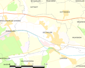
Dettwiller
- commune in Bas-Rhin, France
- Country:
- Postal Code: 67490
- Coordinates: 48° 45' 14" N, 7° 28' 0" E
- GPS tracks (wikiloc): [Link]
- Area: 10.77 sq km
- Population: 2619
- Web site: [Link]