
Zermatt (Zermatt)

- municipality in Visp district, canton of Valais, Switzerland
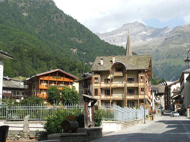
 Hiking in Zermatt
Zermatt, located in the Swiss Alps, is a stunning destination for hiking enthusiasts. This charming car-free village, nestled at the foot of the iconic Matterhorn, offers a range of hiking trails for all skill levels, providing breathtaking views and a chance to explore the unique Alpine landscape.
Popular Hiking Trails:
-
Five Lakes Walk (5-Seenweg):
- A moderately easy loop of about 9 km (5.6 miles) that takes around 2.5 to 3 hours to complete. This trail leads past five beautiful mountain lakes, each reflecting the Matterhorn in its waters. It's suitable for families and offers plenty of picturesque spots for photography.
-
Matterhorn Glacier Trail:
- This trail offers dramatic views of the Matterhorn and takes you to the glacier. It's approximately 6 km (3.7 miles) one-way and has some rocky terrain, but the scenery is worth it. The trail typically takes around 2-3 hours to complete.
-
Gornergrat Trail:
- Starting from Gornergrat, this hike provides stunning panoramic views of the Monte Rosa massif and the surrounding peaks. The trail can be extended or shortened depending on your preference, with sections ranging from easy to moderate. The Gornergrat railway can also be used to access higher elevations.
-
Riffelsee Trail:
- A slightly challenging hike that leads to Riffelsee, which is famous for its reflective views of the Matterhorn. It's about 5 km (3.1 miles) from the Riffelsee to the Schwarzsee and typically takes around 2-3 hours.
-
Alpine Flora Trail:
- A shorter and easier hike that is perfect for nature lovers. You can discover the various Alpine flowers while enjoying views of the surrounding mountains.
Tips for Hiking in Zermatt:
- Weather Preparedness: Mountain weather can change rapidly, so it's important to check the forecast beforehand and be prepared for varying conditions.
- Altitude Considerations: If you're not accustomed to hiking at high altitudes, take it slow, stay hydrated, and acclimatize properly.
- Gear: Good hiking boots, weather-appropriate clothing, and trekking poles can be beneficial, especially on uneven terrain.
- Maps and Apps: Use local maps or hiking apps for navigation. The Zermatt tourist office provides various resources and information on trail conditions.
- Responsible Hiking: Stay on marked trails, respect wildlife, and carry out any litter.
Zermatt not only offers great hiking opportunities but also a vibrant alpine culture, delicious Swiss cuisine, and stunning vistas, making it a perfect hiking destination!
- Country:

- Postal Code: 3920
- Local Dialing Code: 027
- Licence Plate Code: VS
- Coordinates: 45° 59' 23" N, 7° 45' 10" E


- GPS tracks (wikiloc): [Link]
- AboveSeaLevel: 2621 м m
- Area: 242.67 sq km
- Population: 5643
- Web site: http://www.zermatt.ch
- Wikipedia en: wiki(en)
- Wikipedia: wiki(de)
- Wikidata storage: Wikidata: Q27494
- Wikipedia Commons Category: [Link]
- Freebase ID: [/m/025gtc]
- GeoNames ID: Alt: [2657928]
- BnF ID: [121842076]
- VIAF ID: Alt: [157148337]
- OSM relation ID: [1685406]
- GND ID: Alt: [4108981-9]
- archINFORM location ID: [6767]
- Library of Congress authority ID: Alt: [n83215353]
- MusicBrainz area ID: [a2a2571a-f79f-4f74-b22d-658b4c2edebe]
- Quora topic ID: [Zermatt]
- Gran Enciclopèdia Catalana ID: [0073262]
- HDS ID: [2822]
- Swiss municipality code: [6300]
- BabelNet ID: [03148848n]
Shares border with regions:

Macugnaga
- Italian comune
Hiking in Macugnaga
Macugnaga is a beautiful village located in the Italian Alps, specifically in the Piedmont region. It sits at the foot of the impressive Monte Rosa massif, which offers a stunning backdrop for hiking enthusiasts. Here are some key points to consider about hiking in Macugnaga:...
- Country:

- Postal Code: 28876
- Local Dialing Code: 0324
- Licence Plate Code: VB
- Coordinates: 45° 58' 0" N, 7° 58' 0" E
- GPS tracks (wikiloc): [Link]
- AboveSeaLevel: 1327 м m
- Area: 99.57 sq km
- Population: 548
- Web site: [Link]
Alagna Valsesia
- Italian comune
Hiking in Alagna Valsesia
Alagna Valsesia, located in the Valsesia valley in the Piedmont region of Italy, is a fantastic destination for hiking enthusiasts. Nestled in the foothills of the Monte Rosa massif, it offers breathtaking landscapes, diverse trails, and a wealth of natural beauty....
- Country:
- Postal Code: 13021
- Local Dialing Code: 0163
- Licence Plate Code: VC
- Coordinates: 45° 51' 14" N, 7° 56' 14" E
- GPS tracks (wikiloc): [Link]
- AboveSeaLevel: 1154 м m
- Area: 133.17 sq km
- Population: 430
- Web site: [Link]


Ayas, Aosta Valley
- Italian comune
Hiking in Ayas, Aosta Valley
Ayas, located in the Aosta Valley region of Italy, is a stunning area known for its picturesque landscapes, charming alpine villages, and a variety of hiking trails that cater to different experience levels. Here are some highlights and recommendations for hiking in Ayas:...
- Country:
- Postal Code: 11020
- Local Dialing Code: 0125
- Licence Plate Code: AO
- Coordinates: 45° 48' 41" N, 7° 41' 12" E
- GPS tracks (wikiloc): [Link]
- AboveSeaLevel: 1698 м m
- Area: 129.42 sq km
- Population: 1377
- Web site: [Link]


Bionaz
- Italian comune
Hiking in Bionaz
Bionaz is a picturesque valley located in the Aosta Valley region of Italy, offering stunning landscapes, charming scenery, and a variety of hiking opportunities. Here’s what you need to know about hiking in Bionaz:...
- Country:
- Postal Code: 11010
- Local Dialing Code: 0165
- Licence Plate Code: AO
- Coordinates: 45° 52' 0" N, 7° 25' 0" E
- GPS tracks (wikiloc): [Link]
- AboveSeaLevel: 1606 м m
- Area: 142.09 sq km
- Population: 235
- Web site: [Link]


Gressoney-La-Trinité
- Italian comune
Hiking in Gressoney-La-Trinité
Gressoney-La-Trinité is a charming village located in the Aosta Valley region of Italy, known for its stunning alpine scenery and a rich mix of Italian and Walser culture. It serves as a perfect base for hiking enthusiasts, offering a variety of trails suitable for different skill levels, from easy walks to more challenging hikes....
- Country:
- Postal Code: 11020
- Local Dialing Code: 0125
- Licence Plate Code: AO
- Coordinates: 45° 50' 0" N, 7° 50' 0" E
- GPS tracks (wikiloc): [Link]
- AboveSeaLevel: 1635 м m
- Area: 66.52 sq km
- Population: 300
- Web site: [Link]


Valtournenche
- Italian comune
Hiking in Valtournenche
Valtournenche, located in the Aosta Valley of Italy near the Swiss border, is a stunning destination for hiking enthusiasts. It's well-known for its breathtaking mountain scenery, including views of the iconic Matterhorn, which is particularly visible from the valley and its surrounding areas. Here are some highlights about hiking in Valtournenche:...
- Country:
- Postal Code: 11028
- Local Dialing Code: 0166
- Licence Plate Code: AO
- Coordinates: 45° 53' 0" N, 7° 37' 0" E
- GPS tracks (wikiloc): [Link]
- AboveSeaLevel: 1528 м m
- Area: 116.15 sq km
- Population: 2294
- Web site: [Link]