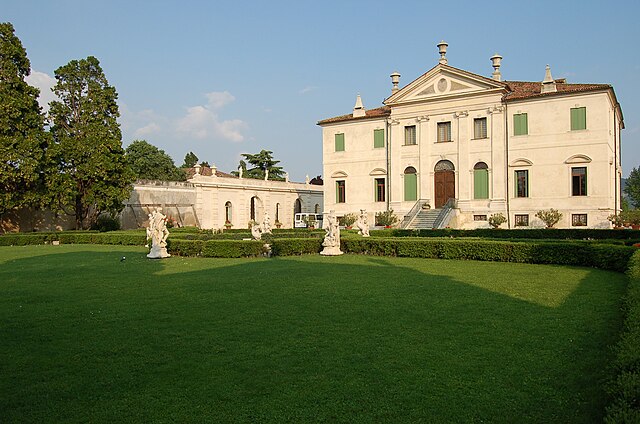
Zermeghedo (Zermeghedo)
.svg)
- Italian comune
 Hiking in Zermeghedo
Zermeghedo is a charming village located in the Veneto region of Italy, surrounded by picturesque landscapes. It offers several hiking opportunities that allow you to explore the natural beauty of the area. Here are some highlights about hiking in and around Zermeghedo:
Trail Options:
-
Local Trails: The region has various marked trails that can lead you through vineyards, olive groves, and beautiful countryside. Many trails offer panoramic views of the surrounding hills and valleys.
-
Monte Grappa: If you're looking for more challenging hikes, you can consider heading towards Monte Grappa, which is not far from Zermeghedo. The area is rich in history and has numerous trails that cater to different skill levels.
-
Lessinia Regional Park: A bit further but worth the trip, Lessinia Park offers stunning hikes with diverse flora and fauna. The trails range from easy walks to more demanding routes.
Best Time to Hike:
- Spring and Fall: These seasons are ideal for hiking in Zermeghedo, as temperatures are moderate and the natural scenery is beautiful with blooming flowers in spring or autumn foliage in fall.
- Summer: While it can be hot, early morning hikes can be enjoyable before the peak heat of the day.
Preparation Tips:
- Footwear: Ensure you have sturdy hiking boots for uneven terrain.
- Hydration: Carry enough water, especially during warmer months.
- Maps and Guides: Have a reliable map or downloadable hiking apps that include GPS tracking to help navigate the trails.
- Weather Check: Always check the weather forecast before heading out, as conditions can change rapidly, especially in mountainous areas.
Local Highlights:
- Cultural Sites: After a day of hiking, explore local wineries or restaurants that offer traditional Veneto cuisine.
- Hospitality: The local community is known for its warm hospitality, so don’t hesitate to ask locals for recommendations on trails or hidden gems.
Overall, hiking around Zermeghedo can be a rewarding experience for both novice and experienced hikers, allowing you to immerse yourself in the beautiful Italian landscape.
- Country:

- Postal Code: 36050
- Local Dialing Code: 0444
- Licence Plate Code: VI
- Coordinates: 45° 29' 0" N, 11° 22' 0" E


- GPS tracks (wikiloc): [Link]
- AboveSeaLevel: 84 м m
- Area: 2.97 sq km
- Population: 1393
- Web site: http://www.comune.zermeghedo.vi.it
- Wikipedia en: wiki(en)
- Wikipedia: wiki(it)
- Wikidata storage: Wikidata: Q46348
- Wikipedia Commons Category: [Link]
- Freebase ID: [/m/0g92lk]
- GeoNames ID: Alt: [6536632]
- OSM relation ID: [45108]
- UN/LOCODE: [ITZRM]
- ISTAT ID: 024120
- Italian cadastre code: M170
Shares border with regions:
Montecchio Maggiore
- Italian comune
Hiking in Montecchio Maggiore
Montecchio Maggiore, located in the Veneto region of Italy near Vicenza, is surrounded by beautiful landscapes that offer a variety of hiking opportunities. Here are some highlights:...
- Country:
- Postal Code: 36075
- Local Dialing Code: 0444
- Licence Plate Code: VI
- Coordinates: 45° 30' 13" N, 11° 24' 43" E
- GPS tracks (wikiloc): [Link]
- AboveSeaLevel: 72 м m
- Area: 30.54 sq km
- Population: 23316
- Web site: [Link]


Montebello Vicentino
- Italian comune
Hiking in Montebello Vicentino
Montebello Vicentino is a charming small town located in the Veneto region of northern Italy, surrounded by beautiful natural landscapes that offer great hiking opportunities. Here are some highlights for hiking in and around the area:...
- Country:
- Postal Code: 36054
- Local Dialing Code: 0444
- Licence Plate Code: VI
- Coordinates: 45° 27' 0" N, 11° 23' 0" E
- GPS tracks (wikiloc): [Link]
- AboveSeaLevel: 48 м m
- Area: 21.48 sq km
- Population: 6542
- Web site: [Link]


Montorso Vicentino
- Italian comune
Hiking in Montorso Vicentino
Montorso Vicentino is a picturesque town located in the Veneto region of northern Italy. It is surrounded by beautiful landscapes, making it an ideal destination for hiking enthusiasts. The area offers various trails that cater to different skill levels, providing opportunities to explore the natural beauty of the region....
- Country:
- Postal Code: 36050
- Local Dialing Code: 0444
- Licence Plate Code: VI
- Coordinates: 45° 29' 0" N, 11° 22' 0" E
- GPS tracks (wikiloc): [Link]
- AboveSeaLevel: 118 м m
- Area: 9.29 sq km
- Population: 3107
- Web site: [Link]