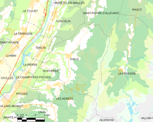
Гонселен (Goncelin, Goncelin)

- коммуна во Франции
 Hiking in Гонселен
Goncelin is a small commune located in the Isère department in the Auvergne-Rhône-Alpes region of southeastern France. Nestled in the picturesque Belledonne mountain range, it offers various hiking opportunities that combine beautiful scenery, diverse landscapes, and the chance to explore the local flora and fauna.
Hiking Trails
-
Belledonne Range: The area around Goncelin serves as an excellent gateway to the Belledonne mountains. There are several marked hiking trails ranging from easy to challenging. Most trails offer stunning views of the mountain peaks and valleys.
-
Lake Trails: There are trails leading to nearby lakes, including Lac de l'Eau d'Olle, which is a popular hiking destination. These trails often provide opportunities for picnicking and enjoying nature.
-
Forested Paths: Some trails wind through dense forests, ideal for those looking to experience the natural tranquility and observe local wildlife, including various bird species.
Recommendations
-
Choosing the Right Trail: Depending on your experience level and fitness, select trails that suit you. Beginner hikers may enjoy shorter, flatter paths, while experienced hikers may opt for more strenuous hikes.
-
Seasonal Considerations: The best time for hiking in Goncelin is from late spring to early fall (May to October). Winter hiking may also be possible, but appropriate gear is essential.
-
Local Guides: If you're unfamiliar with the area or hiking in general, consider hiring a local guide who can provide insights into the landscape and ensure you have a safe experience.
Safety Tips
-
Check Weather Conditions: Always check the weather forecast before heading out, as conditions can change rapidly in mountainous areas.
-
Stay Hydrated and Pack Snacks: Bring sufficient water and energy-rich snacks, especially on longer hikes.
-
Appropriate Gear: Wear good hiking shoes and weather-appropriate clothing. Consider bringing a map or GPS device, particularly if you're venturing on less-marked trails.
-
Leave No Trace: Respect nature by following Leave No Trace principles, ensuring the area remains beautiful for others.
Conclusion
Hiking in Goncelin offers a fantastic way to explore the natural beauty of the French Alps. With its stunning scenery, varied terrain, and numerous trails, it’s a great destination for outdoor enthusiasts of all levels. Enjoy your hike!
- Страна:

- Почтовый код: 38570
- Координаты: 45° 20' 34" N, 5° 58' 45" E


- GPS треки (wikiloc): [Ссылка]
- Площадь: 14.36 кв.км
- Население: 2334
- Веб сайт: http://www.goncelin.fr
- Википедия русская: wiki(ru)
- Википедия английская: wiki(en)
- Википедия национальная: wiki(fr)
- Хранилище Wikidata: Wikidata: Q1002896
- Катеория в википедии: [Ссылка]
- код Freebase: [/m/03nvk2q]
- код GeoNames: Альт: [6433206]
- номер SIREN: [213801814]
- код BNF: [152580005]
- код тезауруса PACTOLS: [pcrtdUY1wr4FIY]
- WOEID: [593112]
- код муниципалитета INSEE: 38181
Граничит с регионами:

Ле-Шелас
- коммуна во Франции
Hiking in Ле-Шелас
Le Cheylas, located in the French Alps near the Isère River, is an excellent destination for hiking enthusiasts. The area offers stunning landscapes, picturesque valleys, and a variety of trails suitable for different skill levels. Here are some highlights you might consider if you're planning a hike in Le Cheylas:...
- Страна:
- Почтовый код: 38570
- Координаты: 45° 22' 17" N, 5° 59' 33" E
- GPS треки (wikiloc): [Ссылка]
- Площадь: 8.44 кв.км
- Население: 2612
- Веб сайт: [Ссылка]

Те
- коммуна во Франции
Hiking in Те
Theys is a charming commune in the French Alps, situated in the Isère department. It's a fantastic location for hiking enthusiasts, offering a variety of trails that cater to different skill levels. Here are some key points about hiking in Theys:...
- Страна:
- Почтовый код: 38570
- Координаты: 45° 18' 1" N, 5° 59' 49" E
- GPS треки (wikiloc): [Ссылка]
- Площадь: 35.77 кв.км
- Население: 1943
- Веб сайт: [Ссылка]


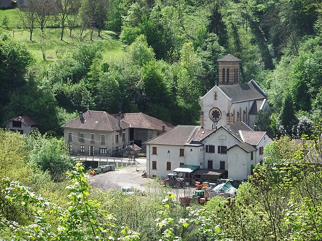
Тансен
- коммуна во Франции
Hiking in Тансен
Tencin, located in the Auvergne-Rhône-Alpes region of France near Grenoble, offers beautiful hiking opportunities amidst stunning natural landscapes. The area features diverse terrain, including hills, forests, and views of the Chartreuse Mountains, making it ideal for hikers of all skill levels....
- Страна:
- Почтовый код: 38570
- Координаты: 45° 18' 34" N, 5° 57' 37" E
- GPS треки (wikiloc): [Ссылка]
- Площадь: 6.75 кв.км
- Население: 1984
- Веб сайт: [Ссылка]

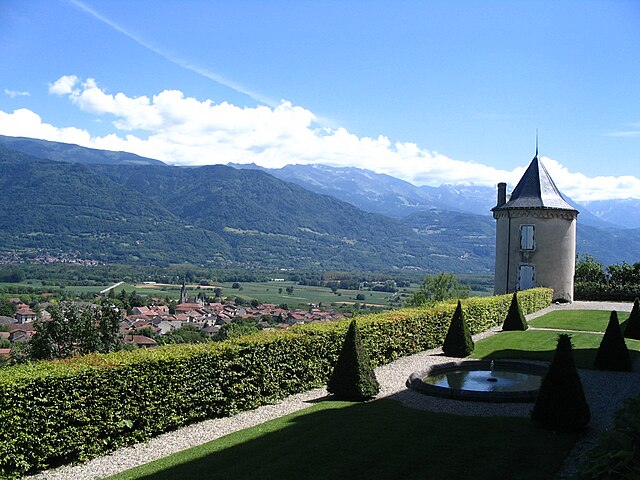
Моретель-де-Май
- коммуна во Франции
Hiking in Моретель-де-Май
Morêtel-de-Mailles is a picturesque village located in the Canton of Vaud in Switzerland, surrounded by beautiful natural landscapes that are ideal for hiking enthusiasts. Here are some highlights and tips for hiking in and around this area:...
- Страна:
- Почтовый код: 38570
- Координаты: 45° 22' 3" N, 6° 1' 0" E
- GPS треки (wikiloc): [Ссылка]
- Площадь: 6.71 кв.км
- Население: 476
- Веб сайт: [Ссылка]


Сен-Венсан-де-Меркюз
- коммуна во Франции
Hiking in Сен-Венсан-де-Меркюз
Saint-Vincent-de-Mercuze, located in the Isère department of the Auvergne-Rhône-Alpes region in southeastern France, offers a variety of hiking opportunities amidst beautiful natural landscapes. Here are some highlights of hiking in this area:...
- Страна:
- Почтовый код: 38660
- Координаты: 45° 22' 27" N, 5° 56' 59" E
- GPS треки (wikiloc): [Ссылка]
- Площадь: 7.85 кв.км
- Население: 1481
- Веб сайт: [Ссылка]

Ле-Туве
- коммуна во Франции
Hiking in Ле-Туве
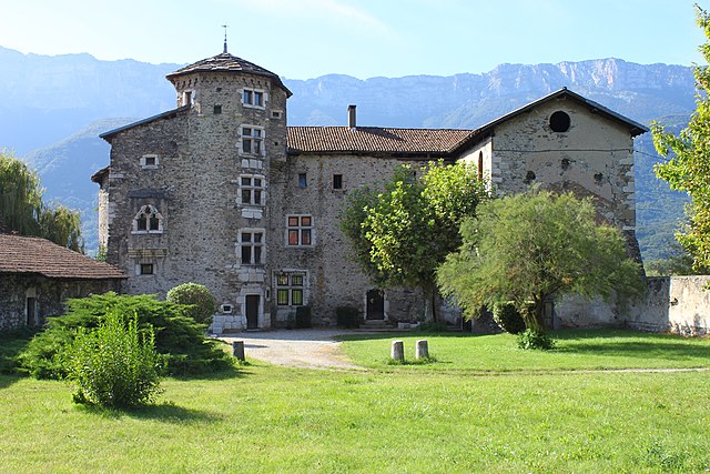
Le Touvet is a charming village located in the French Alps, near the Belledonne mountain range, making it an excellent destination for hiking enthusiasts. The area offers a variety of trails that cater to different skill levels, from easy walks suitable for families to more challenging treks for experienced hikers....
- Страна:
- Почтовый код: 38660
- Координаты: 45° 21' 27" N, 5° 56' 53" E
- GPS треки (wikiloc): [Ссылка]
- Площадь: 11.56 кв.км
- Население: 3231
- Веб сайт: [Ссылка]


Ла-Террас
- коммуна во Франции
Hiking in Ла-Террас
La Terrasse is a charming town in the Auvergne-Rhône-Alpes region of France, known for its picturesque landscapes and access to various hiking trails. Here are some aspects to consider if you're planning to hike in La Terrasse:...
- Страна:
- Почтовый код: 38660
- Координаты: 45° 19' 25" N, 5° 55' 52" E
- GPS треки (wikiloc): [Ссылка]
- Площадь: 9.47 кв.км
- Население: 2567
- Веб сайт: [Ссылка]