Шимьен (Chimilin, Chimilin)

- коммуна во Франции
 Hiking in Шимьен
Chimilin might refer to a specific region or area, but it doesn’t appear to be widely recognized as a hiking destination in available resources or discussions up to October 2023. However, if you are referring to a specific place known for hiking, such as Chimilin National Park or another similar-sounding location, please clarify.
In general, when preparing for a hiking trip, consider the following:
-
Trail Information: Research the trails available in the area. Look for descriptions of difficulty levels, lengths, and any notable features such as viewpoints or water sources.
-
Safety Precautions: Familiarize yourself with safety guidelines, including carrying a map, staying on marked trails, and informing someone about your hiking plans.
-
Weather Conditions: Check the weather forecast before you go, as conditions can change rapidly in mountainous or wilderness areas.
-
Gear and Supplies: Make sure you have appropriate equipment, including sturdy hiking boots, weather-appropriate clothing, a backpack, food, water, and a first aid kit.
-
Leave No Trace: Follow the Leave No Trace principles to minimize your environmental impact, such as packing out what you bring in and staying on designated paths.
If you have specific details about Chimilin or are looking for recommendations for hiking spots, please let me know!
- Страна:

- Почтовый код: 38490
- Координаты: 45° 34' 37" N, 5° 35' 58" E


- GPS треки (wikiloc): [Ссылка]
- Площадь: 9.66 кв.км
- Население: 1467
- Веб сайт: http://www.chimilin.fr
- Википедия русская: wiki(ru)
- Википедия английская: wiki(en)
- Википедия национальная: wiki(fr)
- Хранилище Wikidata: Wikidata: Q574266
- Катеория в википедии: [Ссылка]
- код Freebase: [/m/03nvgz9]
- код Freebase: [/m/03nvgz9]
- код GeoNames: Альт: [6433164]
- код GeoNames: Альт: [6433164]
- номер SIREN: [213801046]
- номер SIREN: [213801046]
- код BNF: [15257930b]
- код BNF: [15257930b]
- код VIAF: Альт: [235234826]
- код VIAF: Альт: [235234826]
- код муниципалитета INSEE: 38104
- код муниципалитета INSEE: 38104
Граничит с регионами:


Аост
Hiking in Аост
Aoste, located in the Isère department of the Auvergne-Rhône-Alpes region in France, is a charming town surrounded by beautiful mountain landscapes, making it a great destination for hiking enthusiasts. The area offers a variety of hiking trails suitable for different skill levels, from leisurely walks to more challenging treks....
- Страна:
- Почтовый код: 38490
- Координаты: 45° 35' 18" N, 5° 36' 32" E
- GPS треки (wikiloc): [Ссылка]
- Площадь: 9.82 кв.км
- Население: 2862
- Веб сайт: [Ссылка]


Романьё
- коммуна во Франции
Hiking in Романьё
Romagnieu is a charming commune located in the Isère department in the Auvergne-Rhône-Alpes region of southeastern France. It’s known for its natural beauty and proximity to hiking opportunities in the surrounding area, particularly due to its location near the Chartreuse Mountains and the Vercors Regional Natural Park....
- Страна:
- Почтовый код: 38480
- Координаты: 45° 34' 12" N, 5° 38' 29" E
- GPS треки (wikiloc): [Ссылка]
- Площадь: 17.11 кв.км
- Население: 1560
- Веб сайт: [Ссылка]
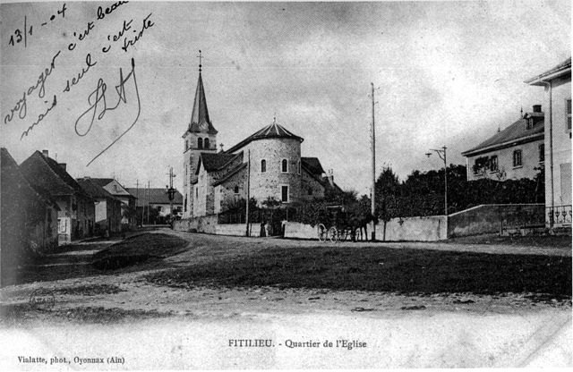

Фитильё
- коммуна во Франции
Hiking in Фитильё
Fitilieu is a charming village located in the Isère department of the Auvergne-Rhône-Alpes region in southeastern France. It’s a fantastic destination for hiking enthusiasts, offering a mix of picturesque landscapes, scenic trails, and opportunities to immerse yourself in nature....
- Страна:
- Почтовый код: 38490
- Координаты: 45° 32' 48" N, 5° 33' 42" E
- GPS треки (wikiloc): [Ссылка]
- Площадь: 10.01 кв.км
- Население: 1905


Граньё
- коммуна во Франции
Hiking in Граньё
Granieu is a charming village nestled in the picturesque French Alps, making it a fantastic destination for hiking enthusiasts. Its location offers access to a variety of trails that cater to different skill levels, from gentle walks to challenging ascents. Here are some highlights for hiking in the Granieu area:...
- Страна:
- Почтовый код: 38490
- Координаты: 45° 35' 58" N, 5° 35' 19" E
- GPS треки (wikiloc): [Ссылка]
- Площадь: 3.73 кв.км
- Население: 482


Корбелен
- коммуна во Франции
Hiking in Корбелен
Corbelin is a charming village located in the Auvergne-Rhône-Alpes region of France, and it offers a variety of outdoor activities, including hiking. The area is known for its scenic landscapes, wooded hills, and proximity to natural reserves, making it an ideal spot for those who enjoy immersing themselves in nature....
- Страна:
- Почтовый код: 38630
- Координаты: 45° 36' 27" N, 5° 32' 41" E
- GPS треки (wikiloc): [Ссылка]
- Площадь: 12 кв.км
- Население: 2223
- Веб сайт: [Ссылка]


Ла-Бати-Монгаскон
- коммуна во Франции
Hiking in Ла-Бати-Монгаскон
La Bâtie-Montgascon is a charming village located in the Auvergne-Rhône-Alpes region of France, near the foothills of the Alps. The area is rich with natural beauty and offers various hiking opportunities for outdoor enthusiasts....
- Страна:
- Почтовый код: 38110
- Координаты: 45° 34' 45" N, 5° 31' 41" E
- GPS треки (wikiloc): [Ссылка]
- Площадь: 8.43 кв.км
- Население: 1890
- Веб сайт: [Ссылка]