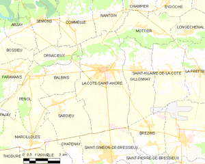
Жийонне (Gillonnay, Gillonnay)

- коммуна во Франции
 Hiking in Жийонне
Gillonnay is a charming village located in the Isère department of the Auvergne-Rhône-Alpes region in southeastern France. The area offers a variety of hiking opportunities, ranging from easy walks to more challenging trails, all set against a backdrop of picturesque landscapes and natural beauty.
Hiking Opportunities in Gillonnay
-
Local Trails: The region has several marked trails that meander through forests, fields, and along rivers. These trails often offer stunning views of the surrounding mountains and valleys. You can enjoy both short and long hikes depending on your fitness level and the amount of time you have.
-
The Vercors Massif: Not far from Gillonnay, the Vercors Massif is a great destination for those seeking more breathtaking hikes. The Vercors National Park features a range of trails that include dramatic cliffs, alpine meadows, and deep gorges.
-
The Chartreuse Mountains: Also within reach, these mountains offer various hiking routes that can cater to different skill levels. The lush forests and stunning views of the surrounding region make this a popular area for hikers.
-
Wildlife and Nature: Hiking in Gillonnay allows you to experience the local flora and fauna. Keep an eye out for various bird species and native animals as you traverse the countryside.
-
Seasonal Considerations: The best time for hiking in the region is typically from spring to early autumn when the weather is mild, and trails are dry. In winter, some areas may offer snowshoeing or cross-country skiing opportunities.
Tips for Hiking in Gillonnay
-
Preparation: Always check local weather conditions before heading out. Pack appropriate gear, including sturdy hiking boots, weather-resistant clothing, and sufficient water and snacks.
-
Maps and Guides: It’s wise to have a local map or guidebook, as this will help you navigate the trails and find points of interest.
-
Respect Nature: Follow Leave No Trace principles to help preserve the beauty of this area for future hikers.
-
Local Guides: Consider hiring a local hiking guide if you want to explore less-known trails or gain more insight into the region’s natural history and culture.
Overall, hiking in Gillonnay offers a delightful combination of scenic beauty and outdoor adventure, making it a great destination for both beginner and experienced hikers alike!
- Страна:

- Почтовый код: 38260
- Координаты: 45° 23' 34" N, 5° 17' 50" E


- GPS треки (wikiloc): [Ссылка]
- Площадь: 14.29 кв.км
- Население: 1014
- Википедия русская: wiki(ru)
- Википедия английская: wiki(en)
- Википедия национальная: wiki(fr)
- Хранилище Wikidata: Wikidata: Q519292
- Катеория в википедии: [Ссылка]
- код Freebase: [/m/03nvjw4]
- код GeoNames: Альт: [6433205]
- номер SIREN: [213801806]
- код BNF: [152579999]
- код муниципалитета INSEE: 38180
Граничит с регионами:


Брезен
- коммуна во Франции
Hiking in Брезен
Brézins is a small commune located in the Isère department in the Auvergne-Rhône-Alpes region of southeastern France. While it may not be one of the most popular hiking destinations, it serves as a great starting point for exploring the surrounding natural beauty of the region, including the stunning landscapes of the Chartreuse and Vercors mountains....
- Страна:
- Почтовый код: 38590
- Координаты: 45° 20' 57" N, 5° 18' 24" E
- GPS треки (wikiloc): [Ссылка]
- Площадь: 8.26 кв.км
- Население: 2042
- Веб сайт: [Ссылка]

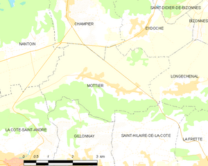
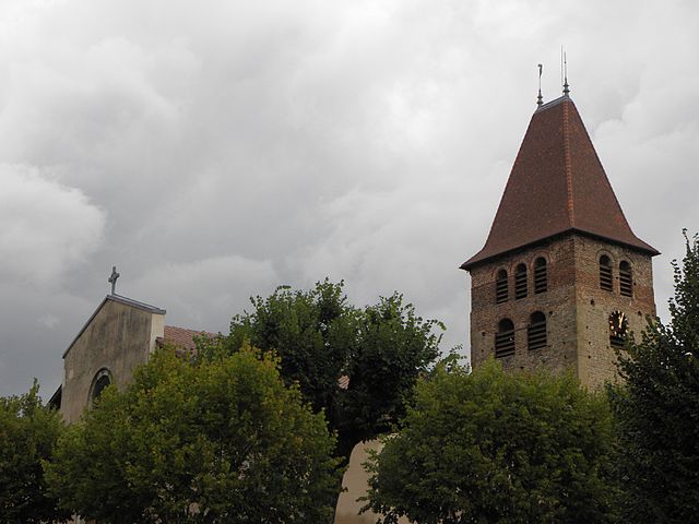
Мотье
- коммуна во Франции
Hiking in Мотье
Mottier, located in the beautiful area of Isère in the French Alps, offers a variety of hiking opportunities that cater to different skill levels and preferences. The surrounding landscape is characterized by stunning mountain views, diverse flora and fauna, and picturesque trails that are perfect for both day hikes and longer excursions....
- Страна:
- Почтовый код: 38260
- Координаты: 45° 25' 8" N, 5° 19' 2" E
- GPS треки (wikiloc): [Ссылка]
- Площадь: 10.72 кв.км
- Население: 690
- Веб сайт: [Ссылка]


Сент-Илер-де-ла-Кот
- коммуна во Франции
Hiking in Сент-Илер-де-ла-Кот
Saint-Hilaire-de-la-Côte is a picturesque mountain village located in the Isère department of the Auvergne-Rhône-Alpes region in southeastern France. It offers a variety of hiking opportunities, attracting both casual walkers and avid trekkers....
- Страна:
- Почтовый код: 38260
- Координаты: 45° 23' 26" N, 5° 19' 38" E
- GPS треки (wikiloc): [Ссылка]
- Площадь: 13.75 кв.км
- Население: 1431
- Веб сайт: [Ссылка]
Ла-Кот-Сент-Андре
- коммуна во Франции
Hiking in Ла-Кот-Сент-Андре
La Côte-Saint-André is a charming commune located in the Isère department in the Auvergne-Rhône-Alpes region of southeastern France. It offers beautiful landscapes and a variety of hiking opportunities, making it a great destination for outdoor enthusiasts. Here are some highlights about hiking in and around La Côte-Saint-André:...
- Страна:
- Почтовый код: 38260
- Координаты: 45° 23' 37" N, 5° 15' 38" E
- GPS треки (wikiloc): [Ссылка]
- Площадь: 27.93 кв.км
- Население: 4745
- Веб сайт: [Ссылка]