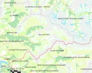
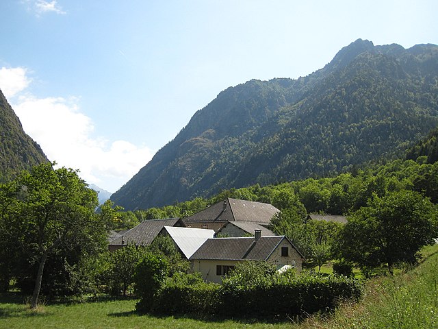
Ле-Перье (Le Périer, Le Périer)

- коммуна во Франции
 Hiking in Ле-Перье
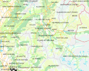
Le Périer is a charming village located in the Isère department of the Auvergne-Rhône-Alpes region in southeastern France. It's situated near the Vercors Regional Natural Park, which offers a variety of hiking opportunities for outdoor enthusiasts.
Hiking Trails
-
Vercors National Park Trails: You can access numerous trails that showcase the stunning landscapes of the Vercors, including limestone cliffs, forests, and alpine meadows. Popular paths include:
- The GR91 Trail: This long-distance trail runs through the Vercors and offers breathtaking views and diverse terrain.
- Les Crêtes Trail: A scenic route along the ridgelines provides panoramic views of the surrounding mountains.
-
Local Walks: There are shorter hiking routes around Le Périer suitable for families or beginners. Many local trails will guide you through forests and quaint villages, offering a more relaxed hiking experience.
What to Expect
- Scenery: The area is known for its beautiful landscapes, with lots of opportunities for photography. Expect to see a mix of lush forests, dramatic rock formations, and, in certain seasons, vibrant wildflowers.
- Wildlife: Keep an eye out for local wildlife, including deer, various bird species, and possibly even marmots in higher elevations.
- Cultural Heritage: Some trails may lead you to historical sites, chapels, and traditional farms that enrich the hiking experience.
Practical Tips
- Weather: Always check the weather forecast before heading out, as conditions can change rapidly in the mountains.
- Gear: Wear appropriate hiking boots and attire. Bring enough water, snacks, and a map or GPS device.
- Local Regulations: Respect the local environment by sticking to marked trails and following any guidelines set by the Vercors National Park.
Getting There
Le Périer is accessible by car, and it's helpful to have a map for the smaller roads. Public transportation options may be limited, so checking schedules before your trip is advisable.
Whether you're seeking a leisurely stroll or a challenging hike, Le Périer and the surrounding Vercors region offer something for everyone. Enjoy your adventure!
- Страна:

- Почтовый код: 38740
- Координаты: 44° 56' 13" N, 5° 58' 24" E


- GPS треки (wikiloc): [Ссылка]
- Площадь: 47.99 кв.км
- Население: 137
- Википедия русская: wiki(ru)
- Википедия английская: wiki(en)
- Википедия национальная: wiki(fr)
- Хранилище Wikidata: Wikidata: Q1068537
- Катеория в википедии: [Ссылка]
- код Freebase: [/m/03g_1hs]
- код GeoNames: Альт: [6455946]
- номер SIREN: [213803026]
- код муниципалитета INSEE: 38302
Граничит с регионами:


Лавальдан
- коммуна во Франции
Hiking in Лавальдан
Lavaldens is a beautiful destination for hiking enthusiasts, located in the stunning region of the Italian Alps, specifically within the Province of Trento. The area is known for its picturesque landscapes, charming villages, and a variety of trails suitable for different levels of hikers. Here are some key points to consider when hiking in Lavaldens:...
- Страна:
- Почтовый код: 38350
- Координаты: 44° 58' 58" N, 5° 53' 15" E
- GPS треки (wikiloc): [Ссылка]
- Площадь: 41.4 кв.км
- Население: 163

Вальжуффре
- коммуна во Франции
Hiking in Вальжуффре
Valjouffrey is a beautiful and lesser-known hiking destination located in the Isère department of the Auvergne-Rhône-Alpes region in France. Nestled in the heart of the Vercors Massif, Valjouffrey offers stunning landscapes characterized by dramatic peaks, lush valleys, and serene alpine lakes, making it a perfect spot for outdoor enthusiasts....
- Страна:
- Почтовый код: 38740
- Координаты: 44° 52' 20" N, 6° 1' 52" E
- GPS треки (wikiloc): [Ссылка]
- Высота над уровнем моря: 1014 м m
- Площадь: 72.56 кв.км
- Население: 145
- Веб сайт: [Ссылка]


Ори-ан-Ратье
- коммуна во Франции
Hiking in Ори-ан-Ратье
Oris-en-Rattier is a charming little village in the Isère department in the Auvergne-Rhône-Alpes region of France. Nestled within the stunning landscapes of the French Alps, it offers a range of hiking opportunities for enthusiasts of all levels....
- Страна:
- Почтовый код: 38350
- Координаты: 44° 55' 16" N, 5° 52' 12" E
- GPS треки (wikiloc): [Ссылка]
- Площадь: 18.83 кв.км
- Население: 111

Антрег
- коммуна во Франции
Hiking in Антрег
Entraigues, located in the Isère department of the Auvergne-Rhône-Alpes region in southeastern France, is a charming village surrounded by beautiful natural landscapes, making it a great destination for hiking enthusiasts. Here are some key aspects to consider when planning your hike in this area:...
- Страна:
- Почтовый код: 38740
- Координаты: 44° 54' 6" N, 5° 56' 53" E
- GPS треки (wikiloc): [Ссылка]
- Высота над уровнем моря: 800 м m
- Площадь: 21.66 кв.км
- Население: 235
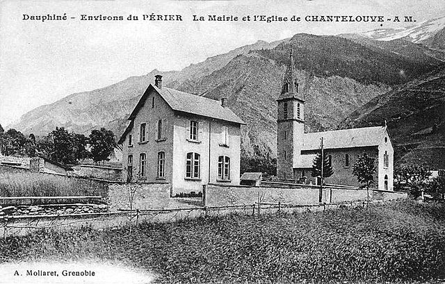

Шантлув
- коммуна во Франции
Hiking in Шантлув
Chantelouve, located in the Isère department of France, is a wonderful destination for hiking enthusiasts, especially those looking to explore the stunning landscapes of the French Alps. Here are some highlights and tips for hiking in this area:...
- Страна:
- Почтовый код: 38740
- Координаты: 44° 59' 2" N, 5° 58' 6" E
- GPS треки (wikiloc): [Ссылка]
- Площадь: 33.41 кв.км
- Население: 80
- Веб сайт: [Ссылка]
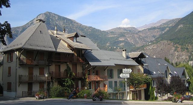
Ле-Бур-д'Уазан
- коммуна во Франции
Hiking in Ле-Бур-д'Уазан
Le Bourg-d'Oisans is a charming commune located in the French Alps, nestled between the Oisans mountain range and the breathtaking Ecrins National Park. It's an excellent base for those who enjoy hiking, as it offers a variety of trails suitable for all experience levels, from beginner to advanced....
- Страна:
- Почтовый код: 38520
- Координаты: 45° 3' 19" N, 6° 1' 46" E
- GPS треки (wikiloc): [Ссылка]
- Площадь: 35.75 кв.км
- Население: 3239
- Веб сайт: [Ссылка]


Вальбонне
- коммуна во Франции
Hiking in Вальбонне
Valbonnais is a beautiful area located in the French Alps, specifically in the Isère department. It’s known for its stunning natural landscapes, diversity of hiking trails, and rich cultural heritage. Here’s what you need to know about hiking in Valbonnais:...
- Страна:
- Почтовый код: 38740
- Координаты: 44° 54' 0" N, 5° 54' 15" E
- GPS треки (wikiloc): [Ссылка]
- Площадь: 23.95 кв.км
- Население: 499
- Веб сайт: [Ссылка]