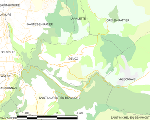
Ори-ан-Ратье (Oris-en-Rattier, Oris-en-Rattier)

- коммуна во Франции
 Hiking in Ори-ан-Ратье
Oris-en-Rattier is a charming little village in the Isère department in the Auvergne-Rhône-Alpes region of France. Nestled within the stunning landscapes of the French Alps, it offers a range of hiking opportunities for enthusiasts of all levels.
Hiking Trails
-
Local Trails: There are various well-marked trails starting from or near Oris-en-Rattier. Many of these paths take you through beautiful alpine meadows, forests, and offer stunning panoramic views of the surrounding mountains.
-
Sentiers de Grande Randonnée (GR Routes): If you're looking for a longer hike, the GR routes that traverse the Alps are accessible from this area. These long-distance trails are perfect for multi-day hikes.
-
Montagne de la Morte: A popular hiking destination nearby, this mountain offers more challenging trails with rewards of breathtaking views. The hike can be steep in places, so it’s advisable for those with a bit more hiking experience.
Best Times to Hike
- Spring (April - June): Ideal for wildflowers and milder weather.
- Summer (July - September): Offers the best conditions for hiking, but the trails can be busier.
- Autumn (October): Perfect for those who enjoy cooler hikes with stunning fall foliage.
- Winter: While many trails are snow-covered, there are opportunities for snowshoeing and cross-country skiing in the region.
Tips for Hiking in the Area
- Preparation: Always check the weather forecast prior to your hike, as mountain weather can change rapidly.
- Gear: Proper hiking boots and gear are essential. Depending on the season, consider trekking poles and layers for temperature changes.
- Local Guidance: If you’re unfamiliar with the area, consider hiring a local guide or participating in organized hiking groups.
- Respect Nature: Follow Leave No Trace principles to preserve the beautiful alpine ecosystem.
Safety
Ensure you carry plenty of water, snacks, and a first-aid kit. Always inform someone about your planned route and estimated return time.
Hiking in Oris-en-Rattier can be a rewarding experience, with opportunities to connect with nature, enjoy stunning views, and discover the local flora and fauna.
- Страна:

- Почтовый код: 38350
- Координаты: 44° 55' 16" N, 5° 52' 12" E


- GPS треки (wikiloc): [Ссылка]
- Площадь: 18.83 кв.км
- Население: 111
- Википедия русская: wiki(ru)
- Википедия английская: wiki(en)
- Википедия национальная: wiki(fr)
- Хранилище Wikidata: Wikidata: Q1068852
- Катеория в википедии: [Ссылка]
- код Freebase: [/m/03g_1m6]
- код GeoNames: Альт: [6433269]
- номер SIREN: [213802838]
- код BNF: [15258095p]
- код муниципалитета INSEE: 38283
Граничит с регионами:


Ла-Валетт
Hiking in Ла-Валетт
La Valette, located in the stunning landscape of Malta, offers a unique hiking experience characterized by its rich history and scenic views. Here are some points to consider when planning a hike in La Valette:...
- Страна:
- Почтовый код: 38350
- Координаты: 44° 56' 31" N, 5° 51' 23" E
- GPS треки (wikiloc): [Ссылка]
- Высота над уровнем моря: 850 м m
- Площадь: 7.87 кв.км
- Население: 73


Лавальдан
- коммуна во Франции
Hiking in Лавальдан
Lavaldens is a beautiful destination for hiking enthusiasts, located in the stunning region of the Italian Alps, specifically within the Province of Trento. The area is known for its picturesque landscapes, charming villages, and a variety of trails suitable for different levels of hikers. Here are some key points to consider when hiking in Lavaldens:...
- Страна:
- Почтовый код: 38350
- Координаты: 44° 58' 58" N, 5° 53' 15" E
- GPS треки (wikiloc): [Ссылка]
- Площадь: 41.4 кв.км
- Население: 163

Сьево
- коммуна во Франции
Hiking in Сьево
Siévoz is a beautiful area in the French Alps, known for its scenic landscapes and hiking opportunities. If you're planning a hiking trip there, here are some key points to consider:...
- Страна:
- Почтовый код: 38350
- Координаты: 44° 54' 12" N, 5° 50' 15" E
- GPS треки (wikiloc): [Ссылка]
- Площадь: 7.37 кв.км
- Население: 136


Ле-Перье
- коммуна во Франции
Hiking in Ле-Перье
Le Périer is a charming village located in the Isère department of the Auvergne-Rhône-Alpes region in southeastern France. It's situated near the Vercors Regional Natural Park, which offers a variety of hiking opportunities for outdoor enthusiasts....
- Страна:
- Почтовый код: 38740
- Координаты: 44° 56' 13" N, 5° 58' 24" E
- GPS треки (wikiloc): [Ссылка]
- Площадь: 47.99 кв.км
- Население: 137


Вальбонне
- коммуна во Франции
Hiking in Вальбонне
Valbonnais is a beautiful area located in the French Alps, specifically in the Isère department. It’s known for its stunning natural landscapes, diversity of hiking trails, and rich cultural heritage. Here’s what you need to know about hiking in Valbonnais:...
- Страна:
- Почтовый код: 38740
- Координаты: 44° 54' 0" N, 5° 54' 15" E
- GPS треки (wikiloc): [Ссылка]
- Площадь: 23.95 кв.км
- Население: 499
- Веб сайт: [Ссылка]