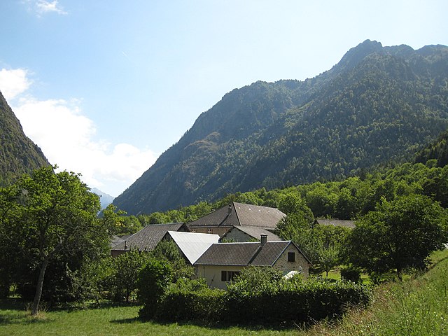
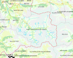
Вальжуффре (Valjouffrey, Valjouffrey)

- коммуна во Франции
 Hiking in Вальжуффре
Valjouffrey is a beautiful and lesser-known hiking destination located in the Isère department of the Auvergne-Rhône-Alpes region in France. Nestled in the heart of the Vercors Massif, Valjouffrey offers stunning landscapes characterized by dramatic peaks, lush valleys, and serene alpine lakes, making it a perfect spot for outdoor enthusiasts.
Key Features of Hiking in Valjouffrey:
-
Scenic Trails: The area boasts a variety of hiking trails suitable for all skill levels, from easy walks to more challenging alpine hikes. The trails often feature breathtaking views of the surrounding mountains and valleys.
-
Lakes and Foothills: One of the highlights of hiking in Valjouffrey is the presence of beautiful mountain lakes, such as Lac de la Muzelle and Lac des Pourettes. These spots are excellent for taking a break and enjoying a picnic amid nature.
-
Wildlife Watching: The region is home to diverse flora and fauna. You may be lucky enough to spot chamois, marmots, and a variety of bird species during your hikes.
-
Accessibility: The starting points for many hikes are easily accessible by car. The village of Valjouffrey itself provides a quaint base for hikers, complete with local accommodations and restaurants.
-
Cultural Heritage: Along the hiking trails, you can also explore the rich cultural heritage of the region, including traditional alpine architecture and historical sites.
-
Seasonal Hiking: The best time for hiking in Valjouffrey is typically from late spring to early autumn. However, some trails may be accessible year-round, depending on snow conditions.
Recommended Hikes:
-
Lac de la Muzelle: A moderately challenging hike that leads to a stunning alpine lake offering gorgeous views and opportunities for a picnic.
-
Col de la Muzelle: A more strenuous hike that takes you to a mountain pass, providing panoramic views of the surrounding peaks.
-
GR 54 Trail: This famous long-distance hiking trail passes through the region, offering experienced hikers an opportunity to experience the spectacular landscapes of the Vercors Massif.
Tips for Hikers:
-
Preparation: Always check the weather conditions before heading out and equip yourself with appropriate hiking gear, including sturdy boots, layers of clothing, and enough water and snacks.
-
Navigation: Obtain trail maps beforehand and consider using a GPS if you're unfamiliar with the area.
-
Leave No Trace: Respect the environment by sticking to trails, avoiding littering, and following local guidelines to preserve the natural beauty of Valjouffrey.
Whether you're a seasoned hiker or just looking for a peaceful escape in nature, Valjouffrey offers a fantastic hiking experience with its picturesque trails and stunning alpine scenery!
- Страна:

- Почтовый код: 38740
- Координаты: 44° 52' 20" N, 6° 1' 52" E


- GPS треки (wikiloc): [Ссылка]
- Высота над уровнем моря: 1014 м m
- Площадь: 72.56 кв.км
- Население: 145
- Веб сайт: http://www.valjouffrey.fr
- Википедия русская: wiki(ru)
- Википедия английская: wiki(en)
- Википедия национальная: wiki(fr)
- Хранилище Wikidata: Wikidata: Q1067704
- Катеория в википедии: [Ссылка]
- код Freebase: [/m/03g_1lj]
- код GeoNames: Альт: [6616681]
- номер SIREN: [213805229]
- код BNF: [152583229]
- код муниципалитета INSEE: 38522
Граничит с регионами:

Аспр-ле-Корп
- коммуна во Франции
Hiking in Аспр-ле-Корп
Aspres-lès-Corps is a charming village located in the Alpes-de-Haute-Provence region of France, surrounded by breathtaking natural landscapes that are perfect for hiking enthusiasts. The area offers a variety of trails that cater to different skill levels, from easy walks to more challenging hikes....
- Страна:
- Почтовый код: 05800
- Координаты: 44° 48' 7" N, 5° 58' 54" E
- GPS треки (wikiloc): [Ссылка]
- Площадь: 16.73 кв.км
- Население: 109


Ле-Перье
- коммуна во Франции
Hiking in Ле-Перье
Le Périer is a charming village located in the Isère department of the Auvergne-Rhône-Alpes region in southeastern France. It's situated near the Vercors Regional Natural Park, which offers a variety of hiking opportunities for outdoor enthusiasts....
- Страна:
- Почтовый код: 38740
- Координаты: 44° 56' 13" N, 5° 58' 24" E
- GPS треки (wikiloc): [Ссылка]
- Площадь: 47.99 кв.км
- Население: 137

Антрег
- коммуна во Франции
Hiking in Антрег
Entraigues, located in the Isère department of the Auvergne-Rhône-Alpes region in southeastern France, is a charming village surrounded by beautiful natural landscapes, making it a great destination for hiking enthusiasts. Here are some key aspects to consider when planning your hike in this area:...
- Страна:
- Почтовый код: 38740
- Координаты: 44° 54' 6" N, 5° 56' 53" E
- GPS треки (wikiloc): [Ссылка]
- Высота над уровнем моря: 800 м m
- Площадь: 21.66 кв.км
- Население: 235

Виллар-Лубьер
- коммуна во Франции
Hiking in Виллар-Лубьер
Villar-Loubière is a picturesque village located in the Provence-Alpes-Côte d'Azur region of southeastern France. It’s surrounded by stunning natural landscapes, making it a great destination for hiking enthusiasts....
- Страна:
- Почтовый код: 05800
- Координаты: 44° 49' 34" N, 6° 8' 44" E
- GPS треки (wikiloc): [Ссылка]
- Площадь: 22.63 кв.км
- Население: 42

Сен-Морис-ан-Вальгодмар
- коммуна во Франции
Hiking in Сен-Морис-ан-Вальгодмар
Saint-Maurice-en-Valgodemard is a beautiful village located in the French Alps, in the Hautes-Alpes department. Known for its stunning landscapes, it serves as an excellent base for various hiking adventures. Here are some key highlights for hiking in the area:...
- Страна:
- Почтовый код: 05800
- Координаты: 44° 48' 14" N, 6° 5' 44" E
- GPS треки (wikiloc): [Ссылка]
- Площадь: 36.37 кв.км
- Население: 133


Веноск
- коммуна во Франции
Hiking in Веноск
Vénosc is a charming mountain village located in the French Alps, near the popular ski resort of Les Deux Alpes in the Isère department. The area offers a variety of hiking opportunities that cater to different skill levels, from leisurely walks to challenging mountain trails. Here are some highlights of hiking in Vénosc:...
- Страна:
- Почтовый код: 38520
- Координаты: 44° 59' 24" N, 6° 6' 56" E
- GPS треки (wikiloc): [Ссылка]
- Площадь: 25.06 кв.км
- Население: 765
- Веб сайт: [Ссылка]
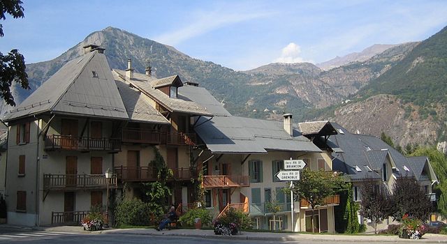
Ле-Бур-д'Уазан
- коммуна во Франции
Hiking in Ле-Бур-д'Уазан
Le Bourg-d'Oisans is a charming commune located in the French Alps, nestled between the Oisans mountain range and the breathtaking Ecrins National Park. It's an excellent base for those who enjoy hiking, as it offers a variety of trails suitable for all experience levels, from beginner to advanced....
- Страна:
- Почтовый код: 38520
- Координаты: 45° 3' 19" N, 6° 1' 46" E
- GPS треки (wikiloc): [Ссылка]
- Площадь: 35.75 кв.км
- Население: 3239
- Веб сайт: [Ссылка]

Ла-Шапель-ан-Вальгодемар
- коммуна во Франции
Hiking in Ла-Шапель-ан-Вальгодемар
La Chapelle-en-Valgaudémar is a picturesque village located in the heart of the Écrins National Park in the French Alps. This area is renowned for its stunning natural beauty, rugged mountains, and a variety of hiking trails suitable for different skill levels....
- Страна:
- Почтовый код: 05800
- Координаты: 44° 49' 1" N, 6° 11' 41" E
- GPS треки (wikiloc): [Ссылка]
- Высота над уровнем моря: 1050 м m
- Площадь: 108.02 кв.км
- Население: 101
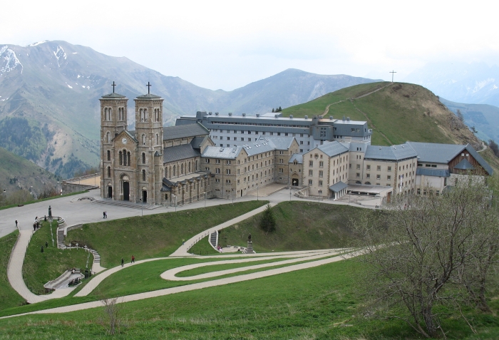

Ла-Салетт-Фаллаво
- коммуна во Франции
Hiking in Ла-Салетт-Фаллаво
La Salette-Fallavaux is a beautiful area nestled in the French Alps, famous for its stunning natural landscapes, history, and religious significance. Here are some key points about hiking in this region:...
- Страна:
- Почтовый код: 38970
- Координаты: 44° 50' 26" N, 5° 58' 30" E
- GPS треки (wikiloc): [Ссылка]
- Площадь: 22.29 кв.км
- Население: 68

Сен-Кристоф-ан-Уазан
- коммуна во Франции
Hiking in Сен-Кристоф-ан-Уазан
Saint-Christophe-en-Oisans is a charming village located in the French Alps, nestled within the Oisans valley. It serves as a gateway to some stunning hiking opportunities in the surrounding terrain, known for its breathtaking scenery, diverse ecosystems, and the proximity to the Écrins National Park....
- Страна:
- Почтовый код: 38520
- Координаты: 44° 57' 26" N, 6° 10' 37" E
- GPS треки (wikiloc): [Ссылка]
- Площадь: 123.5 кв.км
- Население: 105
- Веб сайт: [Ссылка]