Сент-Этьенн-де-Сен-Жуар (Saint-Étienne-de-Saint-Geoirs, Saint-Étienne-de-Saint-Geoirs)

- коммуна во Франции
 Hiking in Сент-Этьенн-де-Сен-Жуар
Saint-Étienne-de-Saint-Geoirs, located in the Auvergne-Rhône-Alpes region of France, is surrounded by beautiful natural landscapes that are ideal for hiking enthusiasts. Here are some highlights and recommendations for hiking in this area:
Scenic Trails
-
Vercors Regional Natural Park: Just a short distance from Saint-Étienne-de-Saint-Geoirs, the Vercors provides a variety of trails that cater to different skill levels. You can explore dramatic cliffs, lush forests, and picturesque villages.
-
Chartreuse Mountains: To the east, the Chartreuse Mountains offer stunning views and a network of trails. The hikes vary from easy to challenging, with opportunities to see unique flora and fauna.
-
Coulmes Plateau: This area offers relatively easy hikes with beautiful landscapes, including panoramic views of the surrounding mountains and valleys.
Things to Consider
- Trail Difficulty: Be sure to choose trails that match your fitness level. Some trails may be steep or rocky, so it's essential to prepare accordingly.
- Weather: The weather can change rapidly in the mountains, so check forecasts and be prepared with proper clothing and gear.
- Leave No Trace: Practice responsible hiking by carrying out what you bring in and staying on marked trails.
Accessibility
Saint-Étienne-de-Saint-Geoirs is accessible by car, and there are often local guides or hiking groups that you can join for an enhanced experience. Local tourism offices can provide maps and recommendations.
Equipment
Ensure you have proper hiking boots, a map or GPS device, water, snacks, and a first-aid kit. If you’re venturing into more remote areas, it can be beneficial to let someone know your planned route.
Conclusion
Hiking around Saint-Étienne-de-Saint-Geoirs offers a wonderful opportunity to enjoy the natural beauty of the French Alps. Whether you're a beginner or an experienced hiker, the area has something to offer everyone. Happy hiking!
- Страна:

- Почтовый код: 38590
- Координаты: 45° 20' 20" N, 5° 20' 43" E


- GPS треки (wikiloc): [Ссылка]
- Площадь: 18.62 кв.км
- Население: 3259
- Веб сайт: http://www.ville-sesg.com
- Википедия русская: wiki(ru)
- Википедия английская: wiki(en)
- Википедия национальная: wiki(fr)
- Хранилище Wikidata: Wikidata: Q1062444
- Катеория в википедии: [Ссылка]
- код Freebase: [/m/03nvhcc]
- код GeoNames: Альт: [6433340]
- номер SIREN: [213803844]
- код BNF: [15258194m]
- код VIAF: Альт: [129028744]
- код LCNAF: Альт: [n82098751]
- код муниципалитета INSEE: 38384
Граничит с регионами:


Брезен
- коммуна во Франции
Hiking in Брезен
Brézins is a small commune located in the Isère department in the Auvergne-Rhône-Alpes region of southeastern France. While it may not be one of the most popular hiking destinations, it serves as a great starting point for exploring the surrounding natural beauty of the region, including the stunning landscapes of the Chartreuse and Vercors mountains....
- Страна:
- Почтовый код: 38590
- Координаты: 45° 20' 57" N, 5° 18' 24" E
- GPS треки (wikiloc): [Ссылка]
- Площадь: 8.26 кв.км
- Население: 2042
- Веб сайт: [Ссылка]
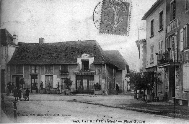

Ла-Фрет
- коммуна во Франции
Hiking in Ла-Фрет
La Frette, located in the Isère department of southeastern France, offers a variety of hiking opportunities that cater to different skill levels and preferences. Nestled in the picturesque landscape of the French Alps, La Frette is surrounded by stunning scenery, including mountains, forests, and rivers....
- Страна:
- Почтовый код: 38260
- Координаты: 45° 23' 26" N, 5° 21' 38" E
- GPS треки (wikiloc): [Ссылка]
- Площадь: 11.8 кв.км
- Население: 1108
- Веб сайт: [Ссылка]


Сийан
Hiking in Сийан
Sillans, nestled in the scenic Var department of Provence, France, is a beautiful destination for hiking enthusiasts. The area is known for its stunning natural landscapes, including lush forests, rolling hills, and picturesque waterfalls. Here are some highlights and information about hiking in Sillans:...
- Страна:
- Почтовый код: 38590
- Координаты: 45° 20' 27" N, 5° 23' 20" E
- GPS треки (wikiloc): [Ссылка]
- Площадь: 12.61 кв.км
- Население: 1885
- Веб сайт: [Ссылка]
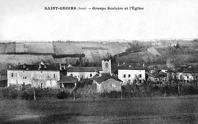

Сен-Жуар
- коммуна во Франции
Hiking in Сен-Жуар
Saint-Geoirs is a charming commune in the Isère department of the Auvergne-Rhône-Alpes region in southeastern France. While it's not as famous for hiking as some larger national parks or mountainous areas, there are still plenty of opportunities for outdoor enthusiasts to enjoy the natural surroundings....
- Страна:
- Почтовый код: 38590
- Координаты: 45° 19' 20" N, 5° 21' 17" E
- GPS треки (wikiloc): [Ссылка]
- Площадь: 6.93 кв.км
- Население: 523


Сен-Пьер-де-Бресьё
- коммуна во Франции
Hiking in Сен-Пьер-де-Бресьё
Saint-Pierre-de-Bressieux is a charming commune located in the Isère department of France, nestled in the picturesque region of Auvergne-Rhône-Alpes. Hiking around this area offers beautiful landscapes, varying terrains, and opportunities to explore the local flora and fauna....
- Страна:
- Почтовый код: 38870
- Координаты: 45° 18' 56" N, 5° 17' 7" E
- GPS треки (wikiloc): [Ссылка]
- Площадь: 23.08 кв.км
- Население: 766
- Веб сайт: [Ссылка]


План
- коммуна во Франции
Hiking in План
Plan, located in the Isère department in the Auvergne-Rhône-Alpes region of France, is a fantastic area for hiking enthusiasts. The region is characterized by stunning natural beauty, including mountains, valleys, and rivers, making it an ideal destination for both casual walkers and experienced hikers. Here are some key aspects of hiking in and around Plan, Isère:...
- Страна:
- Почтовый код: 38590
- Координаты: 45° 18' 46" N, 5° 23' 33" E
- GPS треки (wikiloc): [Ссылка]
- Площадь: 6.1 кв.км
- Население: 256
- Веб сайт: [Ссылка]


Сент-Илер-де-ла-Кот
- коммуна во Франции
Hiking in Сент-Илер-де-ла-Кот
Saint-Hilaire-de-la-Côte is a picturesque mountain village located in the Isère department of the Auvergne-Rhône-Alpes region in southeastern France. It offers a variety of hiking opportunities, attracting both casual walkers and avid trekkers....
- Страна:
- Почтовый код: 38260
- Координаты: 45° 23' 26" N, 5° 19' 38" E
- GPS треки (wikiloc): [Ссылка]
- Площадь: 13.75 кв.км
- Население: 1431
- Веб сайт: [Ссылка]