
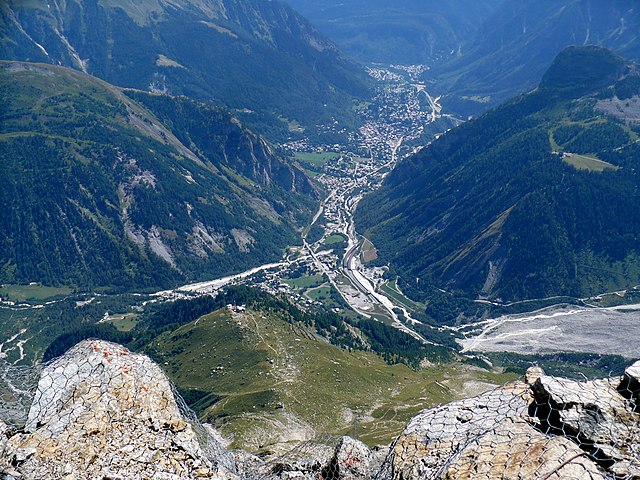
Сен-Жерве-ле-Бен (Saint-Gervais-les-Bains, Saint-Gervais-les-Bains)

- коммуна во Франции
 Hiking in Сен-Жерве-ле-Бен
Saint-Gervais-les-Bains, located in the Haute-Savoie region of the French Alps, is a fantastic destination for hiking enthusiasts. This charming alpine town is not only known for its ski resort but also offers a myriad of hiking trails suitable for all levels, from beginners to experienced hikers.
Hiking Highlights:
-
Diverse Terrain: The area around Saint-Gervais offers a mix of landscapes, including lush valleys, alpine meadows, and rugged mountain terrain. This diversity provides hikers with stunning views of Mont Blanc and the surrounding peaks.
-
Trail Variety: There are numerous trails in and around Saint-Gervais, including:
- Les Bords de l'Arve: A relatively easy trail along the Arve River, perfect for families and beginners.
- Col de Voza: A moderate hike that leads to beautiful views of Mont Blanc.
- Le Dévoluy: For more experienced hikers, this trail offers a challenging ascent with rewarding panoramic views.
-
Marked Trails: Many trails are clearly marked, making navigation easier for hikers. The local tourism office provides maps and information about the current trail conditions.
-
Seasonal Opportunities: While summer is the peak hiking season, the trails can also be enjoyed in the spring for wildflowers or in early autumn for stunning fall colors. In winter, some trails are accessible for snowshoeing.
-
Guided Tours: For those looking for a more structured experience, there are local guides available who can lead hikes, provide insights about the flora and fauna, and ensure safety on more technical routes.
-
Accessibility: Saint-Gervais is easily accessible by public transport from nearby cities such as Chamonix and Geneva, making it a convenient base for hiking enthusiasts.
Preparation Tips:
- Gear Up: Always wear appropriate hiking gear, including sturdy boots, weather-resistant clothing, and carry essentials like water, snacks, a first-aid kit, and a map or GPS device.
- Weather Check: The weather can change rapidly in the mountains, so be prepared for varying conditions.
- Stay Informed: Check with the local tourism office for current trail conditions and any potential hazards.
Whether you're interested in a leisurely stroll or a vigorous hike, Saint-Gervais-les-Bains offers something for everyone, making it a perfect destination for nature lovers and hikers alike.
- Страна:

- Почтовый код: 74190
- Координаты: 45° 53' 33" N, 6° 42' 49" E


- GPS треки (wikiloc): [Ссылка]
- Площадь: 63.63 кв.км
- Население: 5534
- Веб сайт: http://www.saintgervais.com
- Википедия русская: wiki(ru)
- Википедия английская: wiki(en)
- Википедия национальная: wiki(fr)
- Хранилище Wikidata: Wikidata: Q534206
- Катеория в википедии: [Ссылка]
- код Freebase: [/m/02r0x5z]
- код GeoNames: Альт: [2979698]
- номер SIREN: [217402361]
- код BNF: [15274491v]
- код VIAF: Альт: [124515842]
- код GND: Альт: [4274224-9]
- код LCNAF: Альт: [n96106308]
- код SUDOC: [035387947]
- EMLO location ID: [6e0f9303-dd5f-4a18-8a47-69b504126e9e]
- Google Arts & Culture partner ID: [saint-gervais]
- код муниципалитета INSEE: 74236
Граничит с регионами:


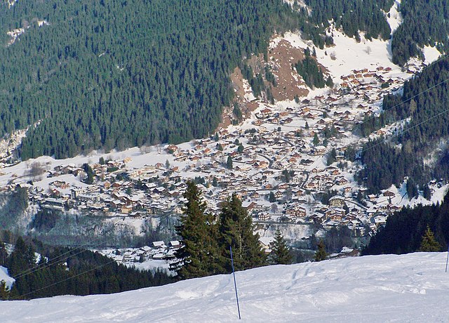
Межев
- коммуна во Франции
Hiking in Межев
Megève, located in the French Alps, is a charming alpine village that offers a variety of hiking opportunities amidst stunning scenery. With its picturesque mountainous landscapes, lush valleys, and an array of well-marked trails, Megève is a great destination for hikers of all levels....
- Страна:
- Почтовый код: 74120
- Координаты: 45° 51' 25" N, 6° 37' 3" E
- GPS треки (wikiloc): [Ссылка]
- Площадь: 44.11 кв.км
- Население: 3210
- Веб сайт: [Ссылка]

Курмайёр
- коммуна Италии
Hiking in Курмайёр
Courmayeur, located in the Aosta Valley of Italy, is a fantastic destination for hikers. Nestled at the foot of Mont Blanc, the area offers a variety of trails that cater to all skill levels, from leisurely walks to challenging alpine hikes. Here are some highlights for hiking in Courmayeur:...
- Страна:

- Почтовый код: 11013
- Телефонный код: 0165
- Код автомобильного номера: AO
- Координаты: 45° 47' 0" N, 6° 58' 0" E
- GPS треки (wikiloc): [Ссылка]
- Высота над уровнем моря: 1224 м m
- Площадь: 210 кв.км
- Население: 2798
- Веб сайт: [Ссылка]


Passy
Hiking in Passy
Passy, located in the Haute-Savoie region of France, is a beautiful destination for hiking enthusiasts with its stunning alpine scenery and diverse trails. Here are some highlights and tips for hiking in and around Passy:...
- Страна:
- Почтовый код: 74480
- Координаты: 45° 55' 25" N, 6° 41' 11" E
- GPS треки (wikiloc): [Ссылка]
- Площадь: 80.03 кв.км
- Население: 11011
- Веб сайт: [Ссылка]

Les Contamines-Montjoie
- коммуна во Франции
Hiking in Les Contamines-Montjoie
Les Contamines-Montjoie is a beautiful alpine village located in the French Alps, known for its stunning mountain scenery, diverse trails, and rich natural environment. Here’s an overview of what you can expect when hiking in this region:...
- Страна:
- Почтовый код: 74170
- Координаты: 45° 49' 18" N, 6° 43' 45" E
- GPS треки (wikiloc): [Ссылка]
- Площадь: 81.35 кв.км
- Население: 1196
- Веб сайт: [Ссылка]


Лез-Уш
- коммуна во Франции, горнолыжный альпийский курорт
Hiking in Лез-Уш
Les Houches is a beautiful village located in the Chamonix Valley of the French Alps, and it offers a wide variety of hiking opportunities suitable for all skill levels. Here are some highlights and information regarding hiking in Les Houches:...
- Страна:
- Почтовый код: 74310
- Координаты: 45° 53' 24" N, 6° 47' 55" E
- GPS треки (wikiloc): [Ссылка]
- Высота над уровнем моря: 1001 м m
- Площадь: 43.07 кв.км
- Население: 2934
- Веб сайт: [Ссылка]

Combloux
- коммуна во Франции
Hiking in Combloux
Combloux, located in the French Alps near the Mont Blanc massif, is a fantastic destination for hiking enthusiasts. This picturesque village offers stunning views, diverse trails, and a charming alpine atmosphere. Here are some key points about hiking in Combloux:...
- Страна:
- Почтовый код: 74920
- Координаты: 45° 53' 44" N, 6° 38' 28" E
- GPS треки (wikiloc): [Ссылка]
- Площадь: 17.27 кв.км
- Население: 2079
- Веб сайт: [Ссылка]
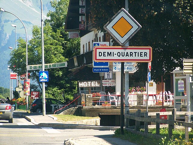

Demi-Quartier
- коммуна во Франции
Hiking in Demi-Quartier
Demi-Quartier is a picturesque commune located in the Haute-Savoie region of the French Alps, close to the famous ski resort of Megeve. It offers a variety of hiking opportunities with stunning views of the surrounding mountains and natural landscapes. Here are some key points about hiking in Demi-Quartier:...
- Страна:
- Почтовый код: 74120
- Координаты: 45° 51' 23" N, 6° 37' 4" E
- GPS треки (wikiloc): [Ссылка]
- Площадь: 8.9 кв.км
- Население: 912
- Веб сайт: [Ссылка]


Domancy
- коммуна во Франции
Hiking in Domancy
Domancy is a small village located in the Auvergne-Rhône-Alpes region of France, near the city of Sallanches and close to the Mont Blanc massif. The area surrounding Domancy offers beautiful landscapes and a variety of hiking opportunities suitable for different skill levels. Here are some key points to consider when hiking in and around Domancy:...
- Страна:
- Почтовый код: 74700
- Координаты: 45° 54' 49" N, 6° 38' 54" E
- GPS треки (wikiloc): [Ссылка]
- Площадь: 7.4 кв.км
- Население: 1988