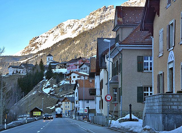
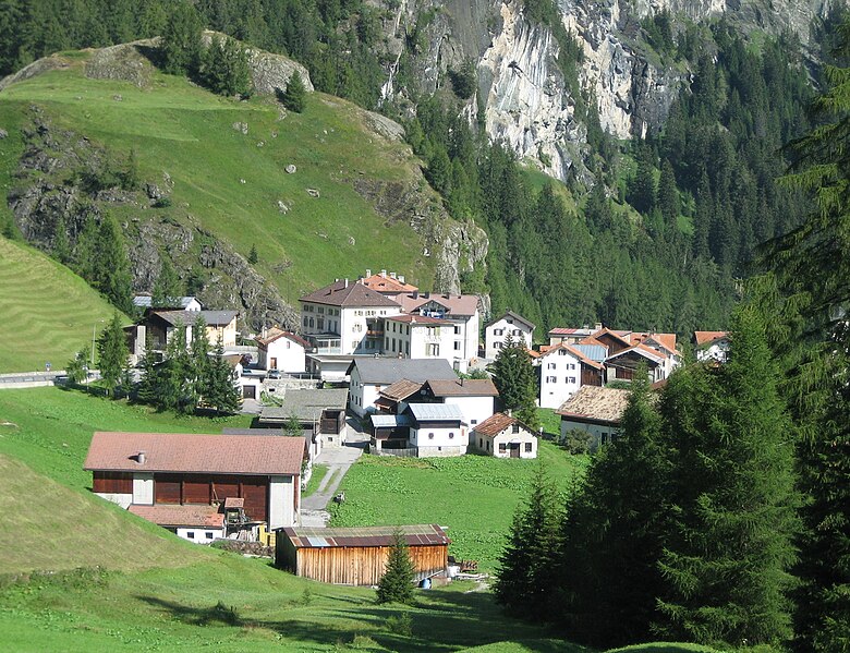
Сур (Sur, Sur)

 Hiking in Сур
Sur is a charming village located in the Swiss canton of Grisons (Graubünden) and offers impressive hiking opportunities, primarily for those who love the beautiful landscapes of the Swiss Alps. Here’s an overview of what you can expect:
Hiking Trails
-
Ladins Trail: This trail leads you through picturesque landscapes with stunning views of the surrounding mountains and valleys. It's a moderate hike, suitable for most hikers, and offers the chance to observe the local flora and fauna.
-
Weissfluhjoch: Starting from Sur, you can trek towards Weissfluhjoch, where you’ll enjoy panoramic views of the surrounding peaks. The trails can vary in difficulty, so make sure to choose one that matches your skill level.
-
Val Surses: The nearby Val Surses region is known for its extensive hiking network. Trails range from easy to challenging, making it a great area for families as well as experienced hikers.
-
Parc Ela: This is Switzerland's largest nature park, located not far from Sur. Within the park, you'll find a variety of trails that showcase the diverse landscapes of alpine meadows, forests, and traditional villages.
Best Time to Hike
-
Summer (June to September): The best time for hiking in Sur and the surrounding areas is during the summer months when the weather is generally warm and the trails are clear of snow.
-
Autumn (October): Early October can also be a lovely time for hiking, as the fall foliage adds beautiful colors to the landscape, but be mindful of the weather as conditions can change.
Preparation
-
Gear: It’s essential to wear proper hiking boots, dress in layers, and bring rain gear, as the weather can change unexpectedly in the mountains.
-
Hydration and Snacks: Always pack water and some hiking snacks, as well as a map or a GPS device.
-
Guided Tours: If you're new to hiking or unfamiliar with the area, consider joining a guided hike to learn more about the local ecology and history.
Other Activities
In addition to hiking, Sur is a great base for other outdoor activities such as mountain biking, and in winter, skiing or snowshoeing when the snow covers the trails.
Local Culture
Take the time to explore the local culture and cuisine. Traditional Swiss meals and the hospitality of the locals make for an enriching experience after a day on the trails.
Make sure to check local maps and resources, such as hiking guides or the official tourism website, for any updates on trail conditions or specific routes. Enjoy your hiking adventure in Sur, Switzerland!
- Страна:

- Почтовый код: 7456
- Телефонный код: 081
- Код автомобильного номера: GR
- Координаты: 46° 30' 59" N, 9° 36' 59" E


- GPS треки (wikiloc): [Ссылка]
- Высота над уровнем моря: 1530 м m
- Площадь: 23.22 кв.км
- Веб сайт: http://www.sur.ch
- Википедия русская: wiki(ru)
- Википедия английская: wiki(en)
- Википедия национальная: wiki(de)
- Хранилище Wikidata: Wikidata: Q29840
- Катеория в википедии: [Ссылка]
- код Freebase: [/m/026fl20]
- код GeoNames: Альт: [7287264]
- идентификатор HDS: [1430]
- код швейцарского муниципалитета: [3540]
Граничит с регионами:


Марморера
Hiking in Марморера
Marmorera is a picturesque area located in the canton of Graubünden in Switzerland, known for its stunning landscapes, diverse hiking trails, and tranquil atmosphere. Here are some key points to consider if you're planning to hike in Marmorera:...
- Страна:
- Почтовый код: 7456
- Телефонный код: 081
- Код автомобильного номера: GR
- Координаты: 46° 29' 59" N, 9° 39' 0" E
- GPS треки (wikiloc): [Ссылка]
- Высота над уровнем моря: 1720 м m
- Площадь: 18.90 кв.км
- Веб сайт: [Ссылка]

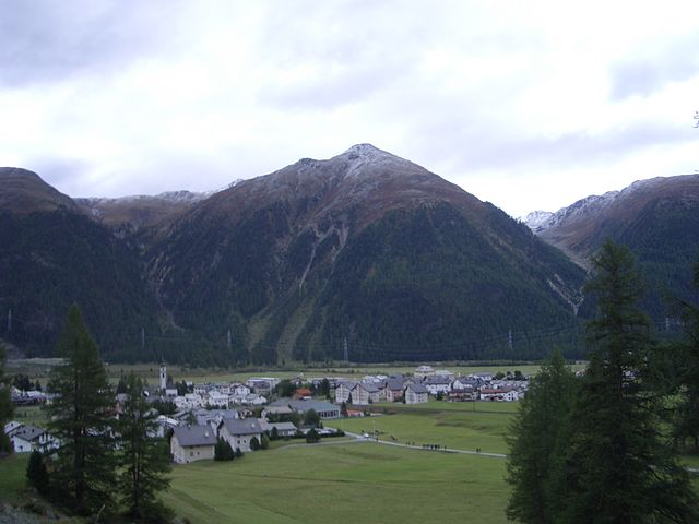
Тиницонг-Рона
Hiking in Тиницонг-Рона
Tinizong-Rona is a beautiful area located in the canton of Graubünden in Switzerland, known for its stunning landscapes and rich natural biodiversity. Hiking in this region offers a plethora of trails suitable for various skill levels, ranging from beginners to advanced hikers. Here's an overview of what you can expect when hiking in Tinizong-Rona:...
- Страна:
- Почтовый код: 7453
- Телефонный код: 081
- Код автомобильного номера: GR
- Координаты: 46° 35' 0" N, 9° 37' 0" E
- GPS треки (wikiloc): [Ссылка]
- Высота над уровнем моря: 1232 м m
- Площадь: 54.30 кв.км

Мулегнс
Hiking in Мулегнс
Mulegns, a picturesque village nestled in the Swiss Alps, offers fantastic hiking opportunities for outdoor enthusiasts. It is known for its stunning alpine scenery, lush meadows, and well-marked trails suitable for various skill levels. Here are some highlights of hiking in Mulegns:...
- Страна:
- Почтовый код: 7455
- Телефонный код: 081
- Код автомобильного номера: GR
- Координаты: 46° 30' 16" N, 9° 34' 46" E
- GPS треки (wikiloc): [Ссылка]
- Высота над уровнем моря: 1952 м m
- Площадь: 33.79 кв.км


Бивио
Hiking in Бивио
Bivio is a charming village located in the Swiss Alps, known for its stunning natural landscapes and excellent hiking opportunities. Situated at the junction of several hiking trails, Bivio serves as a gateway to the surrounding mountains and valleys, making it a popular destination for outdoor enthusiasts....
- Страна:
- Почтовый код: 7457
- Телефонный код: 081
- Код автомобильного номера: GR
- Координаты: 46° 28' 11" N, 9° 39' 4" E
- GPS треки (wikiloc): [Ссылка]
- Высота над уровнем моря: 1769 м m
- Площадь: 76.73 кв.км
- Веб сайт: [Ссылка]

Бевер
- коммуна
Hiking in Бевер
Bever, Switzerland, is a charming village located in the Engadin Valley and is part of the UNESCO Biosphere Reserve. It offers incredible hiking opportunities amidst stunning alpine scenery, making it an attractive destination for both novice and seasoned hikers. Here are some key details about hiking in Bever:...
- Страна:
- Почтовый код: 7502
- Телефонный код: 081
- Код автомобильного номера: GR
- Координаты: 46° 32' 59" N, 9° 52' 59" E
- GPS треки (wikiloc): [Ссылка]
- Высота над уровнем моря: 2653 м m
- Площадь: 47.75 кв.км
- Население: 598
- Веб сайт: [Ссылка]