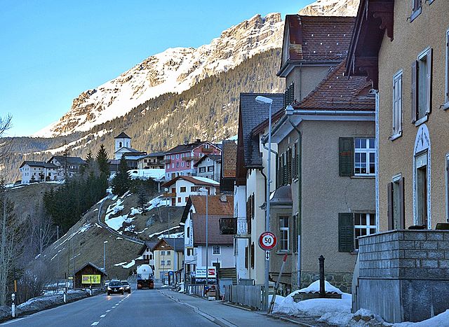
Мулегнс (Mulegns, Mulegns)

 Hiking in Мулегнс
Mulegns, a picturesque village nestled in the Swiss Alps, offers fantastic hiking opportunities for outdoor enthusiasts. It is known for its stunning alpine scenery, lush meadows, and well-marked trails suitable for various skill levels. Here are some highlights of hiking in Mulegns:
Trails and Routes
-
Mulegns to Piz Stuel:
- Distance: Approx. 10 km round trip
- Difficulty: Moderate
- This hike takes you up to the summit of Piz Stuel, offering breathtaking views of the surrounding peaks and valleys.
-
Mulegns to Alvaneu:
- Distance: About 7 km one way
- Difficulty: Easy to moderate
- A scenic trail that winds through forests and meadows, perfect for families.
-
Plan to the Hochwang:
- Distance: Varies based on the loop taken
- Difficulty: Moderate to challenging
- A longer excursion that can provide both a workout and beautiful panoramic views.
Best Time to Hike
- The best time for hiking in Mulegns is during the summer months (June to September) when the weather is generally stable and the trails are clear of snow.
- Autumn can also be a great time to hike, as the fall colors add to the beauty of the landscape.
Preparation
- Gear: Appropriate hiking boots, weather-appropriate clothing, a backpack with water and snacks, and trekking poles for more challenging trails.
- Maps and Guides: It’s advisable to have a map or use a hiking app to navigate the trails, as some paths may not be well signposted.
- Weather: Always check the weather forecast before heading out, as conditions can change quickly in the mountains.
Safety Tips
- Let someone know your hiking plans and expected return time.
- Be aware of your physical limits and the trail conditions.
- Carry a first aid kit and ensure your mobile phone is fully charged in case of emergencies.
Wildlife and Flora
While hiking, keep an eye out for native wildlife, such as chamois and various bird species. The area is also rich in alpine flora, making it a delight for nature lovers and photographers.
Whether you are a seasoned hiker or just starting out, Mulegns provides an excellent backdrop for enjoying the natural beauty of the Alps while indulging in various hiking adventures. Enjoy your hike!
- Страна:

- Почтовый код: 7455
- Телефонный код: 081
- Код автомобильного номера: GR
- Координаты: 46° 30' 16" N, 9° 34' 46" E


- GPS треки (wikiloc): [Ссылка]
- Высота над уровнем моря: 1952 м m
- Площадь: 33.79 кв.км
- Википедия русская: wiki(ru)
- Википедия английская: wiki(en)
- Википедия национальная: wiki(de)
- Хранилище Wikidata: Wikidata: Q65706
- Катеория в википедии: [Ссылка]
- код Freebase: [/m/026fk_8]
- код GeoNames: Альт: [7286577]
- код VIAF: Альт: [313270158]
- идентификатор HDS: [1425]
- код швейцарского муниципалитета: [3534]
Граничит с регионами:


Сур
Hiking in Сур
Sur is a charming village located in the Swiss canton of Grisons (Graubünden) and offers impressive hiking opportunities, primarily for those who love the beautiful landscapes of the Swiss Alps. Here’s an overview of what you can expect:...
- Страна:
- Почтовый код: 7456
- Телефонный код: 081
- Код автомобильного номера: GR
- Координаты: 46° 30' 59" N, 9° 36' 59" E
- GPS треки (wikiloc): [Ссылка]
- Высота над уровнем моря: 1530 м m
- Площадь: 23.22 кв.км
- Веб сайт: [Ссылка]


Савоньин
Hiking in Савоньин
Savognin is a picturesque village located in the Surses valley of the Swiss Alps, and it's a fantastic destination for hiking enthusiasts. The region offers a variety of trails that cater to different skill levels, from easy walks suitable for families to more challenging hikes for seasoned adventurers....
- Страна:
- Почтовый код: 7460
- Телефонный код: 081
- Код автомобильного номера: GR
- Координаты: 46° 34' 53" N, 9° 36' 8" E
- GPS треки (wikiloc): [Ссылка]
- Высота над уровнем моря: 1453 м m
- Площадь: 22.24 кв.км
- Веб сайт: [Ссылка]


Марморера
Hiking in Марморера
Marmorera is a picturesque area located in the canton of Graubünden in Switzerland, known for its stunning landscapes, diverse hiking trails, and tranquil atmosphere. Here are some key points to consider if you're planning to hike in Marmorera:...
- Страна:
- Почтовый код: 7456
- Телефонный код: 081
- Код автомобильного номера: GR
- Координаты: 46° 29' 59" N, 9° 39' 0" E
- GPS треки (wikiloc): [Ссылка]
- Высота над уровнем моря: 1720 м m
- Площадь: 18.90 кв.км
- Веб сайт: [Ссылка]


Риом-Парсонц
Hiking in Риом-Парсонц
Riom-Parsonz is a picturesque village located in the canton of Graubünden in Switzerland, known for its stunning natural scenery and excellent hiking opportunities. The region offers a combination of lush valleys, alpine meadows, and striking mountain views, making it a fantastic destination for hikers of all levels....
- Страна:
- Почтовый код: 7464; 7463
- Телефонный код: 081
- Код автомобильного номера: GR
- Координаты: 46° 35' 59" N, 9° 33' 59" E
- GPS треки (wikiloc): [Ссылка]
- Высота над уровнем моря: 1257 м m
- Площадь: 55.97 кв.км
- Веб сайт: [Ссылка]

Тиницонг-Рона
Hiking in Тиницонг-Рона
Tinizong-Rona is a beautiful area located in the canton of Graubünden in Switzerland, known for its stunning landscapes and rich natural biodiversity. Hiking in this region offers a plethora of trails suitable for various skill levels, ranging from beginners to advanced hikers. Here's an overview of what you can expect when hiking in Tinizong-Rona:...
- Страна:
- Почтовый код: 7453
- Телефонный код: 081
- Код автомобильного номера: GR
- Координаты: 46° 35' 0" N, 9° 37' 0" E
- GPS треки (wikiloc): [Ссылка]
- Высота над уровнем моря: 1232 м m
- Площадь: 54.30 кв.км


Бивио
Hiking in Бивио
Bivio is a charming village located in the Swiss Alps, known for its stunning natural landscapes and excellent hiking opportunities. Situated at the junction of several hiking trails, Bivio serves as a gateway to the surrounding mountains and valleys, making it a popular destination for outdoor enthusiasts....
- Страна:
- Почтовый код: 7457
- Телефонный код: 081
- Код автомобильного номера: GR
- Координаты: 46° 28' 11" N, 9° 39' 4" E
- GPS треки (wikiloc): [Ссылка]
- Высота над уровнем моря: 1769 м m
- Площадь: 76.73 кв.км
- Веб сайт: [Ссылка]


Аверс
Hiking in Аверс
Avers is a beautiful valley located in the Graubünden canton of Switzerland, known for its stunning landscapes, biodiversity, and wide range of hiking opportunities. Here are some highlights and considerations for hiking in the Avers area:...
- Страна:
- Почтовый код: 7447
- Телефонный код: 081
- Код автомобильного номера: GR
- Координаты: 46° 28' 26" N, 9° 30' 49" E
- GPS треки (wikiloc): [Ссылка]
- Высота над уровнем моря: 1960 м m
- Площадь: 93.12 кв.км
- Население: 169
- Веб сайт: [Ссылка]