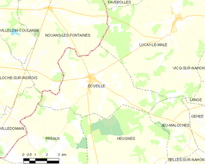
Villedômain (Villedômain)

- commune in Indre-et-Loire, France
- Country:

- Postal Code: 37110
- Coordinates: 47° 3' 10" N, 1° 15' 21" E


- GPS tracks (wikiloc): [Link]
- Area: 16.47 sq km
- Population: 118
- Web site: http://www.villedomain.com/
- Wikipedia en: wiki(en)
- Wikipedia: wiki(fr)
- Wikidata storage: Wikidata: Q744858
- Wikipedia Commons Category: [Link]
- Freebase ID: [/m/03nvczd]
- GeoNames ID: Alt: [6433155]
- SIREN number: [213702756]
- BnF ID: [15257823s]
- INSEE municipality code: 37275
Shares border with regions:
Saint-Médard
- commune in Indre, France
- Country:
- Postal Code: 36700
- Coordinates: 46° 59' 59" N, 1° 14' 48" E
- GPS tracks (wikiloc): [Link]
- Area: 12.6 sq km
- Population: 44
- Web site: [Link]

Écueillé
- commune in Indre, France
- Country:
- Postal Code: 36240
- Coordinates: 47° 5' 3" N, 1° 20' 47" E
- GPS tracks (wikiloc): [Link]
- Area: 34.9 sq km
- Population: 1286
- Web site: [Link]


Nouans-les-Fontaines
- commune in Indre-et-Loire, France
- Country:
- Postal Code: 37460
- Coordinates: 47° 8' 10" N, 1° 17' 54" E
- GPS tracks (wikiloc): [Link]
- Area: 63.31 sq km
- Population: 770


Châtillon-sur-Indre
- commune in Indre, France
- Country:
- Postal Code: 36700
- Coordinates: 46° 59' 16" N, 1° 10' 25" E
- GPS tracks (wikiloc): [Link]
- Area: 45.3 sq km
- Population: 2681
- Web site: [Link]


Préaux
- commune in Indre, France
- Country:
- Postal Code: 36240
- Coordinates: 47° 1' 16" N, 1° 17' 33" E
- GPS tracks (wikiloc): [Link]
- Area: 32.54 sq km
- Population: 161
- Web site: [Link]


Loché-sur-Indrois
- commune in Indre-et-Loire, France
- Country:
- Postal Code: 37460
- Coordinates: 47° 5' 32" N, 1° 13' 9" E
- GPS tracks (wikiloc): [Link]
- Area: 74.13 sq km
- Population: 561