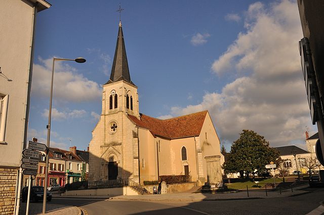
Étrechet (Étrechet)

- commune in Indre, France
- Country:

- Postal Code: 36120
- Coordinates: 46° 46' 43" N, 1° 47' 5" E


- GPS tracks (wikiloc): [Link]
- Area: 17.89 sq km
- Population: 955
- Web site: http://www.mairie-etrechet.fr
- Wikipedia en: wiki(en)
- Wikipedia: wiki(fr)
- Wikidata storage: Wikidata: Q1060687
- Wikipedia Commons Category: [Link]
- Freebase ID: [/m/03nvb60]
- GeoNames ID: Alt: [6448611]
- SIREN number: [213600711]
- BnF ID: [15257375n]
- PACTOLS thesaurus ID: [pcrtqAHkZTFODS]
- INSEE municipality code: 36071
Shares border with regions:
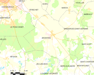
Ardentes
- commune in Indre, France
- Country:
- Postal Code: 36120
- Coordinates: 46° 44' 32" N, 1° 49' 51" E
- GPS tracks (wikiloc): [Link]
- Area: 62.09 sq km
- Population: 3872
- Web site: [Link]


Le Poinçonnet
- commune in Indre, France
- Country:
- Postal Code: 36330
- Coordinates: 46° 45' 50" N, 1° 43' 8" E
- GPS tracks (wikiloc): [Link]
- Area: 45 sq km
- Population: 5890
- Web site: [Link]


Châteauroux
- commune in Indre, France
- Country:
- Postal Code: 36000
- Coordinates: 46° 48' 35" N, 1° 41' 25" E
- GPS tracks (wikiloc): [Link]
- Area: 25.54 sq km
- Population: 43732
- Web site: [Link]

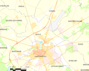
Déols
- commune in Indre, France
- Country:
- Postal Code: 36130
- Coordinates: 46° 49' 48" N, 1° 42' 21" E
- GPS tracks (wikiloc): [Link]
- Area: 31.74 sq km
- Population: 7598
- Web site: [Link]


Mâron
- commune in Indre, France
- Country:
- Postal Code: 36120
- Coordinates: 46° 48' 25" N, 1° 51' 56" E
- GPS tracks (wikiloc): [Link]
- Area: 27.84 sq km
- Population: 783
- Web site: [Link]
Diors
- commune in Indre, France
- Country:
- Postal Code: 36130
- Coordinates: 46° 49' 35" N, 1° 48' 53" E
- GPS tracks (wikiloc): [Link]
- Area: 25.44 sq km
- Population: 778