Amlikon-Bissegg (Amlikon-Bissegg)

- municipality in Switzerland
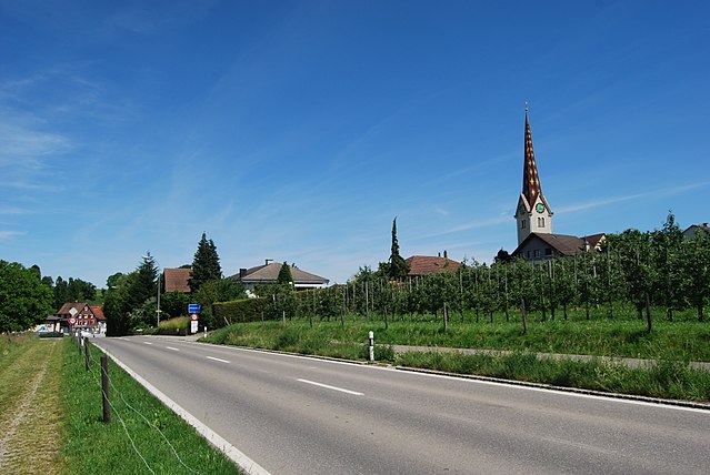
 Hiking in Amlikon-Bissegg
Amlikon-Bissegg is a picturesque area in Switzerland, known for its beautiful landscapes and tranquil hiking trails. Located in the canton of Thurgau, it offers a wonderful mix of nature, farms, and rural charm, making it an excellent destination for hikers of all levels.
Hiking Trails:
-
Lakeside Trails: One of the highlights around Amlikon-Bissegg is the proximity to Lake Constance. You can find charming paths that run along the lake, offering stunning views and opportunities to stop and enjoy the scenery.
-
Forest Paths: The area is surrounded by forests, providing shaded trails perfect for warmer days. These trails can be more challenging, as they often feature varied terrain, including gentle slopes and denser areas.
-
Circular Routes: Many circular hiking routes are available, allowing you to explore the region without retracing your steps. These trails often pass through vineyards and farmland, giving hikers a taste of the local culture and agriculture.
Points of Interest:
-
Vineyards: The Thurgau region is well-known for its vineyards, and while hiking, you may encounter beautiful rows of grapevines. Some wine tastings are available throughout the area if you wish to take a break from hiking.
-
Traditional Swiss Architecture: As you hike, you will likely see traditional Swiss farmhouses and barns, adding a cultural experience to your hike.
-
Viewpoints: Certain trails lead to viewpoints that offer sweeping panoramas of Lake Constance and the surrounding countryside, perfect for photography.
Tips for Hiking in Amlikon-Bissegg:
- Weather Check: Always check the weather before setting out, as conditions can change rapidly in the region.
- Proper Gear: Wear appropriate hiking shoes and consider bringing hiking poles, especially if you plan to tackle more challenging trails.
- Stay Hydrated: Carry enough water, especially on warmer days, and consider packing some snacks.
- Trail Maps: Familiarize yourself with the trail maps available online or at local tourist information centers to ensure you stay on track and discover the best routes.
Best Seasons:
- Spring and Autumn are particularly beautiful in the region when the landscapes are vibrant with blooming flowers or colorful foliage.
Accessibility:
Amlikon-Bissegg is well connected via public transport, so getting to the starting points of your hikes is usually quite easy.
Overall, Amlikon-Bissegg is an excellent choice for those looking to enjoy the natural beauty of Switzerland while engaging in a rewarding hiking experience. Happy hiking!
- Country:

- Postal Code: 8514
- Local Dialing Code: 071
- Licence Plate Code: TG
- Coordinates: 47° 33' 59" N, 9° 2' 59" E


- GPS tracks (wikiloc): [Link]
- AboveSeaLevel: 422 м m
- Area: 14.4 sq km
- Population: 1335
- Web site: http://www.amlikon-bissegg.ch
- Wikipedia en: wiki(en)
- Wikipedia: wiki(de)
- Wikidata storage: Wikidata: Q65787
- Wikipedia Commons Category: [Link]
- Freebase ID: [/m/0g2ghd]
- GeoNames ID: Alt: [7285071]
- VIAF ID: Alt: [161914002]
- OSM relation ID: [1684498]
- HDS ID: [45232]
- Swiss municipality code: [4881]
Shares border with regions:


Thundorf
- municipality in Switzerland
Hiking in Thundorf
Thundorf is a charming village located in the Thurgau region of Switzerland, surrounded by beautiful landscapes that are perfect for hiking enthusiasts. While it might not be as well-known as some other Swiss hiking destinations, it offers a variety of trails that take you through serene nature, vineyards, and picturesque countryside....
- Country:
- Postal Code: 8512
- Local Dialing Code: 052
- Licence Plate Code: TG
- Coordinates: 47° 32' 50" N, 8° 57' 52" E
- GPS tracks (wikiloc): [Link]
- AboveSeaLevel: 546 м m
- Area: 15.6 sq km
- Population: 1452
- Web site: [Link]

Märstetten
- municipality in Switzerland
Hiking in Märstetten
Märstetten, located in the canton of Thurgau in Switzerland, is surrounded by natural beauty and offers several opportunities for hiking enthusiasts. The region features a mix of rolling hills, farmland, and forested areas, providing diverse and scenic hiking trails....
- Country:
- Postal Code: 8560
- Local Dialing Code: 071
- Licence Plate Code: TG
- Coordinates: 47° 36' 0" N, 9° 3' 59" E
- GPS tracks (wikiloc): [Link]
- AboveSeaLevel: 425 м m
- Area: 9.9 sq km
- Population: 2817
- Web site: [Link]


Müllheim
- municipality in Switzerland
Hiking in Müllheim
Müllheim, located in the picturesque region of Switzerland, offers a variety of hiking opportunities that cater to different skill levels and preferences. Situated in the canton of Aargau, Müllheim is surrounded by beautiful landscapes, charming villages, and the serene nature of the Swiss countryside. Here are some highlights of hiking in and around Müllheim:...
- Country:
- Postal Code: 8555
- Local Dialing Code: 052
- Licence Plate Code: TG
- Coordinates: 47° 36' 10" N, 9° 0' 13" E
- GPS tracks (wikiloc): [Link]
- AboveSeaLevel: 413 м m
- Area: 8.7 sq km
- Population: 2970
- Web site: [Link]
Affeltrangen
- municipality in Switzerland
Hiking in Affeltrangen
Affeltrangen is a picturesque village located in the canton of Thurgau, Switzerland. The surrounding region offers a variety of hiking opportunities that cater to different skill levels and preferences. Here are some highlights about hiking in and around Affeltrangen:...
- Country:
- Postal Code: 9556
- Local Dialing Code: 071
- Licence Plate Code: TG
- Coordinates: 47° 30' 59" N, 9° 1' 0" E
- GPS tracks (wikiloc): [Link]
- AboveSeaLevel: 489 м m
- Area: 14.4 sq km
- Population: 2562
- Web site: [Link]


Hüttlingen
- municipality in Switzerland
Hiking in Hüttlingen
Hüttlingen, located in the scenic region of Switzerland, is an excellent destination for hiking enthusiasts. While Hüttlingen itself may not be as well-known as some larger Swiss hiking destinations, its proximity to stunning natural landscapes and various trails make it a hidden gem for both casual walkers and avid hikers....
- Country:
- Postal Code: 8553
- Local Dialing Code: 052
- Licence Plate Code: TG
- Coordinates: 47° 34' 59" N, 8° 59' 0" E
- GPS tracks (wikiloc): [Link]
- AboveSeaLevel: 411 м m
- Area: 11.6 sq km
- Population: 841
- Web site: [Link]

Wigoltingen
- municipality in Switzerland
Hiking in Wigoltingen
Wigoltingen, a charming village in the canton of Thurgau in Switzerland, offers a variety of hiking opportunities for nature enthusiasts. Its picturesque landscape features rolling hills, lush greenery, and scenic views, making it an appealing destination for outdoor activities....
- Country:
- Postal Code: 8556
- Local Dialing Code: 052
- Licence Plate Code: TG
- Coordinates: 47° 36' 2" N, 9° 2' 44" E
- GPS tracks (wikiloc): [Link]
- AboveSeaLevel: 429 м m
- Area: 17.2 sq km
- Population: 2438
- Web site: [Link]

Bussnang
- municipality in Switzerland
Hiking in Bussnang
Bussnang is a picturesque municipality located in the canton of Thurgau, Switzerland. It is surrounded by beautiful landscapes, making it an ideal destination for hiking enthusiasts. Here are some highlights of hiking in and around Bussnang:...
- Country:
- Postal Code: 9565
- Local Dialing Code: 071
- Licence Plate Code: TG
- Coordinates: 47° 33' 30" N, 9° 5' 2" E
- GPS tracks (wikiloc): [Link]
- AboveSeaLevel: 445 м m
- Area: 19.0 sq km
- Population: 2319
- Web site: [Link]

Weinfelden
- municipality in Switzerland
Hiking in Weinfelden
Weinfelden, located in the canton of Thurgau in Switzerland, offers a variety of hiking opportunities that showcase the beautiful landscapes of the area, including vineyards, rolling hills, and views of the nearby Bodensee (Lake Constance). Here are some highlights about hiking in Weinfelden:...
- Country:
- Postal Code: 8570
- Local Dialing Code: 071
- Licence Plate Code: TG
- Coordinates: 47° 33' 59" N, 9° 6' 0" E
- GPS tracks (wikiloc): [Link]
- AboveSeaLevel: 432 м m
- Area: 15.48 sq km
- Population: 11388
- Web site: [Link]