Affeltrangen (Affeltrangen)

- municipality in Switzerland
 Hiking in Affeltrangen
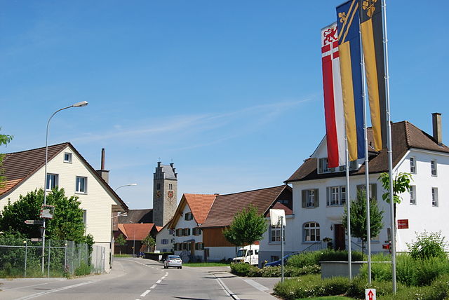
Affeltrangen is a picturesque village located in the canton of Thurgau, Switzerland. The surrounding region offers a variety of hiking opportunities that cater to different skill levels and preferences. Here are some highlights about hiking in and around Affeltrangen:
Hiking Trails
-
Local Trails: The area around Affeltrangen features well-marked trails through beautiful landscapes, including forests, fields, and vineyards. These paths are perfect for a leisurely hike, and you may encounter charming rural scenery along the way.
-
Thurgau Trail: Part of the regional Thurgau Trail network, this trail can be connected to various routes that provide a wider experience of the Thurgau landscape. These trails often pass by historical sites, small villages, and offer impressive views of Lake Constance.
-
Nature Reserves: The nearby natural reserves offer trails that allow hikers to immerse themselves in the local flora and fauna. Birdwatching and photography opportunities abound in these serene environments.
Difficulty Levels
The hiking trails around Affeltrangen cater to all levels of hikers:
- Easy Trails: Suitable for families and beginners, many trails are relatively flat and accessible.
- Moderate Trails: For those looking for a bit more of a challenge, moderately difficult paths explore more rugged terrain and may involve some elevation changes.
Best Times to Hike
- Spring and Summer: These seasons are ideal, as the weather is typically mild and the landscapes are lush and vibrant.
- Autumn: The autumn foliage offers stunning views, making it a great time for photography.
Preparation Tips
- Wear Appropriate Footwear: Good hiking boots or shoes with solid grip are crucial for a comfortable hike.
- Bring Water and Snacks: Staying hydrated and energized is essential, especially on longer hikes.
- Check the Weather: Swiss weather can change rapidly; checking forecasts helps ensure a safe hiking experience.
- Navigation: While trails are marked, having a map or a GPS device is always a good precaution.
Accessibility
Affeltrangen is accessible by public transport as well as by car. If you’re coming from major cities, there are train connections that can get you to Thurgau easily.
Hiking in Affeltrangen provides a wonderful way to experience the natural beauty and peaceful environment of this charming Swiss region. Whether you’re a seasoned hiker or a beginner, you’ll find trails that suit your needs and interests. Enjoy your hike!
- Country:

- Postal Code: 9556
- Local Dialing Code: 071
- Licence Plate Code: TG
- Coordinates: 47° 30' 59" N, 9° 1' 0" E


- GPS tracks (wikiloc): [Link]
- AboveSeaLevel: 489 м m
- Area: 14.4 sq km
- Population: 2562
- Web site: http://www.affeltrangen.ch
- Wikipedia en: wiki(en)
- Wikipedia: wiki(de)
- Wikidata storage: Wikidata: Q65800
- Wikipedia Commons Category: [Link]
- Freebase ID: [/m/0g34mh]
- GeoNames ID: Alt: [7285036]
- VIAF ID: Alt: [148430930]
- OSM relation ID: [1684496]
- HDS ID: [1945]
- Swiss municipality code: [4711]
Shares border with regions:


Thundorf
- municipality in Switzerland
Hiking in Thundorf
Thundorf is a charming village located in the Thurgau region of Switzerland, surrounded by beautiful landscapes that are perfect for hiking enthusiasts. While it might not be as well-known as some other Swiss hiking destinations, it offers a variety of trails that take you through serene nature, vineyards, and picturesque countryside....
- Country:
- Postal Code: 8512
- Local Dialing Code: 052
- Licence Plate Code: TG
- Coordinates: 47° 32' 50" N, 8° 57' 52" E
- GPS tracks (wikiloc): [Link]
- AboveSeaLevel: 546 м m
- Area: 15.6 sq km
- Population: 1452
- Web site: [Link]

Lommis
- municipality in Switzerland
Hiking in Lommis
Lommis, located in the Thurgau region of Switzerland, offers various hiking opportunities characterized by scenic landscapes, rolling hills, and picturesque vineyards. The region is known for its mild climate, making it an excellent destination for year-round hiking. Here are some insights into hiking in Lommis:...
- Country:
- Postal Code: 9506
- Local Dialing Code: 052
- Licence Plate Code: TG
- Coordinates: 47° 30' 59" N, 8° 58' 59" E
- GPS tracks (wikiloc): [Link]
- AboveSeaLevel: 475 м m
- Area: 8.6 sq km
- Population: 1224
- Web site: [Link]

Amlikon-Bissegg
- municipality in Switzerland
Hiking in Amlikon-Bissegg
Amlikon-Bissegg is a picturesque area in Switzerland, known for its beautiful landscapes and tranquil hiking trails. Located in the canton of Thurgau, it offers a wonderful mix of nature, farms, and rural charm, making it an excellent destination for hikers of all levels....
- Country:
- Postal Code: 8514
- Local Dialing Code: 071
- Licence Plate Code: TG
- Coordinates: 47° 33' 59" N, 9° 2' 59" E
- GPS tracks (wikiloc): [Link]
- AboveSeaLevel: 422 м m
- Area: 14.4 sq km
- Population: 1335
- Web site: [Link]


Tobel-Tägerschen
- municipality in Switzerland
Hiking in Tobel-Tägerschen
Tobel-Tägerschen is a scenic area in Switzerland that offers various hiking opportunities amidst beautiful landscapes. Located in the region of Thurgau, it features rolling hills, lush forests, and charming glimpses of rural life. Here are a few highlights and tips for hiking in that region:...
- Country:
- Postal Code: 9555
- Local Dialing Code: 071
- Licence Plate Code: TG
- Coordinates: 47° 31' 0" N, 9° 1' 59" E
- GPS tracks (wikiloc): [Link]
- AboveSeaLevel: 525 м m
- Area: 7.0 sq km
- Population: 1599
- Web site: [Link]

Bussnang
- municipality in Switzerland
Hiking in Bussnang
Bussnang is a picturesque municipality located in the canton of Thurgau, Switzerland. It is surrounded by beautiful landscapes, making it an ideal destination for hiking enthusiasts. Here are some highlights of hiking in and around Bussnang:...
- Country:
- Postal Code: 9565
- Local Dialing Code: 071
- Licence Plate Code: TG
- Coordinates: 47° 33' 30" N, 9° 5' 2" E
- GPS tracks (wikiloc): [Link]
- AboveSeaLevel: 445 м m
- Area: 19.0 sq km
- Population: 2319
- Web site: [Link]


Braunau
- municipality in Switzerland
Hiking in Braunau
Braunau, while not a well-known hiking destination itself, is located in Switzerland near the borders of more prominent hiking areas, particularly in the region of the Swiss Alps. However, it provides access to various scenic trails and the surrounding natural beauty that the Swiss landscape offers....
- Country:
- Postal Code: 9502
- Local Dialing Code: 071
- Licence Plate Code: TG
- Coordinates: 47° 30' 16" N, 9° 4' 8" E
- GPS tracks (wikiloc): [Link]
- AboveSeaLevel: 693 м m
- Area: 9.2 sq km
- Population: 770
- Web site: [Link]