Francillon (Francillon)

- commune in Indre, France
- Country:

- Postal Code: 36110
- Coordinates: 46° 56' 30" N, 1° 33' 43" E


- GPS tracks (wikiloc): [Link]
- Area: 10.27 sq km
- Population: 75
- Wikipedia en: wiki(en)
- Wikipedia: wiki(fr)
- Wikidata storage: Wikidata: Q968124
- Wikipedia Commons Category: [Link]
- Freebase ID: [/m/0bwtdb]
- GeoNames ID: Alt: [6448617]
- SIREN number: [213600794]
- BnF ID: [152573838]
- INSEE municipality code: 36079
Shares border with regions:
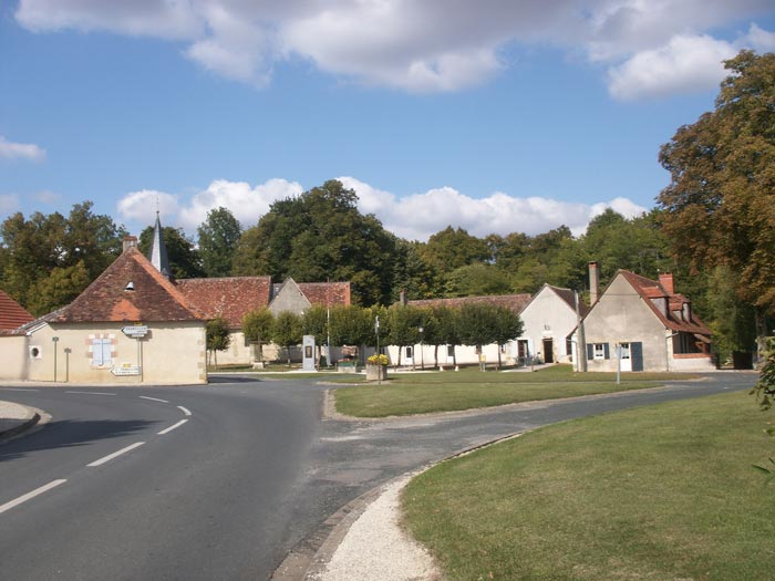
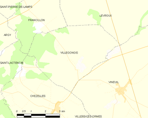
Villegongis
- commune in Indre, France
- Country:
- Postal Code: 36110
- Coordinates: 46° 54' 48" N, 1° 35' 44" E
- GPS tracks (wikiloc): [Link]
- Area: 18.15 sq km
- Population: 121
- Web site: [Link]


Saint-Pierre-de-Lamps
- commune in Indre, France
- Country:
- Postal Code: 36110
- Coordinates: 46° 58' 16" N, 1° 30' 45" E
- GPS tracks (wikiloc): [Link]
- Area: 10.28 sq km
- Population: 53


Saint-Martin-de-Lamps
- former commune in Indre, France
- Country:
- Postal Code: 36110
- Coordinates: 46° 59' 26" N, 1° 31' 29" E
- GPS tracks (wikiloc): [Link]
- Area: 15.61 sq km
- Population: 153


Argy
- commune in Indre, France
- Country:
- Postal Code: 36500
- Coordinates: 46° 56' 21" N, 1° 26' 18" E
- GPS tracks (wikiloc): [Link]
- Area: 38.89 sq km
- Population: 612


Levroux
- commune in Indre, France
- Country:
- Postal Code: 36110
- Coordinates: 46° 58' 37" N, 1° 36' 46" E
- GPS tracks (wikiloc): [Link]
- Area: 56.43 sq km
- Population: 2775
- Web site: [Link]


Saint-Lactencin
- commune in Indre, France
- Country:
- Postal Code: 36500
- Coordinates: 46° 53' 53" N, 1° 29' 35" E
- GPS tracks (wikiloc): [Link]
- AboveSeaLevel: 149 м m
- Area: 32.2 sq km
- Population: 430