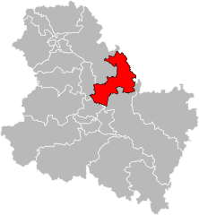
arrondissement of Auxerre (arrondissement d'Auxerre)

- arrondissement of France
- Country:

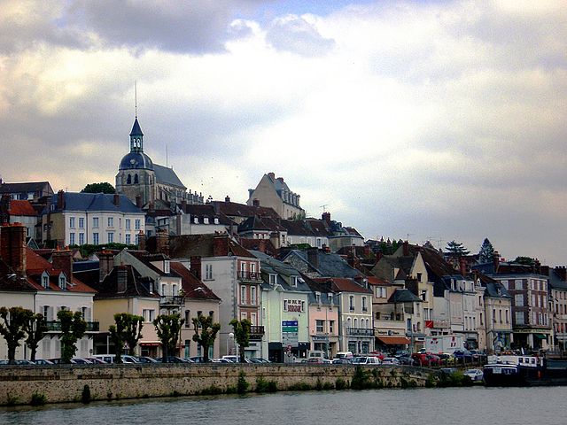
- Capital: Auxerre
- Coordinates: 47° 45' 0" N, 3° 30' 0" E


- GPS tracks (wikiloc): [Link]
- Area: 3514.55 sq km
- Population: 166396
- Wikipedia en: wiki(en)
- Wikipedia: wiki(fr)
- Wikidata storage: Wikidata: Q700534
- Freebase ID: [/m/0955z8]
- GeoNames ID: Alt: [3035842]
- INSEE arrondissement code: [891]
- GNS Unique Feature ID: -1409470
Includes regions:


canton of Brienon-sur-Armançon
- canton of France
- Country:
- Capital: Brienon-sur-Armançon
- Coordinates: 48° 1' 42" N, 3° 38' 6" E
- GPS tracks (wikiloc): [Link]
- Population: 17241
canton of Charny
- canton of France
- Country:
- Coordinates: 47° 52' 30" N, 3° 6' 53" E
- GPS tracks (wikiloc): [Link]
- Population: 17038

canton of Aillant-sur-Tholon
- canton of France (until March 2015)
- Country:
- Capital: Aillant-sur-Tholon
- Coordinates: 47° 52' 13" N, 3° 22' 3" E
- GPS tracks (wikiloc): [Link]

canton of Saint-Fargeau
- canton of France (until March 2015)
- Country:
- Capital: Saint-Fargeau
- Coordinates: 47° 39' 1" N, 3° 4' 37" E
- GPS tracks (wikiloc): [Link]

canton of Coulanges-sur-Yonne
- former canton of France
- Country:
- Capital: Coulanges-sur-Yonne
- Coordinates: 47° 33' 33" N, 3° 33' 35" E
- GPS tracks (wikiloc): [Link]


canton of Chablis
- canton of France
- Country:
- Capital: Chablis
- Coordinates: 47° 46' 56" N, 3° 47' 51" E
- GPS tracks (wikiloc): [Link]
- Population: 17116

canton of Coulanges-la-Vineuse
- canton of France
- Country:
- Capital: Coulanges-la-Vineuse
- Coordinates: 47° 41' 59" N, 3° 34' 22" E
- GPS tracks (wikiloc): [Link]

canton of Joigny
- canton of France
- Country:
- Capital: Joigny
- Coordinates: 47° 59' 4" N, 3° 21' 15" E
- GPS tracks (wikiloc): [Link]
- Population: 18742

canton of Ligny-le-Châtel
- canton of France
- Country:
- Capital: Ligny-le-Châtel
- Coordinates: 47° 52' 53" N, 3° 43' 50" E
- GPS tracks (wikiloc): [Link]


canton of Migennes
- canton of France
- Country:
- Capital: Migennes
- Coordinates: 47° 56' 46" N, 3° 29' 55" E
- GPS tracks (wikiloc): [Link]
- Population: 16298

canton of Saint-Florentin
- canton of France
- Country:
- Capital: Saint-Florentin
- Coordinates: 47° 58' 46" N, 3° 45' 22" E
- GPS tracks (wikiloc): [Link]
- Population: 18524

canton of Saint-Sauveur-en-Puisaye
- canton of France
- Country:
- Capital: Saint-Sauveur-en-Puisaye
- Coordinates: 47° 35' 1" N, 3° 15' 7" E
- GPS tracks (wikiloc): [Link]


canton of Courson-les-Carrières
- canton of France (until March 2015)
- Country:
- Capital: Courson-les-Carrières
- Coordinates: 47° 37' 29" N, 3° 27' 0" E
- GPS tracks (wikiloc): [Link]

Shares border with regions:


arrondissement of Clamecy
- arrondissement of France
- Country:
- Capital: Clamecy
- Coordinates: 47° 20' 0" N, 3° 40' 0" E
- GPS tracks (wikiloc): [Link]
- Population: 21597