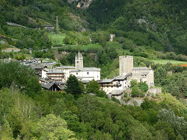
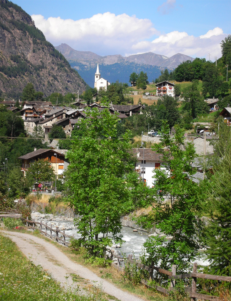
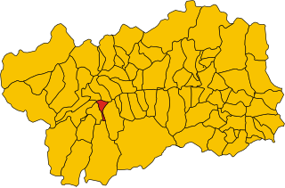
Arvier (Arvier)
.svg)
- Italian comune
 Hiking in Arvier
Arvier, a charming town located in the Aosta Valley region of Italy, offers a wealth of hiking opportunities surrounded by stunning alpine scenery. Here are some highlights to consider when planning a hiking adventure in and around Arvier:
Scenic Trails:
-
Mont Rouvre: A popular hike that provides panoramic views of the Aosta Valley. The trail is moderately challenging and is suitable for hikers looking to experience the local flora and fauna.
-
The Arvier–Quart Trail: This trail takes you from Arvier to Chaudard, offering a relatively easy hike through picturesque landscapes and charming villages.
-
Col de La Becca: A rewarding hike to this col that lies at a higher elevation, featuring breathtaking views of the surrounding peaks. The route can be challenging, so it may be best for experienced hikers.
-
Cascate di Lillaz: A lovely hike that leads to the beautiful waterfalls near the village of Lillaz, showcasing the natural beauty of the area.
Preparation:
- Weather: The alpine weather can change rapidly, so it’s important to check the forecast and be prepared for varying conditions.
- Equipment: Sturdy hiking boots, weather-appropriate clothing, trekking poles, and a map or GPS device are essential.
- Hydration and Snacks: Carry enough water and snacks to keep your energy levels up throughout your hike.
Local Attractions:
- Historical Sites: After your hike, consider exploring the local history, including the Roman ruins and the beautiful churches in Arvier.
- Cuisine: Don't miss the opportunity to sample local dishes, such as polenta and various cheeses, in one of the town's restaurants or mountain huts.
Safety:
- Always inform someone of your hiking plans and expected return time.
- It’s advisable to hike with a buddy or group, especially on less populated trails.
- Familiarize yourself with the terrain and potential wildlife in the area.
Hiking in Arvier not only provides an excellent way to enjoy nature and exercise but also offers a unique glimpse into the rich culture and stunning landscapes of the Aosta Valley. Whether you're a seasoned hiker or a beginner, there are trails to suit all levels of expertise. Enjoy your adventure!
- Country:

- Postal Code: 11011
- Local Dialing Code: 0165
- Licence Plate Code: AO
- Coordinates: 45° 42' 11" N, 7° 10' 0" E


- GPS tracks (wikiloc): [Link]
- AboveSeaLevel: 776 м m
- Area: 33.36 sq km
- Population: 865
- Web site: http://www.comune.arvier.ao.it/
- Wikipedia en: wiki(en)
- Wikipedia: wiki(it)
- Wikidata storage: Wikidata: Q34759
- Wikipedia Commons Category: [Link]
- Wikipedia Commons Maps Category: [Link]
- Freebase ID: [/m/0fsz_n]
- GeoNames ID: Alt: [6540546]
- VIAF ID: Alt: [247406330]
- OSM relation ID: [45620]
- UN/LOCODE: [ITAV8]
- ISTAT ID: 007005
- Italian cadastre code: A452
Shares border with regions:

Avise
- Italian comune
Hiking in Avise
Avise is a charming commune in the Aosta Valley region of Italy, located in the picturesque Alpine area. It offers a variety of hiking opportunities that cater to different skill levels and preferences. Here are some highlights for those interested in hiking in Avise:...
- Country:
- Postal Code: 11010
- Local Dialing Code: 0165
- Licence Plate Code: AO
- Coordinates: 45° 42' 31" N, 7° 8' 26" E
- GPS tracks (wikiloc): [Link]
- AboveSeaLevel: 775 м m
- Area: 52.62 sq km
- Population: 298
- Web site: [Link]


Introd
- Italian comune
Hiking in Introd
Introd is a beautiful commune located in the Aosta Valley region of Italy, nestled in the foothills of the Alps. It is surrounded by stunning natural landscapes, making it an excellent destination for hiking enthusiasts. Here are some highlights and tips for hiking in Introd:...
- Country:
- Postal Code: 11010
- Local Dialing Code: 0165
- Licence Plate Code: AO
- Coordinates: 45° 41' 24" N, 7° 11' 15" E
- GPS tracks (wikiloc): [Link]
- AboveSeaLevel: 880 м m
- Area: 20.04 sq km
- Population: 657
- Web site: [Link]


La Thuile
- Italian comune
Hiking in La Thuile
La Thuile, located in the Aosta Valley region of Italy, is a fantastic destination for hiking enthusiasts. Nestled in the Alps, this area offers stunning landscapes, diverse wildlife, and a variety of hiking trails suitable for all skill levels, from beginners to experienced adventurers....
- Country:
- Postal Code: 11016
- Local Dialing Code: 0165
- Licence Plate Code: AO
- Coordinates: 45° 42' 58" N, 6° 57' 0" E
- GPS tracks (wikiloc): [Link]
- AboveSeaLevel: 1450 м m
- Area: 125.67 sq km
- Population: 783
- Web site: [Link]

Rhêmes-Saint-Georges
- Italian comune
Hiking in Rhêmes-Saint-Georges
Rhêmes-Saint-Georges is a charming village located in the Aosta Valley region of Italy, known for its stunning landscapes and access to numerous hiking trails. The area is surrounded by the majestic mountains of the Gran Paradiso National Park, making it a fantastic destination for outdoor enthusiasts....
- Country:
- Postal Code: 11010
- Local Dialing Code: 0165
- Licence Plate Code: AO
- Coordinates: 45° 39' 8" N, 7° 9' 16" E
- GPS tracks (wikiloc): [Link]
- AboveSeaLevel: 1218 м m
- Area: 36.34 sq km
- Population: 173
- Web site: [Link]


Saint-Nicolas, Aosta Valley
- Italian comune
Hiking in Saint-Nicolas, Aosta Valley
Saint-Nicolas, located in the Aosta Valley region of Italy, offers a stunning backdrop for hikers with its beautiful alpine landscapes, charming villages, and rich cultural heritage. Here are some highlights and information about hiking in the area:...
- Country:
- Postal Code: 11010
- Local Dialing Code: 0165
- Licence Plate Code: AO
- Coordinates: 45° 43' 0" N, 7° 10' 0" E
- GPS tracks (wikiloc): [Link]
- AboveSeaLevel: 1200 м m
- Area: 15.46 sq km
- Population: 307
- Web site: [Link]


Valgrisenche
- Italian comune
Hiking in Valgrisenche
Valgrisenche is a beautiful and relatively lesser-known valley located in the Aosta Valley region of Italy, nestled within the western Alps. It offers stunning natural scenery, alpine landscapes, and various hiking opportunities suitable for different skill levels. Here are some highlights and tips for hiking in Valgrisenche:...
- Country:
- Postal Code: 11010
- Local Dialing Code: 0165
- Licence Plate Code: AO
- Coordinates: 45° 37' 48" N, 7° 3' 52" E
- GPS tracks (wikiloc): [Link]
- AboveSeaLevel: 1664 м m
- Area: 113.48 sq km
- Population: 192
- Web site: [Link]

Villeneuve, Aosta Valley
- Italian comune
Hiking in Villeneuve, Aosta Valley
Villeneuve, located in the Aosta Valley of northwestern Italy, is a charming village surrounded by stunning alpine scenery. The area is notable for its outdoor adventure opportunities, particularly hiking....
- Country:
- Postal Code: 11018
- Local Dialing Code: 0165
- Licence Plate Code: AO
- Coordinates: 45° 42' 9" N, 7° 12' 27" E
- GPS tracks (wikiloc): [Link]
- AboveSeaLevel: 670 м m
- Area: 8.8 sq km
- Population: 1236
- Web site: [Link]