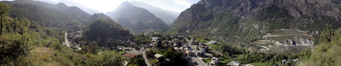
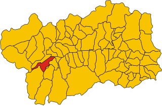
Rhêmes-Saint-Georges (Rhêmes-Saint-Georges)
.svg)
- Italian comune
 Hiking in Rhêmes-Saint-Georges
Rhêmes-Saint-Georges is a charming village located in the Aosta Valley region of Italy, known for its stunning landscapes and access to numerous hiking trails. The area is surrounded by the majestic mountains of the Gran Paradiso National Park, making it a fantastic destination for outdoor enthusiasts.
Hiking Trails
-
Gran Paradiso National Park: Many trails branch out from Rhêmes-Saint-Georges, leading into the national park. This area is renowned for its biodiversity and offers various hiking routes suitable for all levels, from beginner to advanced.
-
Valle di Rhèmes: This valley provides several hiking options. You can explore trails that lead to beautiful alpine lakes, such as Lago di Lapiaz, or towards high mountain passes for breathtaking views of the surrounding peaks.
-
Sentiero Balcone: A well-known panoramic trail that offers stunning views over the valley and is excellent for appreciating the local flora and fauna.
Difficulty Levels
-
Beginner: There are several easy paths suitable for families and those new to hiking. These trails typically have gentle gradients and are well-marked.
-
Intermediate: For those looking for a moderate challenge, consider trails that ascend towards higher elevations. These may require good physical fitness and some hiking experience.
-
Advanced: Experienced hikers can tackle more challenging routes, including those that may require scrambling, good navigation skills, and a head for heights.
Best Time to Hike
The best time to hike in Rhêmes-Saint-Georges is generally from late spring (May) to early fall (September). Summer months offer the best weather conditions, but it’s wise to check for local weather forecasts and trail conditions, especially at higher altitudes where snow can linger.
Preparation Tips
- Gear: Wear good hiking boots, and bring layers of clothing for changing weather, a hat, sunscreen, and plenty of water.
- Maps and Navigation: Familiarize yourself with the trail maps and have a reliable GPS or compass, especially for more remote hikes.
- Wildlife Awareness: Be mindful of local wildlife and follow guidelines for responsible hiking to protect both yourself and the environment.
Local Culture and Cuisine
While hiking, you might also want to explore the local culture. Rhêmes-Saint-Georges offers delicious traditional Aosta Valley cuisine, including polenta, hearty mountain soups, and local cheeses. It's a great way to reward yourself after a day on the trails!
Hiking in Rhêmes-Saint-Georges provides an opportunity to connect with nature, enjoy breathtaking views, and experience the beauty of the Italian Alps. Enjoy your adventure!
- Country:

- Postal Code: 11010
- Local Dialing Code: 0165
- Licence Plate Code: AO
- Coordinates: 45° 39' 8" N, 7° 9' 16" E


- GPS tracks (wikiloc): [Link]
- AboveSeaLevel: 1218 м m
- Area: 36.34 sq km
- Population: 173
- Web site: http://www.comune.rhemes-st-georges.ao.it
- Wikipedia en: wiki(en)
- Wikipedia: wiki(it)
- Wikidata storage: Wikidata: Q35324
- Wikipedia Commons Category: [Link]
- Wikipedia Commons Maps Category: [Link]
- Freebase ID: [/m/0fwz6_]
- GeoNames ID: Alt: [6535999]
- OSM relation ID: [45454]
- ISTAT ID: 007056
- Italian cadastre code: H263
Shares border with regions:
Arvier
- Italian comune
Hiking in Arvier
Arvier, a charming town located in the Aosta Valley region of Italy, offers a wealth of hiking opportunities surrounded by stunning alpine scenery. Here are some highlights to consider when planning a hiking adventure in and around Arvier:...
- Country:
- Postal Code: 11011
- Local Dialing Code: 0165
- Licence Plate Code: AO
- Coordinates: 45° 42' 11" N, 7° 10' 0" E
- GPS tracks (wikiloc): [Link]
- AboveSeaLevel: 776 м m
- Area: 33.36 sq km
- Population: 865
- Web site: [Link]


Introd
- Italian comune
Hiking in Introd
Introd is a beautiful commune located in the Aosta Valley region of Italy, nestled in the foothills of the Alps. It is surrounded by stunning natural landscapes, making it an excellent destination for hiking enthusiasts. Here are some highlights and tips for hiking in Introd:...
- Country:
- Postal Code: 11010
- Local Dialing Code: 0165
- Licence Plate Code: AO
- Coordinates: 45° 41' 24" N, 7° 11' 15" E
- GPS tracks (wikiloc): [Link]
- AboveSeaLevel: 880 м m
- Area: 20.04 sq km
- Population: 657
- Web site: [Link]


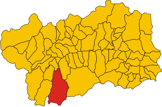
Rhêmes-Notre-Dame
- Italian comune
Hiking in Rhêmes-Notre-Dame
Rhêmes-Notre-Dame is a charming village located in the Aosta Valley of Italy, nestled in the heart of the Gran Paradiso National Park. This picturesque area is known for its stunning landscapes, diverse wildlife, and an extensive network of hiking trails that cater to all levels of experience....
- Country:
- Postal Code: 11010
- Local Dialing Code: 0165
- Licence Plate Code: AO
- Coordinates: 45° 34' 11" N, 7° 7' 7" E
- GPS tracks (wikiloc): [Link]
- AboveSeaLevel: 1725 м m
- Area: 86.84 sq km
- Population: 82
- Web site: [Link]


Valgrisenche
- Italian comune
Hiking in Valgrisenche
Valgrisenche is a beautiful and relatively lesser-known valley located in the Aosta Valley region of Italy, nestled within the western Alps. It offers stunning natural scenery, alpine landscapes, and various hiking opportunities suitable for different skill levels. Here are some highlights and tips for hiking in Valgrisenche:...
- Country:
- Postal Code: 11010
- Local Dialing Code: 0165
- Licence Plate Code: AO
- Coordinates: 45° 37' 48" N, 7° 3' 52" E
- GPS tracks (wikiloc): [Link]
- AboveSeaLevel: 1664 м m
- Area: 113.48 sq km
- Population: 192
- Web site: [Link]

Valsavarenche
- Italian comune
Hiking in Valsavarenche
Valsavarenche is a picturesque valley located in the Aosta Valley region of the Italian Alps, and it is part of the Gran Paradiso National Park. This area is known for its stunning natural beauty, diverse wildlife, and well-maintained trails, making it an excellent destination for hiking enthusiasts....
- Country:
- Postal Code: 11010
- Local Dialing Code: 0165
- Licence Plate Code: AO
- Coordinates: 45° 35' 32" N, 7° 12' 28" E
- GPS tracks (wikiloc): [Link]
- AboveSeaLevel: 1541 м m
- Area: 138.21 sq km
- Population: 164
- Web site: [Link]