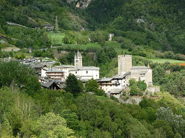
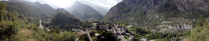
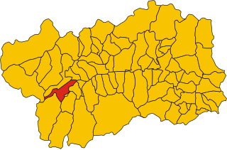
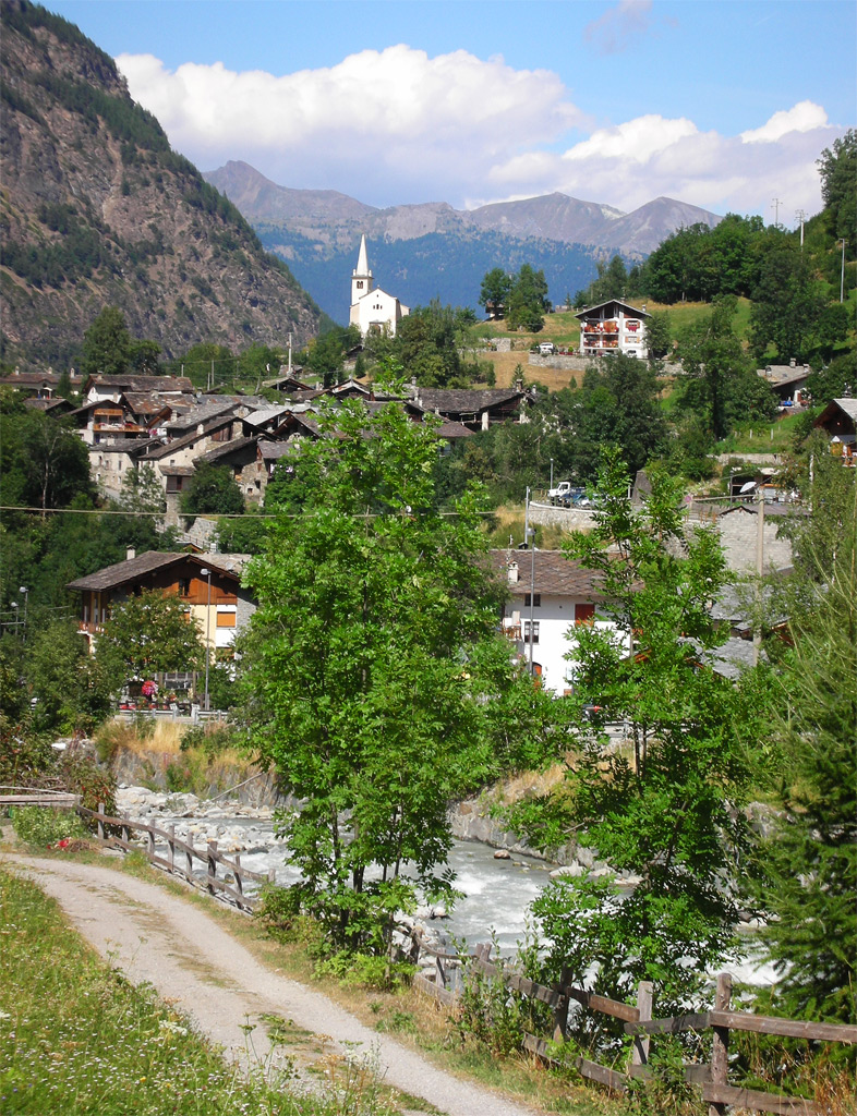
Valgrisenche (Valgrisenche)
.svg)
- Italian comune
 Hiking in Valgrisenche
Valgrisenche is a beautiful and relatively lesser-known valley located in the Aosta Valley region of Italy, nestled within the western Alps. It offers stunning natural scenery, alpine landscapes, and various hiking opportunities suitable for different skill levels. Here are some highlights and tips for hiking in Valgrisenche:
Hiking Trails:
-
Valgrisenche Valley Trail: This is an excellent route that takes you through picturesque meadows and alongside the river. It’s a relatively easy hike, perfect for families and beginners.
-
Lago di Beauregard: This moderate hike leads you to the stunning lake at the foot of the Gran Paradiso mountain range. The trail is well-marked and offers panoramic views, making it a great destination for both hiking and photography.
-
Gran Paradiso National Park: The valley provides access to this national park, which is famous for its wildlife, including ibexes and chamois. There are numerous trails within the park catering to different levels of hiking expertise.
-
Col d'Entrelor: For experienced hikers, this trail offers a challenging trek with breathtaking views of the surrounding peaks. It’s worth the effort for those looking for a rewarding summit experience.
Best Time to Hike:
- Summer (June to September): This is the best time for hiking in Valgrisenche, as trails are generally clear of snow and the weather is mild. The scenery is vibrant with wildflowers in bloom.
Tips for Hiking in Valgrisenche:
- Preparation: Make sure to check the weather forecast before heading out. The mountain weather can change quickly.
- Gear: Wear appropriate hiking footwear and bring layers for varying weather conditions.
- Navigation: While many trails are well-marked, carrying a map or using a GPS device is advisable, especially for less-traveled routes.
- Hydration and Food: Bring plenty of water and snacks, as some trails may not have facilities along the way.
- Wildlife Awareness: Be mindful of local wildlife and practice “leave no trace” principles to preserve the natural environment.
Accommodation and Access:
Valgrisenche offers various accommodation options, from local guesthouses to mountain huts. The valley is accessible by car, and parking is generally available at trailheads.
Hiking in Valgrisenche allows you to enjoy beautiful landscapes while experiencing the tranquility of the Alps without the crowds of more popular destinations. Always remember to prioritize safety and respect nature during your adventures!
- Country:

- Postal Code: 11010
- Local Dialing Code: 0165
- Licence Plate Code: AO
- Coordinates: 45° 37' 48" N, 7° 3' 52" E


- GPS tracks (wikiloc): [Link]
- AboveSeaLevel: 1664 м m
- Area: 113.48 sq km
- Population: 192
- Web site: http://www.comune.valgrisenche.ao.it/
- Wikipedia en: wiki(en)
- Wikipedia: wiki(it)
- Wikidata storage: Wikidata: Q35510
- Wikipedia Commons Category: [Link]
- Wikipedia Commons Maps Category: [Link]
- Freebase ID: [/m/0ft0fr]
- GeoNames ID: Alt: [6543065]
- OSM relation ID: [45452]
- ISTAT ID: 007068
- Italian cadastre code: L582
Shares border with regions:


Tignes
- commune in Savoie, France
Hiking in Tignes
Tignes is a beautiful alpine resort located in the French Alps, renowned for both its skiing and summer hiking opportunities. Here are some insights into hiking in Tignes:...
- Country:

- Postal Code: 73320
- Coordinates: 45° 28' 11" N, 6° 54' 34" E
- GPS tracks (wikiloc): [Link]
- Area: 81.63 sq km
- Population: 2569
- Web site: [Link]

Avise
- Italian comune
Hiking in Avise
Avise is a charming commune in the Aosta Valley region of Italy, located in the picturesque Alpine area. It offers a variety of hiking opportunities that cater to different skill levels and preferences. Here are some highlights for those interested in hiking in Avise:...
- Country:
- Postal Code: 11010
- Local Dialing Code: 0165
- Licence Plate Code: AO
- Coordinates: 45° 42' 31" N, 7° 8' 26" E
- GPS tracks (wikiloc): [Link]
- AboveSeaLevel: 775 м m
- Area: 52.62 sq km
- Population: 298
- Web site: [Link]
Arvier
- Italian comune
Hiking in Arvier
Arvier, a charming town located in the Aosta Valley region of Italy, offers a wealth of hiking opportunities surrounded by stunning alpine scenery. Here are some highlights to consider when planning a hiking adventure in and around Arvier:...
- Country:
- Postal Code: 11011
- Local Dialing Code: 0165
- Licence Plate Code: AO
- Coordinates: 45° 42' 11" N, 7° 10' 0" E
- GPS tracks (wikiloc): [Link]
- AboveSeaLevel: 776 м m
- Area: 33.36 sq km
- Population: 865
- Web site: [Link]


La Thuile
- Italian comune
Hiking in La Thuile
La Thuile, located in the Aosta Valley region of Italy, is a fantastic destination for hiking enthusiasts. Nestled in the Alps, this area offers stunning landscapes, diverse wildlife, and a variety of hiking trails suitable for all skill levels, from beginners to experienced adventurers....
- Country:
- Postal Code: 11016
- Local Dialing Code: 0165
- Licence Plate Code: AO
- Coordinates: 45° 42' 58" N, 6° 57' 0" E
- GPS tracks (wikiloc): [Link]
- AboveSeaLevel: 1450 м m
- Area: 125.67 sq km
- Population: 783
- Web site: [Link]


Rhêmes-Notre-Dame
- Italian comune
Hiking in Rhêmes-Notre-Dame
Rhêmes-Notre-Dame is a charming village located in the Aosta Valley of Italy, nestled in the heart of the Gran Paradiso National Park. This picturesque area is known for its stunning landscapes, diverse wildlife, and an extensive network of hiking trails that cater to all levels of experience....
- Country:
- Postal Code: 11010
- Local Dialing Code: 0165
- Licence Plate Code: AO
- Coordinates: 45° 34' 11" N, 7° 7' 7" E
- GPS tracks (wikiloc): [Link]
- AboveSeaLevel: 1725 м m
- Area: 86.84 sq km
- Population: 82
- Web site: [Link]

Rhêmes-Saint-Georges
- Italian comune
Hiking in Rhêmes-Saint-Georges
Rhêmes-Saint-Georges is a charming village located in the Aosta Valley region of Italy, known for its stunning landscapes and access to numerous hiking trails. The area is surrounded by the majestic mountains of the Gran Paradiso National Park, making it a fantastic destination for outdoor enthusiasts....
- Country:
- Postal Code: 11010
- Local Dialing Code: 0165
- Licence Plate Code: AO
- Coordinates: 45° 39' 8" N, 7° 9' 16" E
- GPS tracks (wikiloc): [Link]
- AboveSeaLevel: 1218 м m
- Area: 36.34 sq km
- Population: 173
- Web site: [Link]

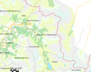
Sainte-Foy-Tarentaise
- commune in Savoie, France
Hiking in Sainte-Foy-Tarentaise
Sainte-Foy-Tarentaise, located in the French Alps, is a fantastic destination for hiking enthusiasts. This region boasts stunning landscapes, diverse trails, and a variety of experiences for hikers of all levels. Here's what you can expect when hiking in Sainte-Foy-Tarentaise:...
- Country:
- Postal Code: 73640
- Coordinates: 45° 35' 21" N, 6° 53' 2" E
- GPS tracks (wikiloc): [Link]
- Area: 100.15 sq km
- Population: 737
- Web site: [Link]